Curated OER
Introducing The Gulf Stream
Sixth graders research the average temperatures of different places on Earth. In this earth science lesson, 6th graders explain how the sun's heat cause ocean movement. They discuss how temperature change affects the weather we experience.
Curated OER
What's Out There? Space Shuttle Exploration and Simulation
Students role-play the jobs of space shuttle astronauts, conduct experiments, and research space using the Internet and offline experiments. Student-astronauts hold a "press conference" to share their information with others in a...
Curated OER
Couriers in the Inca Empire: Getting Your Message Across
Students explore how the Inca communicated across the bast stretches of their mountain realm.
Curated OER
Five Themes of Geography
Young scholars explore the five themes of geography: place, region, interaction, location and movement. They create a Powerpoint presentation with separate slides for each of the themes.
Curated OER
National Park Project
Students develop a descriptive and informative brochure for a National Park. They focus on the history and geology of the park, environmental concerns, and visitor actions that could eliminate the environmental concerns.
Curated OER
Early European Explorers
Fifth graders complete a variety of activities surrounding European exploration of the New World. They research one explorer and write and present an essay or script in which they portray that explorer as he makes his final report to his...
Curated OER
Hot, Wet, and Cold
Students research climate data for a city in each of the 5 major geographic sections of Texas. They use data to describe the climate and what influence the geography of that section has on the weather.
Michigan Sea Grant
Fish Habitat and Humans
Strict habitat requirements are needed for the survival of fish populations and fish variety in the Great Lakes. Young scientists become experts in the basic needs of fish and understand how survival necessities can vary with different...
Curated OER
Animal Trackers
Learners use space technology to monitor migratory species, map their movements, and gather data about their habitats and possible responses to climatic shifts.
Curated OER
Design an Island
Students make a map of an imaginary island using the topographic symbols provided from a worksheet. Students place lakes, dwellins, reefs, etc. in areas where they would logically be located from understanding how the topography of an...
Curated OER
Naviagational Tools
Fifth graders create a compass, with the help of written instructions and then write six sentences discussing how compasses work and why they are helpful. They discuss the different types of navigational tools and how they are helpful.
Curated OER
Minnesota Ospreys and Migration
Students explore the route that Minnesota ospreys follow during spring and fall migration. They describe the important ecological characteristics of the places that ospreys pass through during their migration. They determine where...
Curated OER
Using Coordinate Geometry by Land, Sea and Outer Space.
Students complete a table of values and plot points, as well as construct a graph on a coordinate grid. They construct two graphs on the same coordinate system, and identify the point of intersection. Students represent and record...
Curated OER
Constellation Mapping
Students plot constellations on a grid map. They discuss the various ways early explorers planned their travels. Students identify and recognize major constellations. They color their maps and take them home to try to find various...
Curated OER
Vector Manipulation Unit
Students are introduced to the concept/idea of a vector, what it represents and why they are used. They develop an understanding of what vectors are, how and why they are used.
Curated OER
Coordinate Graphs
Students use coordinate graphs in order to identify objects and their locations. They are shown how to plot the x and y coordinates and then are given values to be plotted during guided and independent practice. Students are assessed on...
Curated OER
Comparison of Snow Cover on Different Continents
Young scholars use the Live Access Server (LAS) to form maps and a numerical text file of snow cover for each continent on a particular date. They analyze the data for each map and corresponding text file to determine an estimate of snow...
Curated OER
Linkages Between Surface Temperature And Tropospheric Ozone
Students collect and interpret data to make predictions about the levels of ozone in the atmosphere. Using the internet to collect data students use their collected data to create a line graph for analysis. Students make mathematical...
Curated OER
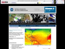
Surface Air Temperature Trends of the Caribbean
Students investigate the seasonal changes to sea surface and near-surface air temperatures near the equator. They use actual satellite data to track and graph the differences in air and sea temperatures during different seasons in the...
Curated OER
Magellan
Learners identify the route of Magellan's voyage. In this map skills lesson, students use a globe to identify various coordinates where Magellan traveled.
Curated OER
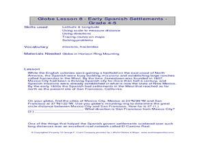
Globe Lesson- Early Spanish Settlements
Young scholars use a globe. In this geography and early settlements lesson, students learn about the settlement of missions and haciendas in New Mexico. Young scholars locate Mexico City and San Francisco on the globe and determine the...
Curated OER
Globe Lesson- The Revolutionary War
Students discover using globes. In this geography lesson plan, students use a globe to outline the original 13 colonies. Students also use a globe to measure the distance from London to New York City and determine how many days it would...
Other popular searches
- Longitude and Latitude
- Longitude Latitude
- Latitude and Longitude Games
- Latitude and Longitude Maps
- Longitude & Latitude
- Longitude and Latitude Game
- Longitude and Latitude Math
- Geography Latitude Longitude
- Whaling Latitude Longitude
- Longitude Latitude Minutes
- Longitude and Latitude Lines
- Volcano Latitude Longitude


