Curated OER
Where in the World
Students explore the global grid system. In this globe lesson, students identify latitude and longitude lines and how these can tell the coordinates of any place. They use the Internet to find the exact coordinates for their town.
Curated OER
GPS Treasure Hunt
Students explore geography by participating in a treasure hunt activity. In this Global Positioning System lesson, students define the terms latitude and longitude while utilizing an electronic GPS device. Students view a PowerPoint...
Curated OER
GPS Sports Field Activity
Students practice using GPS receivers and explore how knowing the coordinates of two locations allows them to determine the distance between those two points. They use the theory that they already had knowledge of and apply it to a...
Curated OER
Hide and Seek with Geocaching
Students locate objects using a Global Positioning System. In this global geography lesson, students explore latitude and longitude using a GPS in order to locate objects.
US Mint
Absolutely and Relatively: The Puerto Rico Quarter Reverse
How much does your class know about Puerto RIco? How much can they learn from the back of a 2009 quarter? Use the coin, part of a series of quarters that depict US territories, to teach learners about the geography, culture, and history...
Curated OER
Where in the World? :Understanding Latitude and Longitude
Students play a grid-based game and devise clues to help classmates locate spots on the globe in order to recognize the value of using longitude and latitude for identifying locations.
Curated OER
CLIMATE AND WEATHER UNIT
Young scholars locate on-line weather source, gathers and interprets weather data, work collaboratively on-line with other schools to collect weather data, and write about the cause of temperature inconsistencies in various locations.
Curated OER
TE Activity: Northward Ho!
Students design a simple compass. They examine how the Earth's magnetic field has both horizontal and vertical components. They determine how a compass works and work with cardinal directions.
Curated OER
Where in the World Is ...?
Students move themselves around a "world" map on the classroom floor, using lines of latitude and longitude to locate specific spots. They determine the locations of 11 countries where Peace Corps Volunteers are serving and identify in...
Curated OER
Bearings
In this online bearings worksheet, students complete a variety of online exercises involving traveling in different directions. Students check their twenty-one answers as they go and the computer computes their final overall score at the...
Curated OER
Design Your Own Imaginary Continent
In this continent activity, students design their own continent and include latitudes, mountain ranged, river, wind patterns, and temperature highs and lows. They also include a variety of cities in specified locations.
Curated OER
Global Wind Patterns Notes
In this global wind patterns worksheet, students take notes on the wind patters in the southern and northern hemispheres. They indicate the latitude the winds occur at, the pressure, the characteristics and the direction the wind moves....
Curated OER
Plotting Earthquakes and Volcanoes
In this earthquakes and volcanoes learning exercise, students are given the latitude and longitude of earthquakes and volcanoes and they plot them on a world map. They answer questions based on their results.
Curated OER
Longitude-Dava Sobel
In this longitude worksheet, students read about how to determine the longitude of location while at sea and they answer 5 questions about calculating longitude.
Curated OER
Weather With a Latitude
Young scholars read the temperature from a thermometer. In this weather lesson, students read a thermometer and record the temperature at twenty minute intervals. Young scholars discuss results.
Curated OER
Terrabagga Activity using a Magnetometer
Students use a magnetometer to determine the orientation of a magnetic field. In this magnetism lesson, students build a simulated planet and use a simple magnetometer to determine the orientation of their planet's magnetic field.
Curated OER
Student Exploration: Summer and Winter
In this recognizing the seasons online/interactive instructional activity, students explore the Earth's positions and determine the summer and winter season. Students answer 21 short answer questions
Curated OER
Earth Science
In this earth science worksheet students complete a series of multiple choice and short answer questions on the different moon phases, gravitational pull and the earths layers.
Curated OER
Map Scale
Third and fourth graders are introduced to the concept of map scale. Using an illustration, they discuss if it shows the actual size of the object and why scale is used to represent areas. They use some items in the illustration to...
Curated OER
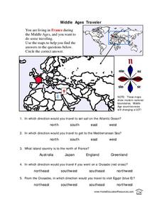
Middle Ages Traveler
In these Middle Ages worksheets, pupils use the maps to help them find the answers to the questions that help them understand the directions of north, south, east and west. Students also color another map of France according the directions.
Curated OER
All About the Animals
Whose footprints are those? After reading Janet Halfmann's book, Little Skink's Tail, young scholars use footprints to determine where on a gridded map certain animals have been spotted. They use the map to answer 3 questions, one...
Curated OER
Compass Rose Activity
Which direction is which? Use this compass rose labeling worksheet to practice with basic directions as learners fill in the compass themselves. They use cardinal and intermediate direction abbreviations. Consider using their compass on...
Curated OER
Compass Rose
Keep it simple and visual when practicing directions using this compass rose labeling activity. Learners fill in the compass themselves, using cardinal and intermediate direction abbreviations. North is done for them. Consider using...
Curated OER
North, South, East, and West
A basic lesson on the teaching of the cardinal directions awaits your class. They are directed to go to different parts of the playground and where they attempt to describe their location in relation to each other by using the cardinal...
Other popular searches
- Map Skills Lesson Plans
- Map Skills Worksheets
- Elementary Map Skills
- Geography Map Skills
- Basic Map Skills
- Social Studies Map Skills
- Globe and Map Skills
- Beginning Map Skills
- United States Map Skills
- Map Skills, Continents
- Early Explorers Map Skills
- Free Map Skills Worksheets


