Mesa Public Schools
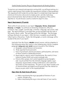
Country Project
Give your young learners the chance to discover more about countries in their world community with a research project. Class members write reports on an assigned country and include such major features as geography, important historical...
Curated OER
What Are the Social Studies?
Identify core social studies subjects with adult learners. They will discuss key issues from twentieth century American history and identify key social studies concepts taught at elementary grade levels. They then modify this activity to...
Curated OER
Flat Stanley
The geography of the United States is the focus of this lesson, as well as writing friendly letters. Your second graders read, "Flat Stanley," by Jeff Brown. They create their own Flat Stanley out of poster board, markers, crayons and...
Curated OER
What Can We Learn about India from a Ten Rupee Bank Note?
The class finds and cites evidence showing India's unity in diversity and work to recognize some of the complex interactions of a civilized community. They read to understand how geography, history, politics, economics,...
Curated OER
Water Quality and Watersheds: A GIS Investigation
Requiring more than one class period, this resource takes earth science learners on a journey through a watershed. Using ArcGIS Explorer, an online geographic information system, they view maps of watersheds and surrounding landscapes....
Curated OER
The Landscape of a Novel
Students, after reading a novel, utilize geographic skills to map out the places described in the novel. They collect data, envision spatial features and then design a map to work off of to complete their assignment. Each student also...
Workforce Solutions
Workforce Solutions 4-5 Lessons
Four lessons focus on job opportunities in Texas. In the first lesson, scholars examine the geography of Texas in preparation for analyzing data that showcases the economy of different regions. Lesson three challenges pupils to research...
Education World
The African American Population in US History
How has the African American population changed over the years? Learners use charts, statistical data, and maps to see how populations in African American communities have changed since the 1860s. Activity modifications are included to...
Curated OER
Linguistic Diversity. Languages in Canada - Elementary
Create a language mosaic to reveal the linguistic diversity in your community. Pupils interview a person with a home language other than English and contribute to a bulletin board display representing the variety of languages spoken. The...
Curated OER
The High Cost of Chemical Dependency
Sixth graders explore, analyze and study the effect and impact that humans have on the environment based on their choices as individuals, businesses and governments. They assess the balance between human activities and aquatic pollution.
Curated OER
Geographic Regions and Backyard Geology with the USGS Tapestry Map
A beautiful tapestry map of North America is examined by geology masters. The map incorporates the topography and geology of different regions. You can purchase printed copies or a large poster of the map, or if you have a computer lab...
Curated OER
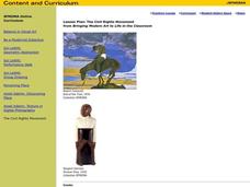
The Civil Rights Movement
Students compare and contrast African-American, Asian-American, Chicano and Native-American movements with the civil rights movement and are exposed to the sociopolitical and economic factors involved in the rise of social movements.
Environment Agency - Abu Dhabi
Plate Tectonics
Young scholars observe a presentation on plate tectonics, layers of the earth, and plate boundaries. They then use the Internet to research major plates and label them on a world map.
Curated OER
Fill in the Blanks
Archaeologists, historians, and scientists all work together to create a timeline of our past. Engages learners in a series of activities that all filter through the NOVA video, "Mysteries of the First Americans." Each activity is...
Curated OER
Christopher Columbus: The Man, the Myth, the Legend
Learn more about maps by examining Christopher Columbus's voyage to the New World. Kindergartners will learn about basic map skills and how to identify the compass rose, oceans, and land masses. They will also discover the purpose of...
Curated OER
"Whose (Is)land is This?": topics in Immigration and The Tempest
Class members compare the ways the subject of immigration is treated in The Tempest, Act I, scene ii, Act II, scene i and Act III, scene ii with patterns in American history. After tracing their own family’s journey, a series of...
Humanities Texas
Primary Source Worksheet: Thomas Jefferson, Confidential Message to Congress Concerning Western Exploration and Relations with the Indians
A confidential message written by Thomas Jefferson provides readers with an opportunity to practice their reading comprehension skills. The resource, part of a series, includes questions that require a close reading of the message and a...
Virginia Department of Education
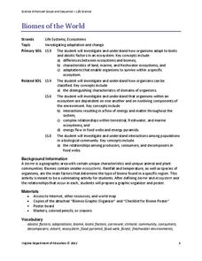
Biomes of the World
Incorporate knowledge about biomes and ecosystems in multiple ways while encouraging creativity. Emerging ecologists collaborate and perform research to complete a graphic organizer about various biomes of the world. They conclude the...
Curated OER
Kid City, USA
What a model community would look like? Get your kids talking with an activity that allows them to create their own town. After printing out a "fold out village," groups of students use a variety of resources to help them build an actual...
Curated OER
On the Road with Marco Polo: Sea Voyage to India
Students examine Marco Polo's route from China to Sumatra. They investigate the geography and climate, the religions and architecture of modern Indonesia. They study the use of spices and why they were so important in medieval times.
Curated OER
"The Clever Monkey"
Second graders complete a variety of activities related to the book "The Clever Monkey" by Rob Cleveland. They answer story comprehension questions, and rewrite the story. Students also complete a comprehension and fact or opinion...
Curated OER
"The Drum"
Second graders read and discuss the folktale "The Drum" from India. They also answer story comprehension questions, complete an adjectives and verb worksheet, and label a map of India. Students sequence events from the story and make...
Curated OER
Where Is Our Food Grown?
Students view the Interactive Whiteboard's supermarket and discuss what they can see there. They watch the animation about where food comes from and discuss any questions they may have. They then are introduced to the "Farm Alarm" game...
Curated OER
Do I Have What it Takes to be an Entrepreneur - and is My Community Ready?
Discover the attributes of entrepreneurs and define what entrepreneurship is while examining data based on local businesses. Learners determine whether their community is supportive of entrepreneurs as they research economic development...
Other popular searches
- China Geography Activity
- U.s. Geography Activity
- Geography Activity Europe
- World Map Activity
- World Geography Activity
- Us Geography Activity
- Greek Geography Activity
- Orange Geography Activity


