Curated OER
Topographic Maps Worksheet
In this geography skills learning exercise, students respond to 37 multi-part questions that require them to read and interpret topographic maps.
Curated OER
FUN WITH MAPS
Second graders receive a general overview about how maps are made and used, how specific information can be derived from them, and how a student can gain personal information about their surroundings from examining them.
Curated OER
Our Land Lesson 2: Song Mapping
Students study the meaning of philanthropy as giving of time. talent, and treasures. They sing This Land Is Your Land while locating five of the places on a map of the United States showing that relief office are everywhere. They decide...
Curated OER
Literacy Map Activity
Students write directions using maps and ad, they define driving directions and convert cardinal numbers to there ordinals. They write directions which are given orally in these multi-level literacy activities.
Curated OER
Using GIS to Construct Water Table Maps and Flow Nets
Students examine how to use GIS software to analyze patterns of groundwater flow. Seepage lake elevation data from the Sand Hills of Nebraska is used to construct a water table map and flow net using Esri's Arc Map software.
Curated OER
Map Skills
In this history instructional activity, students utilize a map and legend to answer eleven comprehension questions. Students check their answers when done.
Curated OER
Weather Maps
Students interpret information on a weather map in order to construct a graph, and discuss how the weather impacts their lives.
Curated OER
Reading Weather Maps
Fourth graders the symbols that are used on weather maps. They develop five day forecasts based on information they gather from weather maps in the newspaper and on the Internet.
Curated OER
Understanding Topographic Maps
Students are introduced to the characteristics and uses of topographical maps. Using a worksheet, they examine the use of specific terminology and use cutouts to create their own topographical map of an area. They answer discussion...
Curated OER
Rivers, Maps, and Math
Students use maps to locate and label the major rivers of North and South America. Using the internet, they identify forests, grasslands, mountain ranges and other landforms on the continents as well. They compare and contrast the...
Curated OER
Me on the Map Lesson 1
Students use maps, globes, geographic information systems and other
sources of information to analyze the nature of places at a variety of scales. They identify on a map and determine the population
of the city, county, state, country...
Curated OER
Landscape Picture Map
Young scholars discuss differences between man made and natural features on the Earth's surface. In this natural and man made features lesson plan, learners brainstorm a list of features and categorize them on the board. Students study a...
Curated OER
Landscape Picture Map - Lesson 8 (K-3)
Students explore the functions of landscape picture maps. In this geography skills lesson, students examine a landscape picture map and identify buildings on the map where people are employed. Students also participate in a discussion...
Curated OER
Mapping World War II: During and After
In this World War II worksheet, students follow the provided instructions to mark 2 maps according to events and outcomes of the war.
Curated OER
Gingerbread Forest Map Skills #2
Learners are read the story "Gingerbread Baby". They work together to develop a 3D map of the journey the baby traveled in the story. They practice their map reading skills to complete the lesson.
Curated OER
Map Out the Important Stuff!
Students practice summarization by creating a story map. Students listen to a read aloud by the teacher, after which the class creates a storymap of the major events in the story. They read a passage from the Indian in the Cupboard...
Curated OER
Semantic Mapping
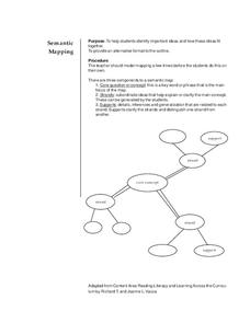
Students explore semantic mapping. Through teacher modeling and independent practice they complete a variety of semantic (concept) maps to coincide with specific areas of subject matter. They identify the core concept and include...
Curated OER
Map Work: How Far?
In this map scale worksheet, students analyze a map of an area with several towns marked. Students use the scale (1 cm = 1 km) to answer 6 questions about the distances between towns.
Curated OER
Mapping Your School Grounds
Students create a map of their school grounds. In this mapping lesson plan, students work in teams to make a map of their school grounds. Students note major features, observe, and record wildlife in the school grounds.
Curated OER
Street Map
In this street map worksheet, students observe the street map and answer short answer questions using the map. Students complete 4 questions.
Curated OER
Using Maps
In this using maps worksheet, student use a small map to find different routes between cities, then find the shortest route by adding the mileage.
Curated OER
Map the Mystery!
Seventh graders read the novel, "The House of Dies Drear", and create a story map to analyze the plot and recall events.
Curated OER
Making a Mental Map
Students discuss maps and explore the concept of the mental maps they use to navigate their everyday routines including the importance of landmarks. They draw a map of how they travel from home to school.
Curated OER
Mapping Comprehension
Students explore story structure. They discuss questions they can ask themselves while silently reading. Students implement their story knowledge by making story maps. They read The Little Pink Rose and the Cloud and create a story map...
Other popular searches
- United States Maps
- Weather Maps
- Topographic Maps
- Story Maps
- Maps and Charts
- Types of Maps
- Maps and Globes
- Middle East Maps
- Maps and Flags
- Historical Maps
- Maps of Europe
- Create Character Maps


