Curated OER
Mapping the Past
Middle schoolers study historical maps to view how the world evolved from medieval times through the Renaissance. They work in groups to examine the maps and present a report on one of the listed maps.
Curated OER
Using Old Maps as Tools to Explore Our World
Learners explore historical maps. In this primary source analysis lesson, students uncover the meanings in selected historical maps as they use them to enhance lessons on historical events. Samples for classroom use are provided in this...
Curated OER
Mapping Your Identity: A Back-To-School Ice Breaker
Identify the unique personal attributes of your class members. Begin by viewing the Visual Thesaurus and discussing displayed attributes associated with famous American leaders. Using these identity maps as models, pupils generate nouns...
Civil War Trust
Creating a Historic Site
A historic site marks a place where a relevant historical event occurred, no matter how many people know about it. Small groups choose their own historical sites, including a place where a class member was born, or even a football field...
Curated OER
Europe Maps
A series of maps depicts pre-WWI to post-WWII Europe for your geographers. They use reference materials to help them correctly fill in the countries and the borders as they changed through time. A great resource for a history lesson, or...
Curated OER
Mapmaker, Mapmaker, Make Me a Map!
Learners evaluate the different types of historical and geographical information that one can gather through close study of historical maps from the 16th through the 19th centuries. They create their own maps.
Curated OER
Whitewater Canal State Historic Site
If you happen to live in Indiana, or a neighboring state, and are planning a field trip to the Whitewater Canal State Historic Site, then this lesson plan will suit your needs quite well. In it, suggestions for activities before, during,...
Curated OER
Waldseemüller’s Map: World 1507
Learners take a closer look at historical maps. For this primary source analysis lesson, students examine the first world map produced by Martin Waldseemuller. Learners complete the included map analysis worksheet and then write letters...
Annenberg Foundation
Reading Maps
Can you read a map? Scholars use an interactive technology tool to analyze maps of various kinds to gather evidence and data to better understand their meanings and usefulness. Using newly obtained knowledge, they form an interpretation...
Austin Independent School District
History Mapping
This is a great activity to have on hand to help your young historians summarize major historical events. Learners identify key players and contextual information, major episodes of the event, and any resolutions or lasting impressions.
National Endowment for the Humanities
On This Day With Lewis and Clark
Walk in the footsteps of Lewis and Clark as they discover the wonders, beauty, and dangers of the American frontier. After gaining background knowledge about Thomas Jefferson and the Louisiana Purchase, young explorers use primary...
Smithsonian Institution
Lexington and Concord: Historical Interpretation
Learners view and analyze three different images related to the Battle of Lexington and Concord. They also answer a variety of questions in a graphic organizer to help keep the information straight.
Curated OER
What Do Maps Show?: Lesson 1 Introduction to Maps
Students brainstorm a list of the different types of maps they have seen or used. Using the activity sheet, they look through a social studies book to find all the maps and to determine what they are used for. Using a poster, they review...
Pennsylvania Department of Transportation
King of Prussia Inn: Exploring Historic Places
Learners of any age examine the significance of historic sites, how we understand those sites, and what they mean in terms of history and the culture of the past. They look at maps, artifacts, and data taken from archaeological sites to...
DocsTeach
Red Record of Lynching Map Analysis
Long before the civil rights movement, leaders were working to secure equal rights. An informative activity explains the 1922 anti-lynching campaign with a map. Scholars analyze the map, complete a worksheet, and participate in group...
Curated OER
Mapping the Halifax Explosion
Students research the Halifax Explosion using historical maps.
Ashbrook Center at Ashland University
The Constitutional Convention
Imagine sitting down with representatives of your school to write a new student handbook. What arguments would ensue? How would compromises be made to finish the project? Scholars research the Constitutional Convention using a directory...
Curated OER
Mapping Perceptions
Students create and read maps. In this map skills lesson, students draw a map of their neighborhood, then use skills acquired during map-making to interpret a classmates map and a map of the Ming Dynasty.
Library of Congress
Investigating the Building Blocks of Our Community’s Past, Present, and Future
As Ken Jennings said, "There's just something hypnotic about maps." Certainly, the longer you look at them the more you can learn. In this project-based learning lesson plan, individuals study both historic and present-day maps of their...
American Institute of Physics
The Physical Sciences at Historically Black Colleges and Universities
The history of science instruction at Historically Black Colleges and Universities (HBCUs) is the focus of a lesson plan that explores the early challenges these institutions faced in accessing equipment for their labs and instructors...
Curated OER
Eastern European Studies
One worksheet, three projects. Learners explore Eastern Europe and mark Eastern European countries on a map. They then collect and record census data on thirteen different countries, and write a 3-5 page expository essay on one of the...
Curated OER
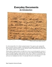
Everyday Documents
Almost more of a lesson than a worksheet, this particular resource has learners examine different types of historical documents. There is a historical docment embedded in the worksheet that learners study, and they also bring in...
Curated OER
Lewis and Clark
Students investigate Lewis and Clark. In this Lewis and Clark lesson, students search the Internet for information about Lewis and Clark and the Corps of Discovery. Students use maps to understand the explorations and decide which...
Curated OER
Where in the World War? Mapping the Geography of D-Day
Students examine how to read maps for historical information. They listen to a lecture on the history of D-Day, analyze a historical map of the invasion of Normandy, and answer discussion questions.
Other popular searches
- Historical Maps Explorers
- Historical Maps Wwi
- Historical Maps Trade Routes
- Historical Maps Rome
- Historical Maps Mesopotamia
- Historical Maps Pirate
- Comparing Historical Maps
- Carthage Historical Maps
- Historical Maps Imperialism
- Historical Maps Inauguration
- Historical Maps Ussr
- Historical Maps" Ptolemy


