Curated OER
Tall Tale Map Worksheet
In this story map worksheet, students make a map of a tall tale they have read or heard to show they understand how the tales develop.
Curated OER
Maps and Lines
In these organizing data worksheets, 5th graders complete four worksheets of activities that help them learn maps, graphs, and lines. Students then study images of maps, lines, and graphs.
Curated OER
United States Map - Lesson 7: Four Main Directions
Students locate the North and South Poles, and learn the definitions of the four directions by using a United States Map and a globe. In this directions lesson plan, students define north, south, east, and west on a map and a globe.
Curated OER
Angles, Bearings and Maps
In this angles, bearings and maps worksheet, students measure angles and classify, calculate the size of unknown angles, and complete related multiple choice and word problems.
Curated OER
Where Am I? Map Activity
In this map activity worksheet, learners determine which countries are shown on a set of 16 maps, then read facts about each country designed to help with a report on that country.
Curated OER
New York: Agricultural Products Maps
In this agricultural products worksheet, 4th graders use the information on four maps of New York Agriculture to make a comprehensive map of all products and answer four questions.
Curated OER
Production of the Lunar Relief Map Project
Students replicate the lunar surface. In this mapping skills lesson plan, students study the topography of the moon. Students then use craft materials to create topographic maps of the lunar surface where the Eagle landed.
Curated OER
Map of Kellyburi
In this map worksheet, 6th graders use a map to label 12 locations, answer 6 directional questions, write the answer for 17 general information questions, select the word for 10 sentences and read 25 English words for Thai animal names.
Curated OER
Arkansas Geography/History Relief Map
Sixth graders research a number of sources including the Internet to find information about the regions of Arkansas while locating sites of national historic interest. They located sites on maps while working at assigned websites. They...
Curated OER
Map Study
In this geography worksheet, students study the United States. Students respond to 6 multiple choice questions about the map.
Curated OER
Landscape Picture Map
Young scholars explore pollution of water sources. In this ecology lesson, students define and identify natural resources. Young scholars use map skills to locate local rivers and lakes used for recreation. Students brainstorm ways in...
Curated OER
Map of Egypt
In this map of Egypt worksheet, students label the cities, bodies of water, surrounding countries and color the map according to the directions.
Curated OER
Mapping the Civil War
Young scholars identify the locations of pivotal American Civil War battles. In this map skills lesson, students label Fort Sumter, Antietam, Vicksburg, Gettysburg, and the Battle for Atlanta on an outline map. The map is not included.
Curated OER
Story Mapping
Students prewrite a story using graphic organizers. In this prewriting lesson plan, students create a story map before they start their writing.
Curated OER
Map Skills
Students examine the nations, battlefields, troop movement of the Germans through Belgium and the location of both fronts during World War I by creating a map. They visualize the strength of the Germans early in the war.
Curated OER
Character Mapping
Third graders choose one character from a book they have read recently. Using paper, they create a character map of the character along with a small drawing to show what they look like. To end the lesson, they share their character map...
Curated OER
Using Maps to Learn About Antarctic Topography
Students explore maps and familiarize themselves with features of Antarctica. They utilize a topographical map to create a three-dimensional model of Antarctica. They identify and describe the different regions of Antarctic ice.
Curated OER
Map Facts Worksheet
In this geography, ecology, and folklife worksheet, students search Louisiana maps of their choosing to discover the factual information required to complete the graphic organizer.
Curated OER
Freshman Science Project-Part 1A-Science Concept Map
In this science project worksheet, students draw a concept map of their science project and use a rubric to determine their progress on their concept map.
Curated OER
Map of Italy
In this map of Italy learning exercise, students find, color and label cities, surrounding countries, bodies of water and landforms in the country of Italy.
Curated OER
How Do Cartographers Find Points on a Map?
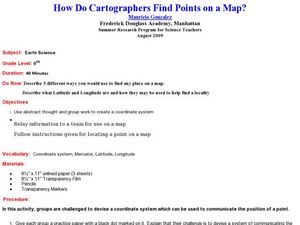
Ninth graders describe latitude and longitude and how they may be useful to find things on a map. In this cartography lesson students divide into groups and devise a coordinate system that can be used to communicate a position.
Curated OER
Mapping Personal Narratives
Second graders write a personal narrative using webs they created and a story map worksheet. In this personal narrative lesson plan, 2nd graders make lists of ideas to write about and pick one to focus on.
Curated OER
Sub-Saharan Maps
In this geography skills instructional activity, students draw real or imaginary maps that feature escarpment, rift valleys, gorges, diamond mines, plateaus, mountains, lakes, rivers, and gold mines.
Curated OER
Bubble Map
This PowerPoint provides a brightly colored "bubble map" featuring one large center circle and a smaller colored circle in each corner. This is an attractive generic graphic organizer that could be used in any content area.
Other popular searches
- United States Maps
- Weather Maps
- Topographic Maps
- Story Maps
- Maps and Charts
- Types of Maps
- Maps and Globes
- Middle East Maps
- Maps and Flags
- Historical Maps
- Maps of Europe
- Create Character Maps


