National Endowment for the Humanities
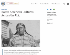
Native American Cultures Across the U.S.
Young scholars examine how American Indians are represented in today's society. They read stories, analyze maps, and complete a chart and create an illustration about a specific tribe.
Center for History Education
To What Extent Were Women's Contributions to World War II Industries Valued?
Women rose to the challenge when the nation's war effort called them—but were sent home when the GIs came back from World War II. Young historians consider whether the United States valued women's contributions during the war using a...
Curated OER
Home in the Desert: Lesson for Use with This House is Made of Mud
Third graders examine how a family modifies their environment to create a home out of mud. They read the book "This House is Made of Mud" by Ken Buchanan, and write a description of their own home that compares the home of mud to their...
Curated OER
Canada 2050: Future Population Trends
Pupils analyze population data and a population pyramid projection for Canada. They make predictions of future society and economic trends.
Curated OER
Can You Give Me Directions To the Game?
Students become familiar with the use and capabilities of GIS and use it for research and mapping purposes. They heighten their ability to estimate travel times by incorporating distance, mode of travel and urban congestion into the...
Curated OER
Comparing Cities
Students research the characteristics of cities in two different geographical areas. Using the internet, they take notes on the information they collect and record their observations on the two cities. They discover how the location...
Curated OER
MAPPING THE BLACK ATLANTIC
Learners examine the geographic characteristics of Western and Central Africa, the impact of geography on settlement patterns, cultural traits, and trade. They compare political, social, economic, and religious systems of...
Curated OER
Understanding the Problems of World Hunger
Students explore the issue of world hunger. They examine hunger on a personal level and explore what it means to be hungry or starving. They discuss the causes of hunger and the effects of hunger on nations.
Curated OER
Geographic Luck
Students examine why some countries are rich while others remain poor. They view a video on the website, Guns, Germs and Steel, analyze primary sources to conduct research about plants and animals, and create a game based on their research.
Curated OER
Geographic Factors and Physical Environment
Sixth graders discuss WWII in their classroom. They take a field trip to the National Museum of the Pacific War. Each section of the museum has a comprehension question to go along with it. The Bougainville Campaign Exhibit asks students...
Curated OER
Pizza and the Economy
Students become aware of the history behind pizza and how it was adapted to the economic and geographic conditions of the United States. They have a basic understanding of the concepts of supply and demand.
Curated OER
Where Life Is Too Short
Students predict how a pandemic would affect aspects of South Africa's society. In this world issues and geography lesson, students read a letter outlining the problems affecting South Africa. Students discuss and analyze how resource...
Curated OER
Africanized Honey Bees And Society
High schoolers investigate how information is disseminated about honey bees and other insects. They make a list of key words and phrases, or even write a brief summary of their impressions of insects and their relatives after viewing the...
Curated OER
Pre-Columbian Settlements and People
Fourth graders describe the social, political, cultural and economic life and interactions among the people of California from the pre-Columbian societies to the Spanish mission and Mexican rancho periods.
Curated OER
Where are We?
Fifth graders explore places visited by Lewis and Clark. In this geographical concepts lesson, 5th graders plot places on a map and put events in chronological order. Students find locations on a map using longitude and latitude....
Curated OER
The Mighty Mississippi River
Students acquire in-depth knowledge of the geographic significance of the Mississippi River. They identify and expand their knowledge of the role of the river in the development of cities. Finally, students gain insight into the ways...
Curated OER
World Oil Reserves and Trade Routes
Students analyze the global distribution of natural resources to determine the relationship of resource availability to international problems and issues. They explain how the uneven distribution of resources can result in global...
Curated OER
Being There: Exploring China And Japan
Learners discover the culture, society, geography, and history of Asia through games, food, art, and literature in this multi-day lesson about China and Japan. An exciting lesson for upper-elementary or lower-middle school classrooms.
Curated OER
Reading the Landscape in Children's Literature
Students identify geographical information about landscapes found in student literature, demonstrate an organizing tool, developed around geographical themes, for the recording of information, and share uses of this approach.
Prince William Network
Migration Math Madness
A great way to incorporate math into life science, this lesson has learners measure migratory routes on a map and calculate the actual distance that shorebirds on the routes would cover. Learners compute the distance covered in both...
Curated OER
Water Resources and the Role of the Independent Sector
Students identify the need to maintain and protect our natural resources. In this natural resource lesson, students study pictures of the effects of pollution on animals and water. Students brainstorm a list of ways water is an...
Curated OER
Garbage/Solid Waste Disposal
Students examine the problem of solid waste disposal in modern society. They decide on a site for waste disposal. They investigate the many different types of waste that need to be dealt with. They participate in three learning station...
Curated OER
Comparing Amount of Rainfall in Different Geographical Areas
Students construct rain gauges and use them to log rainfall in their school zone, local city, and region and then compare and discuss them by plotting this information.
Curated OER
Discovering the Northwest Territories Through the Five Themes of Geography
Students use the Atlas of Canada to find basic geographical information about the Northwest Territories.


