Curated OER
Settling Nroth America: Improvisation and Playwriting
Students map the classroom by marking the movement of the first Americans' migration from Alaska down into North America. To improve their skills in map-reading and sense of direction, students identify physical features of the map and...
Theodore Roosevelt Association
Roosevelt's Legacy: Conservation
The legacy of Theodore Roosevelt carries through modern American politics, economics, foreign policy, and society. But his proudest and most profound efforts were in the world of conservation, and in preserving the natural beauty of...
K12 Reader
Eratosthenes: Geographer and Mathematician
Mathematicians can be famous, too! Introduce your class to Eratosthenes with a reading passage. After they complete the passage, learners respond to five questions, some of which require opinions and others reading comprehension skills.
Indian Land Tenure Foundation
More Tribal Homelands
Here is a very fun idea that introduces young learners to how geographical location affects cultural development. They are introduced to four areas where Native Americans have lived in the past by reading stories and examining images....
Curated OER
Moon Mining
Go on a moon mining expedition from the safety of your classroom with this space exploration simulation. Using simple models of the moon's surface prepared ahead of time by the teacher, young scientists are challenged with locating and...
Curated OER
Route 66 And Population Patterns
Students investigate the geography located along Route 66. They research how the population patterns change in certain areas along the highway. Students use the information in order to form hypotheses about how and why the population...
Curated OER
United States Map Quiz
In this online interactive geography quiz worksheet, students respond to 50 identification questions about the shapes of countries shown. Students have 5 minutes to complete the quiz.
Curated OER
Mapping and Personifying Nations
Eleventh graders analyze the geography, actions, and relationships of countries involved in World War II. They create a map of Europe, Northern Africa, and the Pacific, and analyze and evaluate their self-made map of Europe and the...
Curated OER
How Far Away is Your College?
Eighth graders practice using atlases. For this geography skills lesson, 8th graders select a college they would like to attend and use an atlas to respond to questions about the geography of the place.
Curated OER
Canada Or Bust
Seventh graders answer the following problem based lesson with the essential question, "Which city or town in Canada would adequately meet my family's needs for relocation?" They present their city and provide rationale for its...
Curated OER
Great Monuments of the World
Young scholars explore the wonders of the world through inquiry. In this world monuments lesson, students investigate famous landmarks around the world as they conduct and apply research. Young scholars create products that feature their...
Curated OER
Mobility: A Green City, Past, Present, and Future
Learners explore transportation systems through history. In this transportation instructional activity, students determine how modes of transportation affect quality of life and design transportation plans for cities.
Curated OER
Bird Watching
Students explore the implications of the avian flu. In this personal health instructional activity, students listen to a lecture about the avian flu, its history, and how it spreads.
Curated OER
Canadian Provinces Quiz
In this online interactive geography quiz learning exercise, students examine the map that includes 13 Canadian provinces. Students identify the names of the provinces in 3 minutes.
Curated OER
Country Flags Quiz
For this online interactive country flag quiz worksheet, students examine the 20 pictured country flags and try to name all of the countries represented in 4 minutes.
Curated OER
South America Map Quiz
In this online interactive geography quiz worksheet, students examine the map that includes all of South America's countries. Students identify the 13 countries in 2 minutes.
Curated OER
Middle East Map Quiz
In this online interactive geography quiz worksheet, students examine the map that includes 26 Middle Eastern countries. Students identify the names of the countries in 4 minutes.
Curated OER
Central America Map Quiz
In this online interactive geography quiz instructional activity, students examine the map that includes 22 Central American countries. Students identify the names of the countries in 3 minutes.
Curated OER
Canada Map Quiz
In this online interactive geography quiz worksheet, students examine the map that includes 13 Canadian provinces and territories. Students identify the names of the provinces and territories in 2...
Curated OER
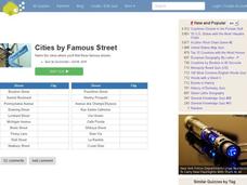
Famous Streets Quiz
In this online interactive geography quiz worksheet, students examine the chart that includes the names of 18 famous streets in the world. Students have 4 minutes to identify the names of the cities where the streets...
Curated OER
State Nicknames Quiz
In this online interactive geography quiz worksheet, students examine the chart that includes the names of 49 states. Students identify the nicknames of the states in 6 minutes.
Curated OER
Highest Mountain Countries Quiz
In this online interactive geography quiz activity, students examine the chart that includes the elevations of 20 world mountains. Students identify the names of the mountains in 4 minutes.
Curated OER
California Cities Map Quiz
In this online interactive geography quiz worksheet, students examine the map that includes 12 California cities. Students identify the names of the cities in 3 minutes.
Curated OER
Biggest Cities in Each State Quiz
In this online interactive geography quiz activity, students examine the chart that includes the names of 50 U.S. states. Students identify the names of the two largest cities in each state in 8...


