Curated OER
Africa, A Look Through the Eyes of A Child
Second graders read literature about Africa, examine physical characteristics of the continent, explore animals native to Africa, and discuss distance between Africa and locations in the United States.
Curated OER
Border to Border
Students use the Internet to gather information on the country of Mexico. They also discover the culture of their people and compare them with the United States population. They take a virtual tour of some of Mexico's most historical ruins.
Curated OER
The Imperialist Vision
Students explore imperialism and why the United States became an imperial power. After reading from their textbook and answering questions, students compare and contrast two political cartoons. They create a bubble map of events...
Curated OER
Shelby County: The Regulator-Moderator War
Seventh graders comprehend the importance of the Regulator-Moderator War through John W. Middleton's memoir. They comprehend how the different motivations held by each faction began the conflict. Students are shown the map of Shelby...
Curated OER
The Geography & Peoples of Europe
Extremely throrough and informative, this presentation details many aspects of European geography and demographics, including natural resources, climate, topography, and population distribution. This slideshow would be an excellent...
Houghton Mifflin Harcourt
Off to Adventure!: Challenge Activities (Theme 1)
Off to Adventure! is the theme of an English language arts unit comprised of a variety of challenge activities. Scholars enhance skills and reinforce concepts by taking part in a grand book discussion, giving an oral report, and writing...
Curated OER
Pearl Harbor
Young scholars identify the location of Pearl Harbor and Hawaiian Islands on a map. In this map skills lesson, students use latitude and longitude coordinates to locate various places of importance of the Pearl Harbor attack.
Curated OER
Mural Mania
Students create a mural that displays symbols for their home state. They complete worksheets and read a book about their state. They collect images of the state flower, tree and bird for the mural. There are 5 other lesson plans included...
Mathematics Vision Project
Circles: A Geometric Perspective
Circles are the foundation of many geometric concepts and extensions - a point that is thoroughly driven home in this extensive unit. Fundamental properties of circles are investigated (including sector area, angle measure, and...
GCSE Modern World History
Mao's China
Here is a great textbook chapter on China's establishment as a communist state in 1949 and the effects of World War II on the nation. The first page prompts learners to complete a timeline activity as they read the material, which...
California Historical Society
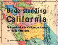
Understanding California
Here is a beautiful handout through which learners can explore the history of California, from the earliest Europeans to visit the Golden State up through its experiences during the Great Depression and position in the modern world.
Curated OER
W Is For Wyoming
Students engage in a lesson about the state of Wyoming. They complete a worksheet looking for facts and identify some common symbols used to represent the state. The symbols are used to practice sounds and give context to class discussion.
Curated OER
Wisconsin Snapshots
Fourth graders study Wisconsin's culture and heritage. They research the state's symbols and identify leaves common to the Wisconsin area. They create a leaf booklet and visit the state park. They visit local farms and create nature maps...
Curated OER
George Washington Birthplace National Monument
Young scholars examine the importance of the George Washington Birthplace National Monument. As a class, they complete a K-W-L chart about George Washington and write about what they believe is going on in a picture they are shown. ...
Curated OER
I Can Compass, Can You?
Students discover how to use geographic tools. In this compass lesson, students identify cardinal directions by appropriately using compasses along with a number of various maps.
Curated OER
Congressional Travel
Students determine the distances traveled by the members of the legislative branch of the US Government. In this travel distance lesson, students locate Washington, DC on a globe using the longitude and latitude of the city. They...
Curated OER
What Is a Primary-Source Document?
Students discover what a primary-source document is, what different types there were back in 1867, and what newer kinds there are today. They play a form of bingo using printed cards that reproduce documents related to Confederation.
Curated OER
Splitting the Motherland?
Students explore issues such as Tibet's struggle for independence and China's invasion in 1950. They create a KWL chart, explore maps of Tibet, and read articles concerning China, the Dalai Lama, and President Bush's relationship to...
Curated OER
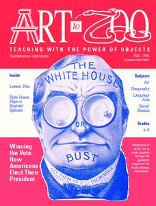
The White House or Bust: How Americans Elect Their President
Students explain the presidential duties and who is eligible to run for president. In this The White House or Bust article, students complete a map of the electoral college. In addition students analyze historical campaign posters....
Curated OER
Bringing the U.S. into World War II
Learners research and explore the cause and effects of global warfare. They assess the concept of the United States policy of isolationism as it involves the United States and Japanese relations. Each group of students prepare a time...
Curated OER
USH Test One
Eleventh graders write about one reason immigrants came to the United States in the late 1800's. They take a test that focuses upon past concepts and then an introduction is given by the teacher for the concepts of Imperialism and The...
Curated OER
Lights, Shoals & Soundings
Students explore nautical charts and their symbols, with a bit of fun thrown in.
Curated OER
Andrew Jackson and the Trail of Tears
Students examine the three historical portraits Andrew Jackson, iam Pitt and Portrait of a Boy for symbolism. They research Andrew Jackson's involvement in the Cherokee Indians' Trail of Tears in North Carolina, and compose a portrait.
Curated OER
Executive Branch of the U.S. Government
Fourth graders create a K-W-L chart of what they know about the executive branch of government. They access the Internet to research a specific level of government. They create a PowerPoint presentation with a minimum of eight slides.


