Curated OER
African Country Study and PowerPoint Presentation
Students investigate the geography of Africa. In this African culture lesson, students research the lifestyles of African residents and create a PowerPoint presentation based on a single African country. Students share their...
Curated OER
Countries of Africa
Students investigate the different countries of Africa. In this African geography lesson, students choose an African country to investigate and construct the country's flag. Students use a map of Africa to color in their country.
Curated OER
Brochure of African Countries
Students research a country in Africa and present the information they found and the brochure they designed to the class while their peers take notes to use as a study guide for the exam.
Public Schools of North Carolina
Democratic Republic of Congo - Map Skills
Work on your map skills with a packet of activities about the river basins in the Democratic Republic on Congo. Learners study the maps provided before answering the geography questions and writing an acrostic poem about the region.
Curated OER
African Safari
Seventh graders examine different countries in Africa to research. They choose one to concentrate their research on using the five themes of geography. They design a multimedia presentation that will make up the African safari.
Curated OER
Africa Unite!
Students work in pairs to research assigned African countries. They compile their research to label a continent map of Africa, present their research to the class and design a game of trivia using their findings.
Curated OER
African Country Report
Sixth graders describe the relationship between the people of Africa and their environment. They examine the climate, economy and inhabitants of this land. Using maps graphic organizers and writing a report, 6th graders demonstrate how...
Curated OER
Day to Day Life in a Small African Village
Students analyze life in a village of Tanzania including its language, geography, health, and hygiene issues. In this African village instructional activity, students locate Tanzania and its capital city on a map. Students compare...
Curated OER
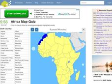
Africa Map Quiz
In this online interactive geography quiz activity, students respond to 53 identification questions about the countries of Africa. Students have 6 minutes to complete the quiz.
Curated OER
Southern Africa Map Quiz
In this online interactive geography quiz worksheet, students examine the map that includes 15 Southern African countries. Students match the names of the countries to the appropriate locations on the interactive map.
ESRI
Juneteenth: An American History through Maps
An interactive website traces the history of Juneteenth celebrations from their origin in Galveston, Texas, on June 19th to the present day. Using interactive maps, learners can find information about the African-American population...
Curated OER
Trey and Dave go to Africa: Music
Trey from Phish and Dave from the Dave Mathews Band took a trip to Africa to explore music, culture, and history. Your class watches this episode from VH1's Music Studio to understand how African culture and music have influenced modern...
Curated OER
Mapping the Human Movement
Students research data on African-American emigration, place the data in a chart and create a human movement map. They also create another map using research on current immigration information.
Curated OER
Studying Mind Maps Created at Other Schools
Students explore Africa and mind maps created by students from other schools. They discuss Africa and the number of countries, diversity of language, cultures, races, religions, and lifestyles and in groups study a mind map from another...
Curated OER
How Has Colonialism Led to Multilingualism in Africa
Prepare yourself for a top-notch presentation on colonialism in Africa! Discussed are the reasons for African multilingualism. Maps and a country-by-country look at various colonists that made their mark on the African continent are...
Curated OER
Day to Day Life in a Small African Village
Students analyze what it is like to live in an African village. They locate Tanzania on a map and compare life there to life here in the United States. They write about the health issues in East Africa.
Curated OER
Africa Map Quiz
For this online interactive geography quiz worksheet, learners examine the map that includes all of Africa's countries. Students match each of the country names to the appropriate locations on the map.
Curated OER
Countries of Africa
Students study the coutries of Africa. In this African American history, small groups of students research a different country, color the country on the map of Africa, write a paragraph about the country, and draw pictures of its flag.
Curated OER
Africa: Geography Concept Map
In this geography skills worksheet, students complete a graphic organizer where they list African countries and their geographic features, languages spoken, natural resources, and historical facts.
Curated OER
Africa: Political Map
Students create a political map for Africa. In this country identification lesson, students locate Africa on a globe and discuss some of its major countries and bodies of water. Students complete a political map of Africa and test...
Curated OER
Africa Test Map
For this geography worksheet, students examine an outline map of Africa that has all of the countries numbered on it. They write the names of the 54 countries on the lines below the map.
Curated OER
The Talking Goat
Students read and analyze an African folktale. They read and discuss the folktale, analyze a map of Africa and Liberia, complete a worksheet, answer discussion questions, and analyze the patterns and analogies of the folktale.
Curated OER
Cyberspace Safari
Middle schoolers go on an information gathering hunt on the Internet to study West African empires. They work in teams; meteorologists, bankers, writers, and archaeologists. They collect data on all sorts of topics related to West...
Boston University
Scramble for Africa
In this fantastic simulation, your young historians take on the roles of imperialistic European countries in the nineteenth century and then "scramble" to carve up the continent of Africa! This is a very hands-on activity that will help...


