Curated OER
Etc: Maps Etc: Orographical Map of South America, 1911
An orographic map of South America from 1911 showing the primary mountain systems and general elevations, and major river systems. The map is color-coded to show elevations from sea level to over 12000 feet, with highlands in buff tints...
Curated OER
Educational Technology Clearinghouse: Maps Etc: South America, 1906
A map from 1906 showing the general highlands and lowlands of South America and the national boundaries at the time. The map is color-coded to show highlands over 4000 feet above sea level in red tint, above 1000 feet in buff tint, and...
Curated OER
Educational Technology Clearinghouse: Maps Etc: South America (Physical), 1901
A map from 1901 of South America showing the physical features of the region. This map is color-coded to show general elevations from sea level to over 6,500 feet, mountain systems, drainage divides, lakes, rivers, coastal features, and...
Curated OER
Etc: Maps Etc: Physical Map of South America, 1916
A map from 1916 of South America showing the general physical features including mountain systems, prominent peaks and volcanoes, river and lake systems, plateaus, and coastal features. The map is color-contoured with land elevations...
Curated OER
Etc: Maps Etc: Physical Map of South America, 1901
A map from 1901 of South America showing the general physical features including mountain systems, prominent peaks and volcanoes, river and lake systems, plateaus, and coastal features. The map is color-coded with the highlands above...
Curated OER
Etc: Maps Etc: Physical Map of South America, 1902
A map from 1902 of South America showing the general physical features including mountain systems, prominent peaks and volcanoes, river and lake systems, plateaus, and coastal features. The map is color-coded with the highlands above...
Curated OER
Educational Technology Clearinghouse: Maps Etc: Peru and Bolivia, 1915
Map of Peru and Bolivia showing boundaries current to 1915, major cities, rivers, Lake Titicaca, and the Andes mountain chain.
Curated OER
Etc: Maps Etc: Physical Map of South America, 1910
A physical map from 1910 of South America showing color-contoured land elevations and water depths. Elevations range from sea level to over 6,500 feet, and water depths range from sea level to below 13,000 feet. This map shows the...
Curated OER
Etc: Maps Etc: Argentina, Chile, Paraguay, and Uruguay, 1915
Map of Argentina, Chile, Paraguay, and Uruguay showing boundaries current to 1915, major cities, rivers, Strait of Magellan, Patagonia, the Falkland Islands, and the southern Andes mountain chain including Mt. Aconcagua.
A&E Television
History.com: How Early Humans Survived the Ice Age
The most recent ice age peaked between 24,000 and 21,000 years ago, when vast ice sheets covered North America and northern Europe, and mountain ranges like Africa's Mt. Kilimanjaro and South America's Andes were encased in glaciers. At...
Study Languages
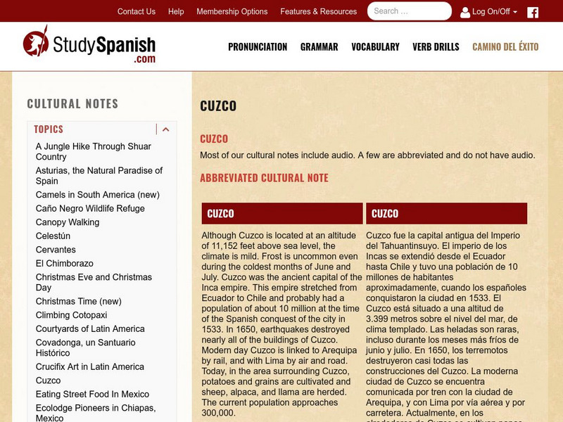
Study Spanish: Cuzco
This site has an explanation in Spanish and English with a few comprehension questions about Cuzco. Great reading selection for beginning and intermediate Spanish students.
Curated OER
Etc: Maps Etc: Relief Map of South America, 1890
A relief map from 1890 showing terrain features of South America. "South America is the fourth continent in size, and strikingly resembles North America in the arrangement of its relief-forms. It has, like the latter, a predominant...
Curated OER
Educational Technology Clearinghouse: Maps Etc: South America, 1885
An orographic map of South America from 1885 showing the primary mountain systems and general elevations. The map is color-coded to show highlands in buff tint, lowlands in green, and the major mountain chains with heavy black lines. The...
Curated OER
Etc: Maps Etc: Orographic Chart of South America, 1891
An orographic chart from 1891 showing the various mountain systems, plateaus, plains, and rivers in South America. The map is keyed to show light portions as mountains, and shaded portions as plains, with the system of the Andes (1),...
Curated OER
Educational Technology Clearinghouse: Maps Etc: Drawing of South America, 1872
A base map from 1872 illustrating instructions for drawing South America. The map shows the equator, major rivers, mountain systems, and includes two east-west cross-sections showing the central and southern Amazon Basin and Andes.
Other popular searches
- Life in Andes Mountains
- Andes Mountains Model
- Andes Mountains and Culture
- Deadly Andes Mountains
- The Andes Mountains
- " Deadly Andes Mountains


