Curated OER
Grid it, Map it
Students participate in designing a city layout using grids and coordinates. They work on a city space and create a grid on a life size layout on the gym floor.
Curated OER
MAP GRIDS, CLIMATES AND HEMISPHERES
Students compare/contrast the grid and latitude/longitude system used on a globe. They describe the areas which are considered to be a tropical, temperate, and polar, based on knowledge of climates.
Curated OER
An Introduction to Pi and the Area of a Circle
Students explore measurements of a circle. In this lesson about circumference and radius, students practice calculating measurements of a circle. Students estimate, calculate, and practice with graphing all while learning how to find...
Curated OER
Area of Parallelograms and Triangles
Students explain the formula for finding the area of a paralellogram and its relation to the area of a rectangle. Finally, they construct the formula for the area of a paralellogram.
Curated OER
Using Graphs
In this using graphs worksheet, 9th graders solve and complete 6 different types of problems. First, they determine how the transformation shown moves the graph. Then, students find the interval that is defined given the coordinates....
Curated OER
Why Do We Add The Bases To Find The Area of A Trapezoid?
Middle schoolers are given patterns of trapezoids and are to calculate the area of one trapezoid by using both patterns. They should form a parallelogram and calculate the area. They practice this technique until there is understanding.
Curated OER
Gridding a Site
Students make observations of effigy mounds and record them in a notebook. In groups, they must determine the scale of measurement and create their own grid to scale part of the Effigy Mounds National Monument. They also practice using...
Curated OER
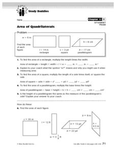
Area of Quadrilaterals
In this math worksheet, students read an informative chart about how to find the area of quadrilaterals. Students then answer 6 questions in which the area of quadrilaterals is calculated.
Curated OER
Map It Out
Third graders create obstacle course maps. They lay out their course on the playground, using symbols for trees, fences, etc, Students, in groups, exchange maps and then follow the courses.
Curated OER
Coordinates (4)
In this mathematical coordinates worksheet, students plot the points on a grid with six different sets of coordinates and a ruler to make six separate shapes.
Curated OER
Shattered Images Value Study
High schoolers create cubist drawings using grids and enlargement.
Curated OER
Geometry- Coordinate Plane
Middle schoolers plot points on a coordinate grid. In this coordinate plane instructional activity, students use a coordinate grid to locate the perimeter points of pictures, identify quadrants and use the coordinate points to draw...
Curated OER
Blackout!
Students read news reports and first-person accounts of a blackout in a large city and keep weblogs or journals. They take on different roles of people who live in the city or commute there to work and then use their journal accounts to...
Curated OER
Topographic Mapping Skills
In this geography worksheet, students read an excerpt about topographic maps and why they are useful for various jobs. They also respond to eleven questions that follow related to the excerpt and locating specific map points on the map...
Curated OER
Tiling Tessellations
Students explore tessellations. In this shapes and geometry lesson, students describe the attributes of many of the shapes displayed on an Elmo. Students create examples of tessellations using pattern blocks.
Curated OER
Pattern Puzzles
A short video introduces place value in addition and subtraction. As a class, your students identify all even numbers up to one hundred and explain the pattern. They use addition strategies to fill in the missing numbers on the number grid.
Curated OER
Task: Grain Storage
Farming is full of mathematics, and it provides numerous real-world examples for young mathematicians to study. Here, we look at a cylinder-shaped storage silo that has one flat side. Given certain dimensions, students need to determine...
Curated OER
Planet Data
Sixth graders use various resources to locate information for a database (name of planets, diameter of planets, etc.). They enter the data onto a prepared data grid. Use of Access to sort data is accented within this lesson. Students...
Scientific American
Life-Sized Drawing
Ocean explorers or mathematicians research the wreck of the CSS H.L. Hunley. They investigate the actual dimensions of the Hunley using math and measuring skills. Afterward, they sketch a large scale drawing of the submarine outdoors on...
Curated OER
Task: Miniature Golf
"Fore!" All right, no one really yells this out in miniature golf, but this well-defined activity will have your charges using lots of numbers in their unique design of a miniature golf hole. Included in the activity criteria is the...
Curated OER
Fish Tank Territories
Students observe swimming and resting patterns of aquarium fish to determine how different parts of the habitat are used. Different pairs of students should compare their results after several days to look for daily patterns.
National Council of Teachers of Mathematics
Stitching Quilts into Coordinate Geometry
Who knew quilting would be so mathematical? Introduce linear equations and graphing while working with the lines of pre-designed quilts. Use the parts of the design to calculate the slope of the linear segments. The project...
Baylor College
There's Something in the Air
Clever! In order to compare indoor and outdoor dispersal rates for the movement of gases and particles through air, collaborators will participate in a classroom experiment. Set up a circular grid and set learners on lines that are...
Curated OER
Footprints: Take a Step into Estimation
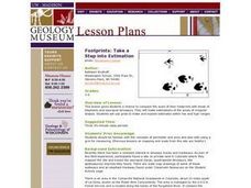
Compare sizes of student footprints with those of elephants and sauropod dinosaurs! Upper graders make estimations of the areas of irregular shapes; young scholars use grids to make and explain estimates within low and high ranges.


