Scholastic
Perfect Postcards: California
It's time to hear about some adventures in travel! The Transcontinental Railroad changed life and travel in the United States during the 1800s. Practicing online research skills, pupils discover the features they would like to visit on...
National Museum of the American Indian
The A:Shiwi (Zuni) People: A Study in Environment, Adaptation, and Agricultural Practices
Discover the connection of native peoples to their natural world, including cultural and agricultural practices, by studying the Zuni people of the American Southwest. This lesson includes examining a poster's photographs, reading...
Curated OER
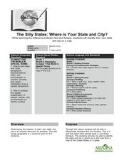
The Silly States: Where Is Your State and City?
First graders read The Scrambled States of America and discuss whether it is real or fantasy as compared to the United States. In this geography instructional activity, 1st graders identify their city or state on a map and work in groups...
Curated OER
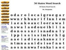
50 States Word Search
In this fifty states worksheet, students identify and locate all fifty states of the United States of America. There are 50 states located in the word search.
Curated OER
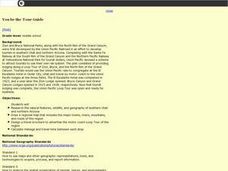
You be the Tour Guide
Middle schoolers research the natural features and wildlife of Arizona and Utah. They draw a map of the region that includes rivers, towns, mountains and roads. They work together to create a travel brochure of the area.
Curated OER
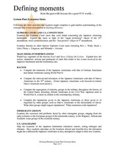
Defining moments from the past with lessons for a post-9/11 world...
Students examine extension ideas concerning 9/11, Defining Moments. They analyze a variety of Supreme Court cases, the U.S. Constitution, Mass Media Interpretations, Racism, Immigrant groups and U.S. geography. Many questions are asked...
Curated OER
Ancient Cities
Students discuss ways homes, buildings and cities are designed for a particular climate and geography. Students use a chart and conduct library and online research to explore ways the Mayans and Incas developed their land based on their...
Curated OER
Timeline of Medical Innovations and Breakthroughs
Learners identify on a time line and a world map where medical innovation/inventions line-up and originated. They collect information on various medical innovations/inventions using encyclopedias and medical research texts. Students make...
Curated OER
World Geography: Who am I?
Students are able to provide a basic description of one country that has arsenic in its water supply. They are able to locate these countries on a map. Students explore the majors countries that have been affected by arsenic...
Curated OER
World Geography: Water: The Indispensable Resource
High schoolers are able to explain why water is an indispensable resource in a written essay and class discussion. They identify at least three examples of where water has been a source of conflict between societies from a reading and...
Curated OER
World Geography: Postcard from the Rim
Students are able to identify the areas of the world that are affected by arsenic contamination of the water supply. They are able to describe the ways in which various societies deal with the problem of arsenic contamination. ...
Agriculture in the Classroom
Wad-a-Watershed
What kind of impact do humans have on watersheds? Find out in a lesson that defines, explores, and promotes ways to protect our watersheds. The ultimate goal of the lesson is for learners to discover how a watershed is impacted by...
Concord Consortium
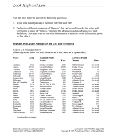
Look High and Low
From the highest high to the lowest low here's a resource that won't fall flat. Given data on the area and the highest and lowest elevations of each of the 50 states, learners decide which states are the least flat and the most flat. Of...
Curated OER
Put Me in My Place: Using Alphanumeric Grids to Locate Places
Students practice locating points on a large wall grid and create and label a neighborhood map. In this geography lesson, students spell and discuss places as the teacher places them on the map. They discuss the concept of an...
Curated OER
Turkey: Bridge Between East and West
Ninth graders study the geography of Turkey. In this Geography lesson, 9th graders examine the characteristics of Turkey. Students create an annotated map of Turkey.
Curated OER
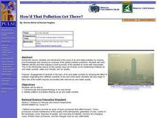
Environment: How'd That Pollution Get There?
Students examine how global wind and water patterns aid in the spread of worldwide pollution. In groups, they read articles about the domino effect of pollution and create posters displaying its journey. On blank world maps, students...
Curated OER
Locating The Cold War
Students identify major players in the Cold War and place them on a world map. They identify the two superpowers location on the map as well as their allies. Students analyze how the world divided itself.
Curated OER
Biggest Cities in Each State Quiz
In this online interactive geography quiz instructional activity, students examine the chart that includes the names of 50 U.S. states. Students identify the names of the two largest cities in each...
Curated OER
Desert Views - First Impressions: Travelers on the Gila Trail
Students draw animals and plants that are described to them as they read passages of people who traveled across the Gila Trail in the Southwest. In this Gila Trail lesson plan, students also write a letter describing a plant or animal in...
Curated OER
Through Time: Change in Sedona
Students locate events on a timeline of Sedona, Arizona and describe human and physical characteristics of the city. For this Sedona lesson plan, students locate the city on a map and listen to stories about Sedona.
Curated OER
This Place is Just Like the Other
Students write paragraphs that compare and contrast the geographical characteristics of Arizona and the Southwest region. In this geographical characteristics lesson plan, students complete a diagram and discuss how Arizona differs from...
Curated OER
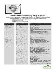
The Mountain Community: Why Flagstaff?
Students identify geographical features that hindered or promoted settlement in the city of Flagstaff, Arizona. In this settlement lesson plan, students write a summary of what they learned and identify geographical features on a map.
Curated OER
Mapping Roxaboxen
Fourth graders read Roxaboxen and draw a map of the Roxaboxen community. In this language arts and geography lesson, 4th graders use specifications given, adding features to the map as described in the book and creating a legend.
Curated OER
Yo Ho, Yo Ho, A Pirate's Map for Me: An Original Story
Students read Blackbeard and brainstorm their knowledge of maps. For this language arts and geography lesson, students use landmarks on their playground to review north, south, east and west and discuss the compass rose. Students read...


