Curated OER
Avalanche And Landslide Hazards in Canada
Students explore where the natural disasters, avalanche and landslides, are most frequent in Canada and investigate their associated causes and effects. They navigate the Atlas of Canada Web site for natural hazards.
Curated OER
Basic Geography of Canada
Students identify different geographical locations in Canada by using an Atlas. In this geography of Canada lesson plan, students locate features such as rivers, lakes, cities, provinces, and more.
Curated OER
Canada's Natural Regions and Their Varied Characteristics
Students examine Canada's six natural regions, with all their underlying human and economic activities, identify specific characteristics of each region, discover economic and human riches of natural regions and, create presentations to...
Curated OER
The Aging Population of Canada
Young scholars analyze age-group population data and make inferences on the impact of the aging population in Canada. They, in groups, focus on health care, social programs and labor issues.
Curated OER
Canada's Landform Regions
Students use a atlas to identify and describe Canada's Landform region. Using the information they collect, they create a thematic map of the region and describe all of the physiographic regions and the processes that formed them. They...
Curated OER
Canada's Geographic Position
Ninth graders investigate the characteristics of the geographic position of Quebec and Canada in the World. They study Canada's land and water boundaries, surface area and time zones.
Curated OER
Canada's Landform Regions
Students identify and describe the processes that created the landform regions in Canada. They map the regions and research one region to discover more about it. They present their findings to the class.
Curated OER
Canada...a Visual Journey
Students, in groups, research Canada's six natural regions (ecozones). They create a visual representation of each region on a large wall map of Canada and present it to the rest of the class.
Curated OER
Canada...A Visual Journey
Learners work together to analyze the six natural regions of Canada. Using this information, they create a visual representation of each region on a large wall map and present it to the class. They must identify five key points of each...
Spark Notes
Atlas Shrugged by Ayn Rand: Study Guide - Mini Essays
For this online interactive literature worksheet, learners respond to 9 short answer and essay questions about Anne Rand's Atlas Shrugged. Students may check some of their answers online.
Curated OER
O Canada
Students examine the history of Canadian settlement through an interactive program. They learn why some parts of the country where more heavily populated than others. They discover what life is like for a Canadian and their government...
Curated OER
Breeding Bird Atlas Activity
In this breeding birds worksheet, learners read a passage about birds and the Breeding Birds Atlas, then answer a set of comprehension questions based on graphs, maps and pictures given. Questions have multiple components.
Curated OER
Canadian Conoe Trip
Sixth graders research Canadian geography - the land and the bodies of water. They then plan an imaginary canoe trip through six major water bodies in Canada. They conclude the unit of study with a creative story.
Curated OER
NATO Geography & Language
The class receives background information on NATO, an atlas, and a blank world map. They color the original 1949 countries in red, the 1952 additions in green, and the 1990 additions in blue. This exercise would be a good starting point...
Curated OER
Like Waves on the Shore: Settling Canada
Students examine and discuss past and current migration patterns in Canada. Using populatioon maps they complete a worksheet on migration waves.
Curated OER
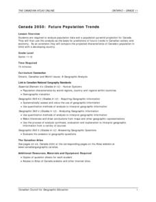
Canada 2050: Future Population Trends
Students analyze population data and a population pyramid projection for Canada. Using this information, they predict what the future trends in the population might be and its effect on Canadian society as a whole. They compare and...
Curated OER
The Arctic and Taiga Ecozone of Canada
Students discover the differences in the Arctic and Taiga regions of Canada. They identify physical and human characteristics of both region. They also practice using an atlas.
Curated OER
Canada's Natural Regions and Their Varied Characteristics
Students study Canada's six natural regions, including both the human and economic activities of each. In groups, they create a display representing one of the six regions.
Curated OER
The Arctic and Taiga Ecozone of Canada
Students examine the various sub-regions of the Arctic and Taiga zones in Canada. Using the online Canadian Atlas, they locate and describe the characteristics of each zone. They organize their information into a chart and share it with...
Curated OER
Geography: Intro to Canada
Students investigate the geography of Canada by analyzing a map of the country. For this North American geography lesson, students identify the 13 provinces of Canada and their locations by examining a Canadian map. Students...
Curated OER
A Canadian Inventory: The Way We Are!
Learners, in groups, explore major thematic sections of the Atlas of Canada. They use their findings to produce a wall display, consider and incorporate the issue of sustainability into their material and deliver a presentation to the...
Curated OER
Some Like it Cold: Canada's Northern Communities
Fifth graders examine cultures close to the arctic circle. In this geography lesson, 5th graders consider the impact of climate on cultural development of arctic communities. Students research a given community and present their findings...
Curated OER
Max Knows Mexicao, United States and Canada
Students utilize their map skills to explore the regions of North America. They explore the physical characteristics and climates of the regions. Students label their map and prepare a presentation of their findings.
Curated OER
Discovering Dinosaurs: Planning your Summer Vacation
Students use the online Atlas of Canada to gather information about places in Canada.


