Curated OER
Canada 2050: Future Population Trends
Students analyze population data and a population pyramid projection for Canada. They make predictions of future society and economic trends.
Curated OER
What's Your Reference
For this reference material worksheet, students choose the correct reference for each question given. Students discover the differences in the materials found in the dictionary, the almanac, the atlas, the newspaper, and the thesaurus.
Curated OER
A Primary Industry and its Environmental Impact in a Region
Students research and write about the importance of a primary industry in an assigned region of Canada. They study the environmental impact of developing a primary resource.
Curated OER
Canada's Forests and Resource Management
Students are introduced to the Canadian forest industry so that they may assess the economic and environmental sustainability of the industry.
Curated OER
Where Do Canadians Live?
Students investigate Canadian people by researching the geography of the country. In this world geography lesson, students identify locations within Canada with large populations based on their access to waterways. Students view and...
Curated OER
Diversity
Fourth graders discover cultural heritage by investigating the Aboriginal community. In this Canadian History lesson, 4th graders identify the First Nations of Canada and research them using an atlas and the web. Students create a First...
Curated OER
Nunavut, Our Communities
Students locate the communities of Nanavut on a territorial map and identify community characteristics. They research the online Atlas of Canada
Curated OER
Deportation of the Acadians
Students use an online atlas to identify the presence of Acadian culture in the Maritime provinces of Canada and explore the deportation.
Curated OER
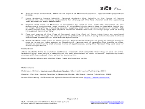
Nunavut - Flag and Coat of Arms
Students examine the symbolism of flags and coats of arms. In this community activity, students discuss the meaning behind the Nunavut flag and coat of arms. Students then design flags and coats of arms that represent their communities.
Curated OER
Discovering Dinosaurs: Planning your Summer Vacation
Students utilize the features of the Atlas of Canada website to plan an imaginary vacation from Victoria, British Columbia to Drumheller, Alberta.
Curated OER
Terrestrial Ecozones, Population Density and Species at Risk
Tenth graders navigate and use the online Atlas of Canada. They explain the cause and effect relationship between human settlement and the natural environment and wildlife species. They utilize a worksheet imbedded in this plan.
Curated OER
Glaciers of Canada
Students examine photos, a poster, maps and an article series by National Geographic to determine characteristics of glaciers and the process of glaciation. They both answer guided questions and develop their own questions about the...
Curated OER
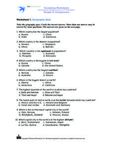
Worksheet 1: Geography Quiz
Students take a geography quiz and circle the multiple choice answer that answers each question correctly. The quiz is quite-challenging, and an atlas may be required to help the students. An answer sheet is provided.
Curated OER
Early Explorers Web Quest
Pupils use the Canadian atlas online to research early explorers and settlers in Canada. They also complete a Web Quest to gather information from maps. They make generalizations about the early settlement patterns as well.
Curated OER
Exploring Canadian Heritage
Students use the online Atlas as a research tool to find information on national parks and world heritage sites.
Curated OER
The Exploration and Settlement of North America
Learners locate place in Canada and explore highlights of early of early American exploration and settlement. In this North American history instructional activity, students locate provinces, major cities, and physical features of...
Curated OER
Give Me Some Latitude
In this latitude worksheet, students use an atlas or other reference to respond to 4 multiple choice questions about the equator and the poles.
Curated OER
Getting to the Core of World and State Geography
Students create topography relief maps. In this geography skills lesson, students review geography core knowledge skills, design and make a state relief map, and compile a student atlas.
Curated OER
Immigration
Students make a paper chain, based on percentages, representing the birthplace of people who immigrated to Canada between 1991 and 2001. They discuss how immigrants contribute to our society.
Curated OER
Nunavut, Our Communities
Students research the Online Atlas of Canada to locate the communities of Nunavut. Students examine the geographic area and characteristics of the communities.
Curated OER
From North to South...Quebec's Forest Regions
Middle schoolers identify and describe the different regions of Canada. With a focus on the forest regions, they use an atlas to locate the ecozones. They identify the characterstics of the climate and vegetation and the relationship...
Curated OER
First Nations Contributions
Eleventh graders recognize the contributions made my Indigenous people around the world. In this research skills lesson, 11th graders research native peoples of several countries and create presentations that feature the contributions of...
Curated OER
Getting to Work
Young scholars examine the modes of transportation people use to get to work in Canada. They examine how the methods chosen differ among provinces and among urban areas. They focus on the choices people make when selecting a method of...


