Curated OER
Blank Europe Map
Simple blank map, limitless possibilities! Here is a single-page resource of a blank map of Europe, without any country boundaries or text.
NASA
Outline Maps
Don't miss this gold mine of blank maps for your next geography lesson! Regions include traditional continents such as Asia, Europe, and Africa, as well as other major world areas such as the Pacific Rim and the Middle East.
Curated OER
European Union Map Quest
Sixth graders identify countries of the European Union. They locate countries of Europe on a map and pair with a student to complete a blank map of Europe. They label each country and complete worksheets for the European Union. They...
Curated OER
Getting to Know Austria- Map Skills
In this Austria map skills worksheet, students apply map skills to answer 14 fill in the blank questions about the country. They determine border countries, identify regions, find the capitol, and name rivers. They draw a map of Austria...
Curated OER
Blank Europe Outline Map
In this blank outline map worksheet, students explore the political boundaries of the continent of Europe and those of the countries located there. This map may be used in a variety of classroom activities.
Curated OER
Blank Europe Outline Map 2
In this blank outline map worksheet, students explore the political boundaries of the continent of Europe and those of the countries located there. This map may be used in a variety of classroom activities.
Curated OER
Europe Map
In this blank outline map worksheet, students explore the political boundaries of the continent of Europe. This map may be used in a variety of classroom activities.
Curated OER
The Roman Empire-Map Activity
In this Roman Empire worksheet, students complete a map activity in which they label and color civilizations, countries and physical features as instructed. There are no maps included.
Curated OER
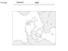
Denmark Outline Map
In this blank outline map learning exercise, students explore the political boundaries of Denmark located in Europe. This map may be used in a variety of classroom activities.
Curated OER
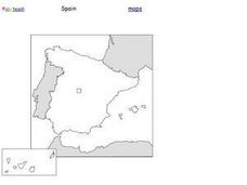
Spain Outline Map
For this blank outline map worksheet, students explore the political boundaries of Spain located in Europe. This map may be used in a variety of classroom activities.
Curated OER
European Map
In this blank outline map worksheet, students explore the political boundaries of the continent of Europe and those of the countries located there.
Curated OER
Europe Outline Map (Labled)
In this blank outline map worksheet, students study the political boundaries of the labeled European nations.
Curated OER
Europe
Students examine the reasons how and why the European Union was formed. They locate Europe on a map and identify the countries in the European Union. They create a tourist brochure for one of the countries.
Curated OER
Europe Outline Map
For this blank outline map worksheet, students explore the political boundaries of the continent of Europe and those of the countries located there.
Curated OER
Lesson Plan on Map Skills for South Asia
Seventh graders observe and discuss an overhead transparency map of South Asia. In small groups, they label a blank map of South Asia, and listen to a lecture on the realm.
Student Handouts
Christopher Columbus Workbook
Youngsters gain ample reading comprehension practice while studying the history of Christopher Columbus with this great workbook! It includes word puzzles and comprehension checks of multiple assessment styles, including multiple choice,...
Curated OER
NATO Geography & Language
The class receives background information on NATO, an atlas, and a blank world map. They color the original 1949 countries in red, the 1952 additions in green, and the 1990 additions in blue. This exercise would be a good starting point...
Edline
How Did the Unification of Germany Change the Course of World History?
Here you'll find a nice guided notes worksheet on Otto von Bismarck, which details Bismarck's plan to unify Germany, as well as asks learners to analyze his motivations and overall impact.
Curated OER
Roman Empire: Physical Framework - Location, Borders, Dimensions
Students relate the classical world to the modern world. For this map skills lesson, students turn a blank map into a colorful complete map by following step-by-step directions. This lesson allows students to connect our current...
Curated OER
First World War Maps
Tenth graders examine the First World War. In this Global History lesson plan, 10th graders analyze various maps of this time. Students construct maps of each front of the war by answering various questions.
Curated OER
Romania
In this blank outline map worksheet, students explore the political boundaries Romania located in Europe. This map may be used in a variety of classroom activities.
Curated OER
Number the Stars
Students read Number the Stars. In this social studies lesson, students read the story and use a map of western Europe and identify the countries involved in the war. Students locate the cities of Denmark that are discussed in the story.
Curated OER
Europe – Religion and Reformation
Ninth graders examine the Reformation. In this European history lesson, 9th graders explore the 95 theses of Martin Luther and discuss the reaction of the Roman Catholic Church to his ideas. Students then take a quiz based on the lesson.
Curated OER
The Race to Dominate the Known World
Students describe cause/effect relationship of a European country's need for resources, exploration, colonization, and settlement of different regions of the world beginning in the 14th Century, and role play representatives of assigned...
Other popular searches
- European Cities Blank Maps
- Blank Europe Political Maps
- Blank Maps of Europerating=3
- Blank Maps of Europe Cold War
- Europe Blank City Map


