NASA
Outline Maps
Don't miss this gold mine of blank maps for your next geography lesson! Regions include traditional continents such as Asia, Europe, and Africa, as well as other major world areas such as the Pacific Rim and the Middle East.
Curated OER
World Landforms
In this blank outline map worksheet, learners note the major landforms of the 7 continents of the world on a Robinson projection map.
Curated OER
World Political Map
In this blank outline map worksheet, students note the political boundaries of the nations of the world on a Mercator projection map.
Curated OER
Where in the World Is Mexico?
Students practice map-reading skills as they locate Mexico and its cities on a world map. By creating a puzzle out of a map of Mexico, students engage in a meaningful hands-on activity to help them explore that country's geography.
Curated OER
World: Continents
In this blank outline map learning exercise, students note the political boundaries of the continents of the world on a Robinson projection map.
Curated OER
European Integration: Who and Why?
This French IV-V activity addresses European integration into the European Union. French language learners research, discuss, and present in the target language. Online research, discussion, and presentations will take approximately 5-7...
Curated OER
Buddhism
In this Buddhism worksheet, students respond to 5 fill in the blank, 7 outlining, 10 short answer, 2 mapping, 5 multiple choice, 10 true or false, and 13 matching questions regarding the history of Buddhism and Buddhist beliefs.
Curated OER
Where In the World Are You?
Fourth graders fill in blank copies of the United States Map and then the World Map.
Curated OER
World Religions
Seventh graders identify major tenets and the distributions of world religions. In this world religions lesson, 7th graders work with a group to research a religion using the given website. Students complete a graphic organizer for the...
Project Food, Land & People
Loco for Cocoa
Students create a time line and map about how chocolate traveled the world. In this chocolate lesson plan, students also create and taste chocolate.
NY Learns
Geography of the Fertile Crescent by ECSDM
Using Google Earth, a vocabulary assignment, and map handout, your class members will outline the Fertile Crescent in Mesopotamia and identify the source of the Tigris and Euphrates rivers. They will then complete graphic organizers...
National First Ladies' Library
World Starvation
Students investigate the concept of world starvation and some of the organizations that are founded in order to help solve the problem. They conduct research using a variety of resources. The information is used in order to conduct class...
Curated OER
Roman Empire: Physical Framework - Location, Borders, Dimensions
Students relate the classical world to the modern world. In this map skills lesson, students turn a blank map into a colorful complete map by following step-by-step directions. This lesson allows students to connect our current geography...
Curated OER
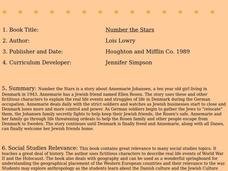
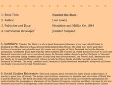
Number The Stars
Students read a book about prejudices that occur in our daily lives. They describe characters in the book. Students discuss real life events of World War II and the Holocaust. Students simulate hiding Jews from the German soldiers. ...
Curated OER
Number the Stars
Students read Number the Stars. In this social studies lesson plan, students read the story and use a map of western Europe and identify the countries involved in the war. Students locate the cities of Denmark that are discussed in the...
Curated OER
Mapping the Middle East
Students examine how the countries of the Middle East were created. They explore the influence of various political and geographic factors in their creation. They list the things they should consider in deciding how to draw new borders...
Curated OER
Where in the United States Are We?
Students spend the lesson identifying the location of the fifty states and the capitals. Using a software program, they retrace te outline of each state numerous times. To end the lesson, they write a story about a state and city of...
Curated OER
Hemispheres & Continents
Students learn in cooperative learning groups to determine how the equator and the Prime Meridian divide the earth into hemispheres and use Venn diagrams. Students will locate and label the hemispheres, continents, and oceans.
Curated OER
China - the Geography of European Imperialism - Spheres of Influence in China
Ninth graders create a map of China. They identify the various spheres of influence carved out by the Imperialist powers of Europe as well as locating geographical features of china and major cities. They explain the global impact of...
Curated OER
Using Venn Diagrams to Compare Two Ecosystems
Students explore the distribution of two ecosystems on a global scale; and map the distribution of tropical and temperate rain forests throughout the world. They use a Venn Diagram to describe these ecosystems and the differences between...
Curated OER
Tear the Continents
Students tear paper into representative continent shapes and configure them with world oceans through relative location, direction and latitude and longitude starting points. They recognize the shape of the continents. Students recognize...
Curated OER
What's Goin' Down?
Young scholars explore the concept of environmental stewardship. In this service learning instructional activity, students investigate the locations of the world's rain forests and concerns regarding the world's rain forests.
Curated OER
Dead Sea Investigation: Middle East and African Connections
Students demonstrate comprehension of the physical characteristics of the Dead Sea region and its connection to the Red Sea and the African Great Rift Valley. They are given students the opportunity to understand the role of plate...
Curated OER
Natural Disaster Blooms Taxonomy
Students complete activities that lead to greater understanding of the variety of natural disasters that occur all over the world.


