Curated OER
First You Take an Ecumene
Although this was written regarding Canadian agriculture, it can be used in any agriculture or environmental science class. Learners evaluate agricultural and economic activity maps and consider land use competition. Activities that get...
Curated OER
Canada: A Land Rich in Beauty and Culture
Third graders in groups research the different regions of Canada. They create a timeline to put the major events of Canada's history in order.
Curated OER
Canada, O Canada
Students study the similarities and differences between Canada and the United State in this unit. They examine geography, government and culture as they "travel" through Canada.
K12 Reader
Conflict Over North American Lands
Readers are introduced to some of the conflicts that arose over land and resources in the Americas in a two-part cross-curricular comprehension worksheet that asks kids to study the article and then to use information provided to...
Curated OER
The United States and Canada: Climate and Vegetation
Display U.S. and Canadian climate and vegetation through this text-companion worksheet. Learners read about the geography of these regions, take notes, and answer 3 comprehension questions as they read the selection. A graphic organizer...
Curated OER
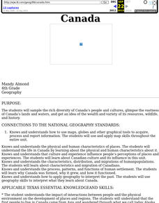
Canada
Fourth graders sample the rich diversity of Canada's people and cultures, glimpse the vastness of Canada's lands and waters, and get an idea of the wealth and variety of its resources, wildlife, and history.
Curated OER
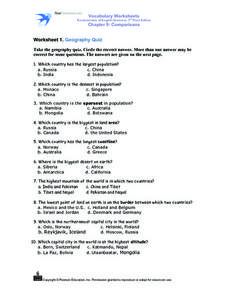
Worksheet 1: Geography Quiz
Students take a geography quiz and circle the multiple choice answer that answers each question correctly. The quiz is quite-challenging, and an atlas may be required to help the students. An answer sheet is provided.
Curated OER
Canada's Landform Regions
Students identify and describe the processes that created the landform regions in Canada. They map the regions and research one region to discover more about it. They present their findings to the class.
Curated OER
Canada's Landform Regions
Young scholars use a atlas to identify and describe Canada's Landform region. Using the information they collect, they create a thematic map of the region and describe all of the physiographic regions and the processes that formed them....
Curated OER
Canada's Geographic Position
Ninth graders investigate the characteristics of the geographic position of Quebec and Canada in the World. They study Canada's land and water boundaries, surface area and time zones.
Curated OER
The United States and Canada Review Worksheet and Study Guide
In this geography skills worksheet, students respond to 34 short answer questions about the geographic features and climates found in the United States and Canada.
Curated OER
Geography Words
This worksheet uses maps of South America and Canada to combine basic geography vocabulary and using prepositions. Students use the maps to answer questions about the locations of various countries on the two maps. This would be a good...
Curated OER
Some Like it Cold: Canada's Northern Communities
Fifth graders examine cultures close to the arctic circle. For this geography lesson, 5th graders consider the impact of climate on cultural development of arctic communities. Students research a given community and present their...
Curated OER
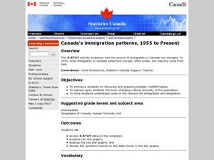
Canada's Immigration patterns: 1950 to Present
Students examine the changing immigration pattern of Canada. In this immigration lesson, students use statistical data from a web-site to complete a worksheet and graph their findings.
Penguin Books
A Teacher's Guide to the Signet Classics Edition of Mark Twain's The Adventures of Huckleberry Finn
Whether new to teaching The Adventures of Huckleberry Finn or an experienced pro, you’ll find useful resources in this teacher’s guide. The 40-page packet includes background information, historical context, an annotated list of...
Curated OER
Geography Words, Page 1
In this geography words and maps worksheet, students examine maps of North and South America. Students respond to 12 multiple choice questions regarding the maps.
Curated OER
Canadian Conoe Trip
Sixth graders research Canadian geography - the land and the bodies of water. They then plan an imaginary canoe trip through six major water bodies in Canada. They conclude the unit of study with a creative story.
Curated OER
This Rich Land
Students examine the geography of different treaty areas in order to see what it was that made these areas valuable to Europeans and Aboriginal peoples. They look at the treaties to see how these resources are dealt with, or how they...
Curated OER
The Arctic and Taiga Ecozone of Canada
Students discover the differences in the Arctic and Taiga regions of Canada. They identify physical and human characteristics of both region. They also practice using an atlas.
Curated OER
The Arctic and Taiga Ecozone of Canada
Students examine the various sub-regions of the Arctic and Taiga zones in Canada. Using the online Canadian Atlas, they locate and describe the characteristics of each zone. They organize their information into a chart and share it with...
Curated OER
Alberta And Saskatchwan: the View in 1905
Students analyze the differences between maps 1905 and current maps of Alberta and Saskatchewan. They use maps from the Canadian Council for Geographic Education to complete a guided inquiry. This lesson also has many extension activities.
Curated OER
Aboriginal Societies of Canada
Fourth graders study Aboriginal Societies in Canada and do an oral presentation to the class.
Curated OER
Comparing Neighbors
Students compare and contrast Minnesota to its Canadian neighbors. In this geography lesson, students work in groups to examine a map for their political division to Minnesota. Students compare and contrast information about Minnesota to...
Curated OER
Worksheet 2: Geography Quiz: True or False
Students read 10 statements associated with geography information from Worksheet 1 and determine if they are true or false. This worksheet would be a good follow-up to Worksheet 1 after the answers have been determined.


