Curated OER
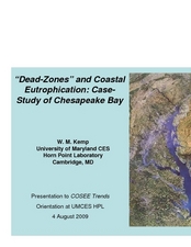
"Dead-Zones" and Coastal Eutrophication: Case-Study of Chesapeake Bay
Take an in-depth look at nutrient loading, eutrophication, and hypoxia using data on The Chesapeake Bay as an example. This comprehensive presentation includes detailed graphs, photos, and details about the changes in marine organism...
Curated OER
Chesapeake Bay
The Chesapeake Bay is the largest estuary in the United States. Explore its origins, organisms, and contributing rivers with this PowerPoint. It opens with several slides of general information on the formation of estuaries, then it...
Curated OER
Rivers & Watersheds
An outstanding presentation of rivers and watersheds awaits your earth scientists! The erosion process created by rivers is addressed. Viewers are introduced to v-shaped valleys, alluvial fans, and watersheds. Several slides are...
Curated OER
Regions of North America: The Chesapeake Bay
In this reading comprehension activity, students read an article on "The Chesapeake Bay". Students read 5 sentences and fill in each blank in each sentence with a word from the article. Students answer 3 short answer questions on the...
Curated OER
Journey of a Raindrop to the Chesapeake Bay
Students explore the water cycle and the path a single drop of water would take if it traveled from their schoolyard to the Chesapeake Bay in Virginia.
Curated OER
Regions of North America:The Chesapeake Bay
In this Chesapeake Bay worksheet, students read a 1-page article about the region and then respond to 5 fill in the blank and 3 short answer questions.
Curated OER
Bay B C's
In this unit of lessons, students examine the Chesapeake Bay area. Students learn what lives here and how humans are affecting the area.
NOAA
Marine Ecosystems
Be at the top of the food chain when it comes to understanding marine ecosystems. The 21st installment of a 23-part NOAA Enrichment in Marine sciences and Oceanography (NEMO) program investigates marine ecosystems, ocean zones, and food...
Curated OER
Nutrients In Chesapeake Bay
Learners perform pH and turbidity test to determine water quality. In this environmental science instructional activity, students analyze NASA database on chlorophyll-a in the bay. They explain how a small river area affects Chesapeake Bay.
Curated OER
Captain John Smith's Chesapeake Bay
Middle schoolers conduct research to determine how the Chesapeake Bay has changed since the 17th century when Captain John Smith first explored it. Students read from Smith's historical documents.
Curated OER
Chesapeake Bay Watershed Project
Students conduct a simulation to determine the health of local streams and rivers. They role-play as researchers, scientists, politicians, and writers and use technology to implement plans to improve the quality of waterbodies.
Curated OER
Native vs. Non-native Species: Who Will Win?
Students examine non-native species and the problems they have caused in the waters of the Chesapeake Bay. They create a "Wanted" poster for one of the species. They describe the effects of non-native species on the schoolyard species.
Curated OER
Marvelous Marshes of the Chesapeake
Third graders identify sources of salt water and fresh water that enter the Chesapeake Bay. They build a model watershed and describe how runoff enters the Bay.
Curated OER
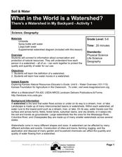
What in the World Is a Watershed?
Students discover the role of a watershed. In this geography lesson, students are shown a diagram of a watershed and discuss the definition of a watershed. Students demonstrate the role of a watershed by using an umbrella and spraying it...
Curated OER
Exploration Watershed
Students discuss what a watershed is, and locate watersheds on a map. For this watershed lesson, students use the information they have been introduced to and create a color coded watershed map of their own.
Curated OER
Be a Watershed - Create a Living River
Learners investigate water ways by conducting an experiment with classmates. In this natural resources instructional activity, students define a watershed and identify where large ones are located within the United States. Learners...
Curated OER
Who Killed SAV?
Middle schoolers research the factors that contributed to the decline of submerged aquatic vegetation in the Chesapeake Bay. Students evaluate the natural and human factors that led to the decline of bay grasses.
Curated OER
Our Keystone FFA Spring
Students identify where their water sources and explore a watershed on a map. In this watershed lesson students walk a wetland, and identify sources of pollution.
Curated OER
Land Use and Nitrogen
Students consider the effects of development on water quality. They test nitrogen levels in waters before and after development, investigate wastewater treatment options and research best management practices to reduce nitrogen loads.
Curated OER
The Effect of Tides & Elevation on Wetland Plant Communities
Students comprehend how tides can impact shoreline plant communities through the study of a freshwater tidal marsh. They use actual tidal data to show that tidal ranges differ among geographic locations, even those relatively close...
National Geographic
National Geographic: Exploring Place in the Chesapeake Bay Watershed
In this activity, students use the National Geographic FieldScope to examine the Chesapeake Bay watershed and its tributaries, and learn how their location connects to it. They then develop a watershed profile for their location....
BSCS Science Learning
Bscs: Chesapeake Bay Algal Blooms
In this inquiry, students engage with mapping data to determine what kind of land coverage is contributing the most to harmful algal blooms in the Chesapeake Bay Watershed. Click on the link for teacher resources for teaching guides and...
National Geographic
National Geographic: Visualizing Watershed Health
Using data visualizations that show dissolved oxygen levels, students analyze the health of the Chesapeake Bay watershed. They will also learn about dead zones, which are aquatic areas where there is insufficient oxygen to support life....
Smithsonian Institution
Smithsonian Environmental Research Center: It's All in the Watershed
Learn about your ecological home on this site. The nation shares the Chesapeake Bay watershed, our ecological home. Most stories on this site focus on separate plants and animals, but together, these stories literally show a web of life.


