Curated OER
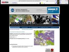
Aruba Cloud Cover Measured by Satellite
Students analyze cloud cover and to compose written conclusions to a given related scenario. They submit a letter of response and a report detailing their calculations and conclusions.
Curated OER
Trickster Tales
Students study folk tales and moral lessons from cultures around the world. In this character traits lesson, students study moral lessons through the character traits in various cultures folk tales. Students complete 11 activities...
Curated OER
Biomes: Islands and Evolution
Students discover how islands form, how plant and animal species get there and what the term means. In this biomes activity students prepare a presentation that describes the life forms and geography of an island.
Curated OER
If These Walls Could Talk: Seeing a Culture Through Human Features
Pupils read Talking Walls and discuss the walls presented and their importance to the culture. In this geography lesson, students locate and label each country/continent discussed in the book on a world map. Pupils take a walk and point...
Curated OER
If You Build It, Will They Come?
Students examine the city of Duluth, Minnesota. In groups, they use the internet to discover its current state of urban geography. After their research, they create and plan their own redeveloping of the city. They share their results...
Curated OER
Patterns of Settlement in Early Alabama
Fourth graders study the settlement of Alabama. They collect data from the U.S. census website and answer questions regarding settlement patterns in the counties of Alabama in 1820. They write a paagraph describing where they would have...
Curated OER
Yaks, Yurts, and Yogurt: A Look at China's Autonomous Regions
Learners are introduced to five Chinese geographical areas. They, in groups, research these areas and develop presentations including information on the physical characteristics, climate, elevation, agriculture and language.
Curated OER
All Things Chinese
Fourth graders bring in items or pictures related to Chinese culture. The items are displayed in the room as a museum exhibit.
Curated OER
State of Arkansas Travel Brochure
Eighth graders design a travel brochure to persuade others to visit Arkansas. They depict particular points of interest they decide are the best in the state.
Curated OER
Got Park? Or if you build it, they will come!
Students use GIS and GPS technology to evaluate, research, locate, and recommend where a new park should be located that benefit the community.
Curated OER
Introduction to Junkanoo! A Bahamian Festival
Students examine a Bahamian festival called Junkanoo. They analyze how group cooperation is related to the festival. They finally identify how factions form and how they can help or hurt a community.
Curated OER
America the Beautiful
Students listen to a read-aloud discussing the landmarks of the United States. In pairs, they use the internet to research a landmark of their choice. They create a visual aid to be given with a presentation sharing the information...
Curated OER
Sea Surface Temperature Trends of the Gulf Stream
Students use authentic satellite data to produce plots and graphs of sea surface temperature as they explore the seasonal changes of the Gulf Stream.
Curated OER
Native Americans
Students, in groups, research various Native American tribes. They wirte a report about the tribe which includes information about their food and ceremonies, among other things. They create a diorama and a poster that shows how they...
Curated OER
Sea Surface Temperature Trends of the Gulf Stream
Students explore the importance of the Gulf Stream. Using a NASA satellite images, they examine the sea surface temperature. Students collect the temperature at various locations and times. Using spreadsheet technology, they graph the...
Curated OER
Circle the Earth - Explore Surface Types on a Journey around Earth
Pupils use CERES percent coverage surface data with a world map in locating landmasses and bodies of water at Earth's Equator.
Curated OER
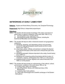
Networking at Early James Fort
Students examine the impact of global trade on regional civilizations of the world after 1500. They research and analyze images of pottery excavated at Jamestown, and create a poster that presents information about world trade networks...
Curated OER
Aruba Cloud Cover Measured by Satellite
Students analyze cloud cover over Aruba. They compose and submit written conclusions which include data, analysis, errors in data collection, and references.
National Endowment for the Humanities
Neh: Edsit Ement: Mapping Our Worlds
In this lesson, introduce your students to the world of maps and discover a world of information online. Students learn how to identify different types of maps, comparing maps to the rooms of a house.
National Geographic
National Geographic: Mapping Ocean Currents
An unfortunate spill of 92,000 rubber ducks into the ocean in 1992 elicited invaluable information about global ocean currents as scientists tracked their journeys around the world. In this lesson, students first learn about the Ocean...
Bob Dunn
History Globe: The Oregon Trail: 1843 Map
Take a virtual tour of the historic Oregon Trail and see photos of the landmarks along the way. Compare the map of 1843 with a modern map of today.
Alabama Learning Exchange
Alex: Arctic Adventures
During this lesson, students will explore plant and animal life found at the Arctic Circle. They will also learn about the dangerously cold climate and the location of the Arctic Circle relative to the school's location on maps and globes.
Science Buddies
Science Buddies: Ozone Depletion
The ozone layer is important for blocking most of the harmful radiation that comes from the sun. You can find maps of the ozone layer and compare different regions of the globe for ozone coverage. Some scientists think that aerosols in...


