Curated OER
Topographic Maps Worksheet
In this geography skills learning exercise, students respond to 37 multi-part questions that require them to read and interpret topographic maps.
Curated OER
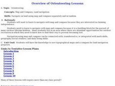
Orienteering Lessons - Overview
Welcome to the Orienteering lesson plans page. There is a short introduction to the topic and links to the ten lessons in this unit. There is also a linkto the unit home page. This orienteering unit is worth taking a look at.
Curated OER
Orienteering - Lesson 3 - Topographical Maps and Contour Lines
Learn how to read a topographical map and understand what the contour lines mean. Explore longitude and latitude. Find a cliff, a valley, a mountain peak, and more. This is just one of the ten lessons in this unit on oreinteering....
Curated OER
Rivers Run Through It
Using a relief map of New York State, learners answer questions about the distance between different cities, identify bodies of water, and more. First, they discuss vocabulary related to the Hudson River area. Then, they complete a...
Curated OER
Mapping with a Compass: A Simulated Survey
Students use compasses and grids to map the locations of artifacts found in a simulated dig site. In groups, they role-play as future archeologists excavating a school site. Groups begin at their assigned datum and site the artifacts...
Curated OER
In Mr. Lincoln's Shoes
Students demonstrate basic map skills. For this US history lesson, students review cardinal directions and use a compass rose while at the same time discuss what life was like for Abraham Lincoln.
Curated OER
A School Map
In this school map worksheet, students practice their map reading skills as they use the word box and the compass rose the help them answer 6 fill in the blank questions.
Curated OER
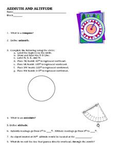
Azimuth and Altitude
In this altitude worksheet, learners define compass, azimuth, astrolabe, and altitude. Students use a protractor to determine the altitude of the given stars on a graph. This worksheet has 7 short answer questions and 8 fill in the blank...
Curated OER
C is for Compass: Letter Cc
In this letter Cc worksheet, students study the stroke patterns for the uppercase and lowercase letter Cc. Students trace and print both letters several times. Students then trace and print the word compass.
Curated OER
Using Map Skills
Third graders study maps. In this U.S. geography lesson, 3rd graders explore directions on a compass rose and use a map scale to determine distances between two points on a map. They listen to a lecture and use their own maps to practice...
Curated OER
Those Who Have Come Before Me
Class members are transformed into explorers as they work in groups to locate hidden items and map their journey along the way. They then leave clues for other groups of students to follow, and ultimately discover how past explorations...
Curated OER
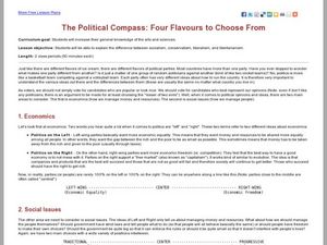
The Political Compass: Four Flavours to Choose From
Students learn about the issues that separate political parties. In this politics lesson, students look at economics and social issues from different perspectives and use the Nolan Chart to organize their information.
Curated OER
Direction and Angle: Positions and Directions
This is an interesting mix of concepts. Half of this presentation provides double-digit addition and subtraction practice and the other half has students discuss cardinal directions and right angles. Use these together, or use them on...
Curated OER
Leaf, Tree and Prairie Study
Young scholars are introduced to the topic of Botany and the process of photosynthesis. Using various habitats, they research the amount of destruction it is facing and how to solve the problem. They make a leaf booklet with leaves they...
Curated OER
Mapmaker, Mapmaker, Make Me a Map
Second and third graders practice with basic map skills. They create their own map including a legend and a compass rose. This fabulous plan has many excellent websites linked which allow learners to explore maps of all kinds; including...
Intel
Plugging into the Sun
What's cooking? A sizzling STEM unit challenges scholars to build a solar cooker that can successfully cook an egg. The unit opens with a study of Earth's rotation, the sun's energy, and shadows. Pupils use a compass and thermometer to...
Curated OER
Where in the World? The Basics of Latitude and Longitude
Learners are introduced to the concepts of latitude and longitude. In groups, they identify the Earth's magnetic field and the disadvantages of using compasses for navigation. They identify the major lines of latitude and longitude on a...
Curated OER
Cardinal and Ordinal Directions
Students use a compass to locate cardinal and ordinal directions. In small groups, they describe and create a journey for their classmates using their compass. Groups create a scale map for their classmates to follow and relate this...
Media Education Lab
The Ethics of Propaganda
What are the short and long-term consequences for consumers and producers of modern media propaganda? Class members ponder this essential question as their unit study of ethics of propaganda concludes. After examining two case studies,...
Curated OER
How To Read A Map
In this map skills worksheet, learners view a map and answer five short answer questions by using the map key as a guide.
Curated OER
Compass Rose Directions
Second graders use cardinal and intermediate directions to locate places on maps and places in the classroom, school, and community. They draw a setting map of "Little Red Riding Hood." Students give five steps of cardinal or...
University of Colorado
Looking Inside Planets
All of the gas giant's atmospheres consist of hydrogen and helium, the same gases that make up all stars. The third in a series of 22, the activity challenges pupils to make scale models of the interiors of planets in order to...
Corbett Maths
Loci Part 1
Where can it go? The first video on loci develops a definition and provides some quick sketches of the loci of all points with given characteristics. The presenter does an example of the loci of points a given distance from an L shape.
Mathed Up!
Bearings
Keep the math straight and true. Using information learned about angle relationships, pupils determine drawn bearings, or draw a line with a given bearing. The accompanying video provides the definition of a bearing and its three...
Other popular searches
- Compass Skills Worksheets
- Compass Skills 3rd Grade
- Compass Skills First Grade
- Compass Skills Elementary
- Map and Compass Skills
- Compass Skills Lesson Plans
- Map Compass Skills
- Math Compass Skills
- Tecahing Compass Skills
- Decaying Compass Skills
- Compass Skills Yr 10
- Math Compass Skills Triangle


