Curated OER
Converging Earthquake!
Students identify the fault lines and tectonic plates on the map. In this earth science lesson, students simulate landscape formation using robots. They take a quiz at the end of the lesson to demonstrate mastery.
National Research Center for Career and Technical Education
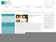
Hospitality and Tourism 1: Safety and Sanitation
Math and science come alive in this career-related lesson on sanitation. Along the way, learners explore bacterial growth rates using exponential notation and graphs. A link to a very brief, but vivid video shows just how quickly these...
Computer Science Unplugged
Treasure Hunt—Finite-State Automata
Introduce your class to the concept of finite-state automata with an activity that asks individuals to try to map their way to Treasure Island by taking different routes though an island chain. Each island has two ship sailing...
Indian Land Tenure Foundation
More Tribal Homelands
Here is a very fun idea that introduces young learners to how geographical location affects cultural development. They are introduced to four areas where Native Americans have lived in the past by reading stories and examining images....
Star Wars in the Classroom
Star Wars Geography Unit
What kind of animals live on an ice planet like Hoth? How would the habitat on Tatooine allow different organisms to thrive? Connect social studies, science, and Star Wars in one engaging activity that focuses on the ecosystems...
Fluence Learning
Writing Informational Text: Lemonade Stand
Use a performance task to assess third graders' ability to read informational text. After they plan a lemonade stand business, young entrepreneurs implement that plan through informational writing. The task assumes learners can...
Curated OER
Tracking Satellites Using Latitude and Longitude
Students, viewing an Internet site, plot the path of several satellites using latitude and longitude over the course of an hour. They learn the four basic types of satellites and their purpose.
Curated OER
Story Stretching: Tall Tales in North America
Students are introduced to tall tales. In this introductory tall tales unit, students explore the tall tales of Casey Jones and Johnny Appleseed. This unit includes many interdisciplinary lessons including graphing skills and geography.
Curated OER
Endangered Animals Books
Middle schoolers research endangered species and create and publish books to present their findings. Designed to use Inspiration software, this resource could be adapted if you don't have access to the program. Contains handy website...
Curated OER
Dependence and Interdependence
Third graders explore the dependence and interdependence that plants and animals in every environment have on one another. They examine how plants and animals depend on each other for survival. Students complete a variety of experiments...
Curated OER
What's Up With the Water Cycle?
Young scholars explore the water cycle. Students identify the stages in a water cycle and create a PowerPoint presentation based on their knowledge.
Curated OER
Introduction to WorldWatcher: Coloring Temperature Maps
Young scholars are introduced to the software program WorldWatcher. In groups, they discover the temperature variations throughout the world and color a map according to the temperatures. They also practice using visualization to...
Discovery Education
Sonar & Echolocation
A well-designed, comprehensive, and attractive slide show supports direct instruction on how sonar and echolocation work. Contained within the slides are links to interactive websites and instructions for using apps on a mobile device to...
Curated OER
Eyewitnesses to Change
Students explore recent changes in the Artic's climate that have been observed by Artic residents. They watch videos, take notes and create a concept map. They also look at historical weather data from a specific Artic community. The...
Curated OER
Smart Ideas Lesson Plan
Seventh graders create a concept map about the cardiovascular system. In this life science instructional activity, 7th graders identify the parts and functions of each system component. They explain how cardiovascular system works with...
Curated OER
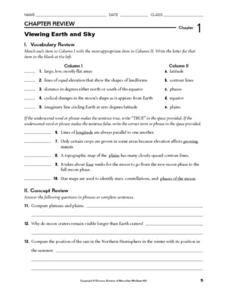
Viewing Earth and Sky
For this earth and sky worksheet, students review terms associated with map reading. Students also review topographic maps and how contour lines represent elevation. This worksheet has 5 matching, 5 true or false, 5 fill in the blank,...
Curated OER
REPRODUCTION
Students complete a variety of activities to study different concepts in Science. The activities are part of a layered curriculum. This is used to differentiate instruction and give a wide variety of assessment opportunities.
Curated OER
Atom and Eve
Students research and define an atom using a concept map. They design and create a model of an atom, labelling all the parts, and write a journal entry.
Curated OER
Chemical Changes or Reactions
In this chemical changes worksheet, students create a concept map for chemical changes or reactions. They indicate the definition, the description, they give examples and they give non-examples in a graphic organizer.
Curated OER
Orientation of the Earth in Space
Students hypothesize the location of the sun in the sky at diferent times of day and at different latitudes. They perform several experiments to provide evidence for their hypothesis. Experiments including observing the sun's position at...
Curated OER
Bathymetric Mapping
Students draw contour lines based on NOAA soundings on a nautical chart. They color the contours and glue label tags for topographic features. They determine that the floor of the ocean is composed of hills, plains, ridges, trenches,...
Curated OER
A Year (a Day or a Week) In My Life as a Shorebird
Students describe the basic life history of one shorebird common to their area. They use the writing process which includes brainstorming, rough draft writing, peer editing, and re-writing to create a factually and grammatically...
Orange County Water Atlas
Location, Location, Location…
Young geographers discover not only how to read and recognize coordinates on a map, but also gain a deeper understanding of latitude and longitude and how climate changes can vary significantly across latitudes.
Teach Engineering
The Great Pacific Garbage Patch
The Great Pacific Garbage Patch is one of several garbage patches around the world where garbage accumulates naturally. As part of a GIS unit that combines oceanography, environmental science, and life science, class members investigate...


