National Wildlife Federation
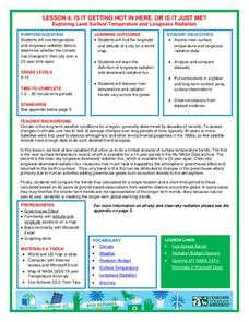
Is It Getting Hot in Here, or Is It Just Me?
Currently, only 2.1% of global warming is felt on continents, while over 93% is felt in the oceans. The fourth instructional activity in the series of 21 on global warming is composed of three activities that build off one another. In...
Curated OER
Making a Globe
Young scholars examine the mercator projection or nautical chart and observe how global maps do not have the same distance as flat maps. They design handmade globes using the meridians and equator as guides to draw in the land. They...
Curated OER
The Big Blue
Third graders create paper mache globes with balloons. They label the 4 oceans on their balloons with reference to large wall map, classroom globe, and Encarta Virtual Globe CD-ROM projected on large screen TV with Tvator or other...
Curated OER
Important Rivers of the World
Third graders become familiar with names of the different parts of a river, define and locate drainage basins, locate six of the continents and explore the major rivers on each one, conduct research on a river of their choice.
Curated OER
Our Changing View of the Earth
Students explore the theory of Plate Tectonics. They participate in a simulation in which they re-enact the debate over Plate Tectonics vs. traditional beliefs of stationary continents that were widely accepted during the 1800's and...
Curated OER
Map Puzzles
Young scholars make puzzles from world maps, dramatizing how much of the globe is covered by ocean.
California Academy of Science
Tropical Belt
Where in the world is the equator? Explore a world map with your class, coloring in oceans, continents, and rainforests while locating the three major lines of latitude: the equator, Tropic of Cancer, and Tropic of Capricorn. Discuss how...
Curated OER
Garb and Grub Across the Globe
First graders discuss what part of the world their ancestors came from. They locate the locations on a map and discuss the differences and similarities of each continent and their people. They become familiar with the traditional...
Curated OER
Climatic Changes
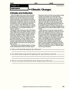
For this weather worksheet, students read an excerpt describing the climate and extinction. Then they explain what the climate was like during the Age of Dinosaurs. Students also determine some factors that affected the climate during...
Curated OER
The Ocean Floor -- Science
Young scholars work together to create a model of the ocean floor. They practice using new vocabulary associated with the ocean floor as well. They share their model with the class.
Curated OER
We've got the whole world in our hands
Students explore spatial sense in regards to maps about the globe. In this maps lesson plan, students label oceans, locate the continents and poles, follow directions, and explain the symbols on a map.
World Maps Online
Introduction to the World Map
Learners identify the differences between maps and globes. In this map skills instructional activity, students are shown a globe and a map and recognize the differences. Learners use post-it notes to locate several locations on the world...
Curated OER
Fantastic Flying Journey
Third graders listen to a teacher reading of the "Fantastic Flying Journey." students research each country/continent using the Internet and creating a travel journal.
Curated OER
Welcome to My World!
Students use maps to locate information. They read the story, "It Looked Like Spilt Milk", view images of the continents and discuss the various continents. Afterward, they make their own Atlas to record information that they can later...
Curated OER
National And International
Students participate in a series of geography lessons in which they identify the meaning of national and international. They discover the regions of the US after identifying the planet on which they live, the continents, the oceans and...
Curated OER
Size It Up
Students practice their math skills in determining the water/land proportions of the Earth. Using globes, they locate the seven continents and oceans and determine which covers more space. They use this information to participate in...
Curated OER
Hypothermia on the High Seas
Students identify and present the effects on humans when the body temperature falls, demonstrate and explain how the body loses heat, and understand hypothermia and cold water survival techniques.
Biology Class
Plate Tectonics
A great reference to include in the classroom and on your class website, the presentation covers the following topics: Alfred Wegener's theory of continental drift, Pangea, layers of the earth and their properties, convection, plate...
Curriculum Corner
Earth Day Book
This Earth Day, celebrate our beautiful planet with an activity book that challenges scholars to show off their map skills, complete a crossword puzzle, write acrostic poems, alphabetize, and reflect on their personal Earth-friendly habits.
NOAA
Please Pass the Salt
Salinity is the focus of two experimenters that work to answer the question, How does salt change the physical properties of water? Super scientists compare the freezing rate of salt and fresh water, combine the two waters to observe how...
Curated OER
Maps and Globes: Where in the World are We?
Students explore maps and globes. In this introduction to map and globe concepts lesson, students identify features of physical maps, political maps, and globes. Students locate land and water, and recite a poem about the names of the...
Curated OER
Gallery Walk Questions about Energy and Material Cycles
Students state the physical, chemical or biological processes associated with these environments: Pelagic ocean zone, California coat Cave, Indiana Barrier island beach, North Carolina Sand dune, Dunes National Park, Colorado Wetland and...
Curated OER
Water, Water Everywhere, and Nary a Drop to Drink!
Students sing the continent song and locate oceans between the continents on a map. They read "They Earth is Mostly Ocean" and copy notes into their journals. They watch a demonstration of water and saltwater evaporated to see what is...
BrainPOP
Latitude and Longitude Differentiated Lesson Plan
Scholars warm-up their map skills with a discussion using location words to describe familiar places. An engaging video informs class members about latitude and longitude. Three leveled activities extend the learning experience for...
Other popular searches
- Oceans and Continents
- 7 Continents and Oceans
- Continents and Oceans Map
- Continents Oceans Landforms
- Label Oceans and Continents
- World Continents and Oceans
- Identify Continents Oceans
- Earths Oceans and Continents
- Canada Oceans and Continents
- Oceans and Continents Maps
- Continents Oceans Rating=3
- Map of Continents and Oceans


