Curated OER
Christopher Columbus: The Man, the Myth, the Legend
Learn more about maps by examining Christopher Columbus's voyage to the New World. Kindergartners will learn about basic map skills and how to identify the compass rose, oceans, and land masses. They will also discover the purpose of...
Owl Teacher
Introduction to World of Geography Test
Assess your learners on the five themes of geography and the most important key terms and concepts from an introductory geography unit. Here you'll find an assessment with 15 fill-in-the-blank and 14 multiple-choice questions, sections...
Curated OER
Maps and Globes
First graders complete a unit on map skills and the globe. They label maps, create a styrofoam ball globe, create a map of their community, sing a continent song, and complete a map and globe assessment worksheet.
Curated OER
Mapping the News
Students explore cartography. In this map skills and map making activity, Students work in groups to create wall size world maps including legends, compass roses, latitude and longitude, and physical features. Students...
Curated OER
Geography Puzzles
Students study the continents of the world. In this Internet geography instructional activity, students connect to online mapping games. Students collaborate in order to develop their understanding of world geography, including countries...
Curated OER
Continents and Oceans
Young scholars identify oceans and continents and their locations on a map. They color-code and label their own map of the world's continents and oceans. They play the game Continents and Oceans to identify specific areas.
Royal Geographical Society
An Introduction to Maps
First graders are introduced to a variety of maps such as globes, street maps, atlases, and different types of floor plans. The focus of the instructional activity requires individuals to create their own plan of the classroom using...
BrainPOP
Latitude and Longitude Differentiated Lesson Plan
Scholars warm-up their map skills with a discussion using location words to describe familiar places. An engaging video informs class members about latitude and longitude. Three leveled activities extend the learning experience for...
Curated OER
Underwater Mountains & Trenches
Students determine Earth's deepest trench, outline continents, major ocean mountains, and trenches on color-key map using Crayola Erasable Colored Pencils, identify oceans' geographic features, locate significant oceanic features around...
Compton Unified School District
How Can We Locate Places?
How can we locate places? Maps, of course! Expose second graders to the tools available in maps and discuss how these tools can help people find locations. Students also look at communities, including what makes a community and the...
Curated OER
Map Puzzles
Students make puzzles from world maps, dramatizing how much of the globe is covered by ocean.
Curated OER
Continents of the Globe
Learners identify the continents on the globe. In this map skills lesson, students define the term "continent" and identify the seven continents on the globe.
NASA
Outline Maps
Don't miss this gold mine of blank maps for your next geography lesson! Regions include traditional continents such as Asia, Europe, and Africa, as well as other major world areas such as the Pacific Rim and the Middle East.
Curated OER
Maps and Globes: Where in the World are We?
Students explore maps and globes. In this introduction to map and globe concepts lesson, students identify features of physical maps, political maps, and globes. Students locate land and water, and recite a poem about the names of the...
Curriculum Corner
Earth Day Book
This Earth Day, celebrate our beautiful planet with an activity book that challenges scholars to show off their map skills, complete a crossword puzzle, write acrostic poems, alphabetize, and reflect on their personal Earth-friendly habits.
Curated OER
Geography: Continents
First graders identify basic geographical facts about the world they live in and distinguish between land and water on a globe. They research the continents and information associated with each one focusing on building their map skills.
Curated OER
Magical Maps
Second graders discuss the importance of using maps and how they are used. After they listen to a folktale, they develop their own story line maps and write their own folktale to accompany a map. They also identify and locate the seven...
Curated OER
Food on the Map
Students work together to examine the tastiest towns in the United States. After discovering the names of the equipment, they identify the seven continents. They take a survey and locate the cities and states of the foods mentioned.
Curated OER
Maps Reinforcement
In this map activity, students complete 6 multiple choice questions and 5 short answer questions about 3 different map figures.
Curated OER
The Seven Continents Scavenger Hunt
Who doesn't enjoy an engaging scavenger hunt? Here, scholars listen to, and discuss, the informative text, Where is my Continent? by Robin Nelson. They then explore the seven continents and four major oceans using...
National Endowment for the Humanities
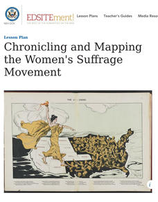
Chronicling and Mapping the Women's Suffrage Movement
While women's suffrage is often believed to be the result of a single constitutional amendment, the effort of women to secure the vote spanned decades and continents. Using primary sources in online archives, class members explore the...
Curated OER
Getting it Straight with Latitude and Longitude Skills
Teachers can help students learn latitude and longitude skills using games and other motivating activities.
Curated OER
Where Am I: How to Read a Map
Third graders develop an understanding of maps. They explore what a map is, who uses maps, and how to use maps. Students investigate the compas rose. They create a compose rose which illustrates the cardinal directions. Students practice...
Curated OER
Map Skills: Explorers, Continents, and Oceans
Third graders use a software program to make and label a map of the world. On the map, they locate the seven continents, oceans and the countries of Europe. They also draw the routes of Christopher Columbus, Juan Ponce de Leon and...


