Illustrative Mathematics
Why Does SSS Work?
While it may seem incredibly obvious to the geometry student that congruent sides make congruent triangles, the proving of this by definition actually takes a bit of work. This exercise steps the class through this kind of proof by...
Curated OER
Problem Solving: Graphing Functions
In this graphing functions activity, students solve 6 word problems, finding ordered pairs, missing coordinates and numbers, slopes of lines and functions.
Curated OER
Where In the World Are We?
Fifth graders read postcards and find their locations on maps. They use the pictures and text on the postcards to write about imaginary vacations. They compute the mileage and compare it to TripMaker data.
Curated OER
Poetic Justice: A Study of Poe's Famous Works
Students explore Edgar Allan Poe's most famous short stories. In this Edgar Allan Poe lesson, students complete a 25 page packet of activities where they recognize the features of genres and literary devices Poe uses. Students read "The...
Curated OER
Measurement and the Illampi Mound Colony
Young scholars comprehend the basic units of measurement, scale, plotting, and basic grids. Students practice their estimation
and measuring skills and will demonstrate their ability to work well in groups.
Curated OER
The Tale of Scale
Eighth graders, using a range of data, produce three bar graphs for various scales along the y-axis.
Curated OER
Gridding a Site
Students establish a grid system over an archaelogical site. They label each grid unit. They determine the location of artifacts within each grid unit. They construct a scientific inquiry concerning the location of artifacts on the site.
Curated OER
Dough Lake Topology
Students practice coordinates and measurements, develop 2D, 3D topological map, construct grid with string on real surface, establish "level" fixed point for measurements, take and record data points of elevation, and enter data on...
Curated OER
Measure Up!
Learners examine parallax and angular measurements. In this investigative lesson students calculate distances of objects and map their results.
Curated OER
Where Am I?
Students identify the latitude and longitude of various locations and calculate the distance between two given coordinate points. They read an eBook, explore the City Zen program, and complete a worksheet.
Mathematics Assessment Project
College and Career Readiness Mathematics Test C2
Scholars apply knowledge learned over their high school math courses in order to determine their college readiness. The 20-page resource emphasizes applied problem solving.
Curated OER
Tracking the Storm
Students discuss the different types of storms that can hit land. They locate specific coordinates on a plane grid. They discuss lonsgitude and latitude to plot the coordinates of a tropical storm. They practice finding coordinates...
Curated OER
2 x 2
Students work together to grid a 2 x 2 meter unit using the formula for the Pythagorean Theorem. After creating the grid, they identify the location of artifacts and create a map of their location. They develop a graph and table of their...
Curated OER
Houses
Third graders use a number of problem solving strategies in this unit of lessons. They determine how to draw and model three-dimensional objects, use co-ordinate systems, determine probability of events, and identify paths of simple...
Curated OER
Attu: North American Battleground of World War II
Students examine military maps and photos to better explain why an isolated battle on a remote island in Alaska alarmed the nation. They explain how the Japanese occupation and American recapture of Attu were significant in the history...
EngageNY
Motion Along a Line – Search Robots Again
We can mathematically model the path of a robot. Learners use parametric equations to find the location of a robot at a given time. They compare the paths of multiple robots looking for parallel and perpendicular relationships and...
EngageNY
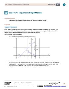
Sequences of Rigid Motions
Examine the various rigid transformations and recognize sequences of these transformations. The lesson asks learners to perform sequences of rotations, reflections, and translations. Individuals also describe a sequence that results in...
Space Awareness
How To Travel On Earth Without Getting Lost
Have you ever wanted to travel the world? Take a virtual trip with a geography lesson that uses longitude and latitude, the position of the sun, an astronomy app, and a classroom globe.
Curated OER
Carbon Monoxide and Population Density
Tenth graders investigate the carbon monoxide level at a fixed latitude. They determine if there is a relationship to population density. They download data sets and generate a graph. They determine a link between human activity and...
MARS, Shell Center, University of Nottingham
Defining Regions Using Inequalities
Your young graphers will collaboratively play their way to a better understanding of the solution set produced by the combining of inequalities. Cooperation and communication are emphasized by the teacher asking questions to guide the...
US Navy
The Science of Diving
Introduce gas laws using the popular topic of SCUBA diving. This activity makes a connection between the gas laws and the effect of pressure and temperature changes during diving. Young engineers complete introductory experiments to...
Noyce Foundation
Photographs
Scaling needs to be picture perfect. Pupils use proportional reasoning to find the missing dimension of a photo. Class members determine the sizes of paper needed for two configurations of pictures in the short assessment task.
Curated OER
Where is ? ? ? ?
Students explain and explain the concept of a grid system. They define absolute and relative location and develop an imaginary city on graph paper using a grid system.
Curated OER
Slides, Flips. Turns......It's All On A Memory Book Page
Fourth graders use tangram sets to investigate the congruence of shapes. They use congruent shapes to demonstrate the properties of slides, flips, and turns. They complete a math journal entry that describes and illustrates each concept.


