Curated OER
Bird and Dog Race
Your pupil's pet dog and bird are racing down the city streets. In order to know who is going to win, they better know something about calculating rates, the Pythagorean Theorem, and applying those topics to the map of the city.
EngageNY
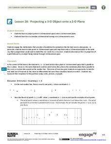
Projecting a 3-D Object onto a 2-D Plane
Teach how graphic designers can use mathematics to represent three-dimensional movement on a two-dimensional television surface. Pupils use matrices, vectors, and transformations to model rotational movement. Their exploration involves...
Mathematics Assessment Project
Square
Don't be a square! Young mathematicians determine the slope and length of a line segment. They then prove whether four given coordinate points form a square.
It's About Time
The Electricity and Magnetism Connection
Magnets don't grow in fields, but magnetic fields are important to understand. The lesson covers the effect electricity has on magnetic fields. Scholars use a compass, magnets, and electrical wire to test magnetic fields and energy...
Curated OER
Understanding Growth of the Phoenix Area
Students study the growth of the Phoenix area using geographic images, maps, tables, and graphs. They study the idea of community.
Curated OER
What a Site!
Fourth graders are introduced to how to properly create a grid site. In groups, they use Cartesian coordinates to establish the boundaries for the grid and photograph the location of artifacts. They exchange their photos with another...
Curated OER
TE Activity: Nidy-Gridy
Students make a grid and coordinate system map of their classroom as they investigate why it is important to have a common map making system. They look at how landmarks are used for navigating an area.
Curated OER
Lagoon Lake
Students develop skill in using co-ordinates. Up to eight cardinal points of the compass are used making this a useful activity in simple map and grid work. They utilize educational software to gain practice.
Curated OER
A Message in a Bottle
Students investigate the motion of water currents by mapping the possible movement of messages cast into the ocean in bottles.They accurately plot the appearance of bottles on a world map and illustrate the flow of an ocean current...
Curated OER
Make Your Own "Weather" Map
Learners create their own "weather" map using data from x-ray sources. They analyze and discuss why it is important to organize data in a fashion in which is easy to read. They compare and contrast different x-ray sources using a stellar...
Curated OER
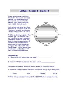
Latitude
In this latitude instructional activity, students answer questions about latitude that include absolute locations of countries and coordinates. Students complete 12 questions.
Curated OER
Locating Places
Students demonstrate how to use the map grid system. In this map skills instructional activity, students are given coordinates to locate several locations on a world map. Students use the map grid system to identify these locations.
Curated OER
Gridding a Site
Students establish a grid system over an archaelogical site. They label each grid unit. They determine the location of artifacts within each grid unit. They construct a scientific inquiry concerning the location of artifacts on the site.
Curated OER
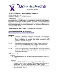
Translating Transformations in Geometry
Students create an image using given coordinates and evaluate how the coordinates change when a slide or rotation takes place.
Curated OER
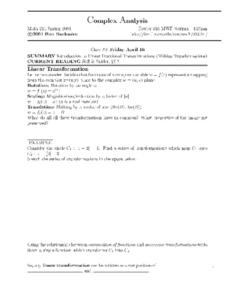
Complex Analysis: Linear Fractional Transformations
In this transformation worksheet, students explore linear transformations and mappings. They map equations on a coordinate plane. This two-page worksheet contains approximately three problems.
Curated OER
Complex Analysis: The Complex Derivative
For this complex derivative worksheet, students determine the circle of a radius under the mapping principle. They identify analytic functions, and explore the relationship between real and imaginary parts of complex functions. This...
Curated OER
Hurricane Tracking
Students access the Internet to find information on current hurricanes. They get locations, speeds, and air pressures and then plot the location of the hurricane on a hurricane-tracking map. They also access the FEMA website to solve...
Curated OER
Plotting A Hurricane Using latitude and Longitude
Students explore map and plotting skills by tracing the movement s of hurricanes through the Earth's systems. a hurricane map is developed from daily media reports.
Curated OER
Clickable Image Maps
Students understand the difference between server-side and client-side processes. They create an inline image that has different portions hyperlinked to other web pages, pictures, and other sites on the Internet.
Curated OER
Life on an Island: Early Settlers Off the Rock-Bound Coast of Maine
Students study the characteristics of life on the Cranberry Isles off the coast of Maine as they were settled. They examine images and maps to determine the location and lifestyle.
Curated OER
MAPPING THE SCHOOL FOREST
Students measure distances and directions using paces and a compass. They determine their own pace, explore how to read a compass bearing, and how to take bearings on given sites.
Curated OER
Distance Formula
Students create ways to find the number of square miles that lie in a triangle having vertices at A, B, and C. They compute the distance between two points and use Heron's formula to find the area of the triangle. Finally, students...
Curated OER
Finding Latitudes and Longitudes
Students analyze Columbus' rationale for sailing west, and find the latitude and longitude of modern and ancient place names.
Curated OER
Your Expedition of Discovery
Young scholars study GPS and see how it is used to determine points on the Earths surface. In this expedition lesson students use GPS to find given coordinates.


