Captain Planet Foundation
Predicting Whether the Weather is Good for the Garden
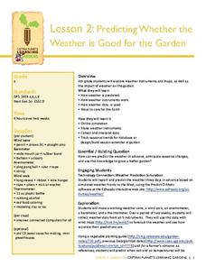
Can your class predict the weather? Show them how they can come close with a instructional activity about creating weather instruments, including weather vanes, barometers, wind socks, anemometers, and thermometers. Kids research weather...
Teach Engineering
Stormy Skies
Young meteorologists examine the four main types of weather fronts and how they appear on a weather map. Participants learn about the difference between the types of weather fronts along with their distinguishing features. A...
Curated OER
Weather Map Challenge
In this weather worksheet students use a weather map to answer given questions. Students answer questions using map symbols and make predictions based on map. Students create additional questions with answers using the same map.
Curated OER
Weather Map
Ninth graders utilize several different types of maps to forecast weather conditions specific areas of the country. Air masses, wind, cloud types, fronts, and the pH of the rain is explored in this lesson.
British Council
Weather 1
Match weather words with pictures in a weather vocabulary worksheet. Beginning readers look at pictures of various weather patterns and choose/write the word that describes the weather. They create a map and write about the weather...
Kenan Fellows
Sensors, Sensors…..Everywhere! Middle School Meteorologist Create Weather Bots!
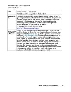
My forecast is that you'll want to use the resource. Pupils design and create a weather bot as part of a project-based unit. These bots should be able to measure temperature, humidity, barometric pressure, wind speed and direction, and...
Curated OER
Weaving Weather Maps with the World Wide Web
Students access the Internet and use real time data from the American Meteorological Society to create a detailed weather map. They make weather predictions based on the data collected.
National Wildlife Federation
It's All in the Name: Weather Versus Climate
What goes up when rain comes down? An umbrella! Activity eight in the series of 12 explores weather and climate. In pairs, participants analyze maps, watch a short video, create a weather forecast, and complete a reading to determine the...
Montana State University
What's the Weather?
How many jackets do you need to stay warm and climb Mount Everest? An informatie resource covers the topic of Mount Everest, the resource helps young scientists discover the difference between climate and weather. Activities include...
Curated OER
Weather instruments
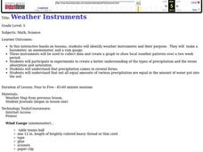
Students explore weather instruments. In this weather lesson, students make rain gauges, anemometers, and barometers following the instructions given in the lesson. Students set up a weather station using their instruments and record and...
Curated OER
Story Mapping
Fill-out a story map to help your scholars with pre-writing. They will use a story map template to pre-write. They also organize their ideas into steps which become the foundation for their first draft. Concrete objects are brought in to...
Curated OER
Creating a Thematic Map
Students create and analyze a weather-related data table and a thematic map based upon information provided.
Curated OER
Regents High School Examination: Physical Setting Earth Science 2006
Test your class on earth science with this extensive resource. This test, created by The University of the State of New York Regents, is made up of 50 multiple choice questions and 32 short answer questions that cover the branches of...
Curated OER
Weather and Seasons
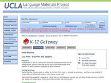
Use pictures and manipulatives to develop vocabulary with your beginning language learners. This plan can be used with foreign language learners (although you'll have to provide the vocabulary), English language learners, or a young...
Curated OER
Hurricane and Weather Power Points
Providing a wealth of information about hurricanes, tornadoes, and other types of weather-related events, this resource could be used in the classroom in a variety of ways. A teacher could use the PowerPoints listed as a way to introduce...
National Wildlife Federation
Hot, Hotter, Hottest: Extreme Weather's Impact on Our Resources
How dry is it? It's so dry, the river only runs twice a week! Through an analysis of maps and discussions, pairs learn about droughts across the United States in the ninth of 12 lessons. They then read about, answer questions, analyze...
Office of the New Jersey State Climatologist
Play Ball! – Or Not…Making a Decision Using Weather Data
Should the game go on or not? An engaging instructional activity asks small groups to make a decision using weather data. After analyzing a map, an updated forecast, and radar information, groups have to decide whether to cancel a...
Curated OER
Create a Country
Learners work in small groups to list features and elements found on a variety of grade- appropriate maps. They develop a class list of map features and elements to draw from as they create a map of an imaginary country.
Curated OER
Weather Forecasting
Students examine cold, warm, and stationary fronts. They also examine the roles of relative humidity and the way air masses move. They are to create forecasts based on the information they collect. Tapes are shared with the class.
Curated OER
Fantasy / Art Maps
Ninth graders analyze a fantasy art map by Jeremy Anderson, paying careful attention to the way the topographic features of the land are represented. They create a similar map of Sacramento that includes topographical features as well as...
Curated OER
Understanding Weather and Climate Patterns
Students research the climate patterns of various locations and make predictions based on their findings. They determine the importance of latitude and longitude in weather and climate. Students create graphs displaying their collected...
Curated OER
Create a Weather Newscast
Fourth graders explore and study basic weather terms, strengthen research skill on the web and create a weather newscast. They choose a weather site on the web, copy weather maps and create a videotape based on a written script to...
Curated OER
Creating Station Models
Students review weather conditions at various cities and create station models on a weather map.
Curated OER
Utah Weather
Fourth graders diagram the weather in Utah through the use of a glyph. In this Utah weather lesson, 4th graders create weather glyphs of different areas in the state. Students answer questions about the weather and then compare their...


