Curated OER
Maps! Maps! Maps!
Third graders examine and identify different types of maps. They review the types of projections and which maps are better for different information. They answer comprehension questions at the end of the lesson.
Curated OER
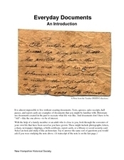
Everyday Documents
Almost more of a lesson than a activity, this particular resource has learners examine different types of historical documents. There is a historical docment embedded in the activity that learners study, and they also bring in documents...
Rainforest Alliance
Knowing the Essential Elements of a Habitat
To gain insight into the many different types of habitats, individuals must first get to know their own. Here, scholars explore their school environment, draw a map, compare and contrast their surroundings to larger ones. They then...
Curated OER
Introduction to Maps
Students investigate different types of maps and their purposes. In this mapping lesson students complete a worksheet, participate in a class discussion and do a hands on activity.
Curated OER
Geographic Regions and Backyard Geology with the USGS Tapestry Map
A beautiful tapestry map of North America is examined by geology masters. The map incorporates the topography and geology of different regions. You can purchase printed copies or a large poster of the map, or if you have a computer lab...
Curated OER
Exploring Arizona's Biotic Communities Lesson 1: Mapping Biotic Communities
As part of a unit on Arizona's biotic communities, young ecology learners create a map. They describe how humans and animals adapt in their habitat. They take notes and create graphic organizers from articles they read. Beautiful maps,...
Mathematics Assessment Project
Sorting Functions
There's no sorting hat here. A high school assessment task prompts learners to analyze different types of functions. They investigate graphs, equations, tables, and verbal rules for four different functions.
Indian Land Tenure Foundation
Create a Map
Do your students have a connection to their natural environment? Create neighborhood maps together with your little learners. The lesson starts as the class talks about where they live and what their homes look like. They review their...
Curated OER
Mapmaker, Mapmaker, Make Me a Map!
Young scholars evaluate the different types of historical and geographical information that one can gather through close study of historical maps from the 16th through the 19th centuries. They create their own maps.
Curated OER
Analyzing Two Dances and Making a Dance Map: The Nutcracker
Students discuss dance elements and create a dance map. They choose a dance theme and incorporate movement into their dance maps and choreography. They also experiment with different types of music.
Oregon State
World Map of Plate Boundaries
Young geologists piece together the puzzle of plate tectonics in an earth science lesson. Given a physical map of the world, they search for land formations that indicate the location of different types of plate boundaries.
Texas Heart Institute
Anatomy: How Does the Cardiovascular System Work?
How can the circulatory system compare to a city map? Pupils distinguish the "roadways" and "vehicles" of the cardiovascular system, compare the anatomy and function of veins and arteries, and review different types of blood cells with...
Curated OER
Map Exploration
Are you looking for a terrific lesson on map activities for your second graders? Then, this resource is for you! The activities range from decoding, to fill-in-the-blank, to read-and-search. There is a website activity related to maps...
Curated OER
Understanding a Geological Map
Students identify different types of maps and observe a geological map. In this geology lesson students create a replica map of a geological area that includes a key.
Curated OER
Second Graders on the Map
Second graders explore the various types of maps. They examine the differences between street maps and aerial photographs. Students identify various features on each map. They use cardinal directions and the compass rose. They write...
Curated OER
Scale Skills
For this mapping skills worksheet, students read an excerpt that describes three different types of scales and how to calculate distance on a map. They respond to two short answer questions using the map provided on the sheet and to...
Curated OER
Map It!
Fourth graders demonstrate map making skills by using the computer to create maps of the geographic features, regions, and economy for their state.
Seterra
Northern Europe: Countries - Map Quiz Game
Remembering geography is a tiring and tedious task to many scholars. Change it up by assigning the map quiz game. Elementary and middle schoolers alike test their knowledge and compete with the clock to match as many countries as...
EngageNY
How Do Dilations Map Lines, Rays, and Circles?
Applying a learned technique to a new type of problem is an important skill in mathematics. The lesson asks scholars to apply their understanding to analyze dilations of different figures. They make conjectures and conclusions to...
CK-12 Foundation
Identify Line Types: Intersecting and Parallel Lines
Navigate your way through a lesson on types of lines. Individuals drag line segments to illustrate paths between pairs of houses on an interactive map. They determine if these line segment pairs are intersecting or
parallel.
Agriculture in the Classroom
A Holiday Tradition: Which Christmas Tree Will You Choose?
Different varieties of Christmas trees provide an interesting way to combine social studies, science, math, and technology. Class members not only research the history of the Christmas tree holiday tradition, they compare and...
Curated OER
Eastern European Studies
One worksheet, three projects. Learners explore Eastern Europe and mark Eastern European countries on a map. They then collect and record census data on thirteen different countries, and write a 3-5 page expository essay on one of the...
Curated OER
Maps as Models of Earth
Eighth graders use different types of maps to find locations and surface features. In this map-reading lesson students use a compass to find direction.
Curated OER
Map Projections
Young scholars view examples of various map projections using a website. Students record differences between the map projections. Young scholars discuss uses for the various map projections and the differences between the maps they...


