Science Matters
Finding the Epicenter
The epicenter is the point on the ground above the initial point of rupture. The 10th lesson in a series of 20 encourages scholars to learn to triangulate the epicenter of an earthquake based on the arrival times of p waves and s...
Science Matters
Earthquake Preparedness
Forty-five states and territories in the USA are at moderate to very high risk of earthquakes. The discussion-based instructional activity covers what to do before, during, and after an earthquake. The 14th instructional activity in...
Curated OER
Tic-Tac-Toe for Layers of the Earth
Eighth graders identify the different layers of the earth. In this earth science activity, 8th graders choose a project to do from a given list according to their learning style. They present their finished project in class.
National Wildlife Federation
Why All The Wiggling on the Way Up?
Some of the CO2 emitted by burning fossil fuels is removed from the atmosphere by natural sinks, such as the ocean. The fifth engaging lesson in the series of 21 examines the CO2 data from three very different locations. It then makes a...
Curated OER
Volcanoes
Students participate in groups to complete a volcano project. In this volcano lesson, students work in groups to follow directions and create a working, model volcano. Students then answer discussion questions about their project.
Curated OER
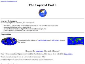
The Layered Earth
Students role play plate tectonics by creating a "plate statue" made up of students. In this earth science instructional activity, students describe how Earth's movement cause earthquakes and volcanoes. They draw and name the different...
Curated OER
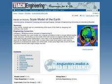
Scale Model of the Earth
Learners work together to create a model of the Earth. They label and identify each layer and describing its properties. They discover how engineers use models to test different concepts.
Curated OER
Ozone Layer
Seventh graders develop an understanding of the ozone layer, it's affect on Earth, and the effect of human activity on the ozone layer. They then interpret data from satellite pictures and develop an understanding of longitude/latitude...
Curated OER
Fossil Fuels (III), The Geology of Coal: Interpreting Geologic History
Students hypothesize about why various samples of coal have different characteristics. Pupils use information that they found during Internet searches to ascertain the validity of their hypotheses and verify the "story" of coal. ...
Curated OER
Climate Change: Is there a Controversy
Students explore climate changes. In this climate changes lesson, students research what causes changes. Students search the Internet, summarize reports they find and create a poster with the information.
Curated OER
Water Layering and Circulation
Students examine relationships and interactions between different types of water. They experiment with colored water of different temperature and salinity and discuss how the results relate to real ocean currents.
Curated OER
Types And Magnitudes Of Earthquakes
Learners investigate the concept of earthquakes and the different types of magnitudes. They research the Richter scale and how it is used to measure the intensities of earthquakes. Students then apply the concept by completing a...
Curated OER
The Effects Of Earthquakes
Students investigate the concept of how earthquakes occur and the after effects of how they effect landforms. They conduct research it using a variety of resources and measure the varying intensities of how earthquakes effect the...
Curated OER
Earth Science
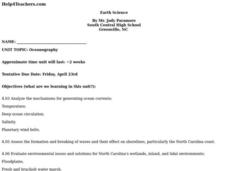
High schoolers analyze the mechanisms for generating ocean currents, temperature, and deep ocean circulation. They are able to assess the formation and breaking of waves and their effect on shorelines, particularly the North Carolina...
Curated OER
Incorporating 3D Visualizations into Your Classroom
Students make observations through 3-D visualizations. They explore scientific and geologic processes through the use of 3-D pictures.
Curated OER
Tropical Rainforests
Students create their own rainforest environment. This tropical rainforest activity, introduces where rainforests are located, their real world connections, and their structural make up. It includes further resources online.
Polar Trec
What Can We Learn from Sediments?
Varve: a deposit of cyclical sediments that help scientists determine historical climates. Individuals analyze the topography of a region and then study varve datasets from the same area. Using this information, they determine the...
National Wildlife Federation
Why All the Wiggling on the Way Up? CO2 in the Atmosphere
The climate change debate, in the political arena, is currently a hot topic! Learners explore carbon dioxide levels in our atmosphere and what this means for the future in the 11th installment of 12. Through an analysis of carbon dioxide...
Wilderness Classroom
Pollution
Educate scholars on pollution—air, water, and land—with a series of lessons that begin with a thorough explanation of each type. Learners then take part in three activities to reinforce the importance of reducing pollution. They...
Curated OER
Environmental Studies: The Environment Rocks!
Rock exploration, so exciting! After reading the book Everybody Needs a Rock, the class makes sandwiches to better understand that the Earth is made in layers. They then use a description of the 3 types of rock to conduct an observation...
Curated OER
Air Quality Issues
Young scholars identify the different layers of the atmosphere. They examine the different types of air pollutants. They also discover laws in effect that work to protect the environment.
Curated OER
Ring of Fire
Pupils locate some of the 1,500 active volcanoes on a world map. Then by comparing their maps with a map of the world's tectonic plates, they discover that volcanoes occur because of the dynamic nature of the Earth's lithosphere.
Curated OER
The Rain Forest of Costa Rica
Fifth graders examine and discuss the topography, climate, natural resources and artwork of Costa Rica. They develop a diagram of the layers of the rain forest, and design a tourist brochure or advertisement promoting Costa Rica's...
Curated OER
Groundwater Movement
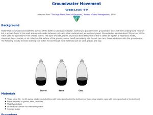
Pupils study groundwater movement beneath the surface of the Earth. In this agriculture lesson plan, students experiment with how water moves through rock materials such as sand, gravel, and clay.


