Oregon State
World Map of Plate Boundaries
Young geologists piece together the puzzle of plate tectonics in an earth science lesson. Given a physical map of the world, they search for land formations that indicate the location of different types of plate boundaries.
PHET
Earth’s Magnetic Field from Space
Feel the pull of science! The final installment of this 18-part series is an application of everything learned in the previous high school lessons. Scholars are given a magnetic field map and must propose an arrangement of magnets that...
PHET
Mapping the Field of Multiple Dipole Magnets
So you built a magnetometer, now what? High school scientists use their magnetometer made in a previous lesson to map the union of magnetic fields of dipole magnets. They experiment with different alignments and draw conclusions about...
Curated OER
Changing Planet: Sea Levels Rising
Begin by showing a six-minute video, Changing Planet: Rising Sea Level as an anticipatory set. Pupils draw a topographic map of a potato continent. Finally, they will visit NOAA's sea levels online map and NASA's carbon dioxide...
Howard Hughes Medical Institute
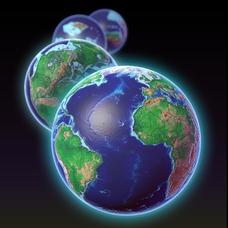
EarthViewer
Can you imagine Washington DC and London as close neighbors occupying the same continent? Learners will be fascinated as they step back in time and discover the evolution of the earth's continents and oceans from 4.5 billion...
PHET
Mapping the Field of a Dipole Magnet
High school scientists build their own magnetometer and use it to map the field surrounding a bar magnet. Excellent background resources is included, as well as a diagram of how to build the magnetometer.
Curated OER
Earth, The Universe, And Culture
Students examine how science is interpreted based on social environments. They watch and discuss a video, identify scientists and locate their countries of origin on a map, explore various websites, and complete a handout.
Curated OER
Changing Planet: Permafrost Gas Leak
Pair earth scientists up to use an amazing online arctic portal mapping tool and Google Earth to analyze permafrost changes. They compare changes to data on atmospheric concentrations of methane to see if there is a correlation. Then...
Curated OER
Fostering Geospatial Thinking: Space to Earth: Earth to Space (SEES)
Young scholars locate and access data to help them with their science inquiry. For this geographical positioning lesson students evaluate and compare data sets.
Curated OER
Water Quality and Watersheds: A GIS Investigation
Requiring more than one class period, this resource takes earth science learners on a journey through a watershed. Using ArcGIS Explorer, an online geographic information system, they view maps of watersheds and surrounding landscapes....
Science 4 Inquiry
An Investigative Look at Florida's Sinkholes
In May of 1981, the Winter Park Sinkhole in Florida first appeared and is now referred to as Lake Rose. Scholars learn about the causes of sinkholes through an inquiry project. Then, they analyze recent data and draw conclusions to...
University of Colorado
Strange New Planet
The first remote sensors were people in hot air balloons taking photographs of Earth to make maps. Expose middle school learners to space exploration with the use of remote sensing. Groups explore and make observations of a new...
US Environmental Protection Agency
Mapping Greenhouse Gas Emissions Where You Live
After investigating the US Environmental Protection Agency's climate change website, your environmental studies students discuss greenhouse gas emissions. They use an online interactive tool to look at data from power production...
Astronomical Society of the Pacific
Getting Ready for the All American Eclipse!
Give your pupils a front row seat at the biggest light show in the sky this year! In addition to admiring the total solar eclipse, young astronomers can explain the phenomenon with a little help from an inquiry-based instructional...
Texas State University
Earth: Deposition and Lithification
Geology geniuses analyze sediment samples with a hand lens and sort according to physical characteristics. They also learn about the processes of cementation, compaction, and lithification within the rock cycle. The lesson plan is...
EduGAINs
Go H2O! Investigating Residential Water Systems
Before your learners excuse themselves to get a drink at the water fountain, prompt them to think about where that water comes from. A middle school science lesson encourages groups to research their community's source of drinking water,...
Curated OER
Pangaea Puzzle: Exploring the Tectonic Forces That Shape the Earth
Sixth graders follow in the footsteps of early scientists as they put the pieces of Pangaea back together and discovered the forces that create the variety of landforms and sea-floor features of our Earth.
Curated OER
How Do Cartographers Find Points on a Map?
Ninth graders describe latitude and longitude and how they may be useful to find things on a map. In this cartography instructional activity students divide into groups and devise a coordinate system that can be used to communicate...
Curated OER
An Introduction to the Night Sky and Movement Astronomy
Basically, this is an interactive exploration of educational astronomy software and an app. Young astronomers discover how the apparent motion of the sky relates to Earth's movements and the position of the observer. It is out of this...
Columbus City Schools
Experiencing Eclipses
Don't be caught in the dark! Young scientists investigate the causes of both solar and lunar eclipses using an interactive to help them understand the development of an eclipse over time. They then research facts and characteristics...
Curated OER
Weather Forecasting: From Then to Now
Eighth graders review the history of weather forecasting. In this earth science lesson, 8th graders identify the different tools used in forecasting weather. They explain why it's important to know the weather.
Curated OER
Is Your Spot Hot?
Eighth graders explore global warming. In this Earth Science lesson plan, 8th graders will look for Harbingers and fingerprints for different areas. The students will identify an area at risk and they will then create a...
Curated OER
Changing Planet: Melting Glaciers
Resource links to a video, satellite images, data, and photographs of glaciers provide emerging earth scientists the opportunity to examine how the ice has been retreating over the years. A data table is included for pupils to record...
Curated OER
A Comparison Study of Water Vapor Data to Precipitation over North America
Students use NASA satellite data to compare water vapor over the United States. In this data analysis lesson students use an Excel spreadsheet to map their data.


