Curated OER
Studying Snow and Ice Changes
Students compare the change in snow and ice over a 10 year period. In this environmental science activity, students use the live data on the NASA site to study and compare the monthly snow and ice amounts on a map of the entire Earth. ...
Curated OER
Michigan Food: From Farm to You
Students recognize Michigan on a map and understand how its climate is affected by the Great Lakes. In this Michigan food lesson, students play a trivia game to identify the produce of Michigan. Students relate the climate in each part...
Curated OER
You Can Die Here
Students examine Death Valley including the amount of precipitation and winds that it gets. In this climate based lesson students explain the reasons for the amount of precipitation and windward patterns in Death Valley.
Curated OER
Aquifer Model
Students, after researching and brainstorming about aquifers and locating aquifer maps of Texas, participate in the building of a model of an aquifer complete with a pumping station. They also answer a variety of questions at the...
Curated OER
Working With Hypotheses
In this science worksheet, students examine the topic in order to solidify knowledge covered in the curriculum using puzzles and creative games.
Science 4 Inquiry
Deforestation
Young scientists observe deforestation from satellite photos and discuss the importance of forests to the global environment. They then simulate a plot of forest when farmers move into the area over the course of seven years. Finally,...
Curated OER
What is the Rock Cycle and Its Processes?
Geology beginners examine three different rock samples and determine their origin by their characteristics. By making and recording observations, they become familiar with features of igneous, metamorphic, and sedimentary rock types....
Curated OER
Watersheds, Watersheds Everywhere
Students identify the watershed in which their school is located. They use maps to locate their homes and school. They define and use the correct vocabulary.
Curated OER
It Came from Outer Space! The AA Meteorite Connection
Young scholars discover why Antarctica is the most fruitful place on earth for locating meteorites. They work in groups. Students are given a Museum or University Name for each group. They are explained that each group is allowed to...
Curated OER
NIGHT AND DAY: DAILY CYCLES IN SOLAR RADIATION
High schoolers examine how Earth's rotation causes daily cycles in solar energy using a microset of satellite data to investigate the Earth's daily radiation budget and locating map locations using latitude and longitude coordinates.
Curated OER
Soils
Students apply knowledge of soil, environmental impacts, economics, multiple human demands, and use given data for a proposed scenario in making land use decisions. They debate land use issues and/or scenarios and discuss a case study.
Curated OER
What's Under There?
Young scholars determine ways to make "observations" about unknowns, such as the land beneath an ice sheet or the interior of the Earth, using tools other than sight. They build "mystery boxes" and exchange them with other groups to...
Curated OER
The Bulbs: Camas and Daffodil
Fourth graders become aware of the importance of the camas bulb to the Nez Perce people, they learn the parts of plants, and gain understanding of the interdependence of Nature. They study about the possible causes and outcomes of global...
Curated OER
How Deep is the Ocean
Students predict and then analyze the layout of the tectonic plates that form the ocean's floor using mapping skills and Inquiry based problem solving, They compare the depth of various regions in the ocean with the geologic age to...
Curated OER
"Hard" Data from Space
Students use satellite images to analyze development patterns within Baltimore City. They prepare a land cover map for Baltimore indicating the prevalence of impervious surfaces and explore how these patterns affect water pollution.
Curated OER
Earthquake Depth
Students research and locate earthquake epicenters on a map using latitude and longitude. They determine if the depth of an earthquake has any relationship to the distance from a plate boundary.
Curated OER
Eyewitnesses to Change
Students explore recent changes in the Artic's climate that have been observed by Artic residents. They watch videos, take notes and create a concept map. They also look at historical weather data from a specific Artic community. The...
PHET
Soda Bottle Magnetometer
Introduce learners to set of complete instructions that describe how to build a magnetometer that works just like the ones professional photographers use to predict auroras. The diagrams are wonderfully descriptive, and the written...
PHET
Where to See an Aurora
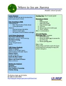
Where can you see an aurora in North America? After completing an astronomy activity, scholars can locate the exact coordinates. Pupils plot points of the inner and outer ring of the auroral oval and answer questions based on their...
University of Colorado
Are All Asteroids' Surfaces the Same Age?
There are more than 600,000 asteroids in our solar system. Pupils analyze images of two asteroids in order to determine if they are the same age. They count craters for each asteroid and compare numbers.
Monroe City Schools
Clouds! Clouds! Clouds!
Here is a beautiful lesson on clouds designed for your 1st graders. Learners study three different types of clouds. They construct drawings of cumulus, cirrus, and stratus clouds. The Cloud Book, by Tommie dePaola is used to introduce...
NASA
Tools to Study Tornadoes and Galaxies
Take your class on an intergalactic journey as they explore the galaxy and various meteorological events taking place in our atmosphere each day. Learners investigate electromagnetic waves and the Doppler Effect before gathering radar...
Curated OER
Are Butterflies Free?
Students use remote sensing to study monarch butterfly migration and human interaction to save the Oyamel forest (Mexico) for butterfly and human habitation.
Curated OER
Trends of Snow Cover and Temperature in Alaska
Students gather historical snow cover and temperature data from the MY NASA DATA Web site. They compare this data to data gathered using ground measurements from the ALISON Web site for Shageluk Lake. They graph both sets of data and...


