Curated OER
Hazards: Second Grade Lesson Plans and Activities
Equip learners with safety knowledge in the case of an earthquake. After coloring the places to go to get help after a quake, and label places that wouldn't be safe to go after a quake, young geologists simulate three levels of...
Curated OER
Hazards: Kindergarten Lesson Plans and Activities
The last unit in the series allows kindergarteners to see the dangers and hazards associated with each of the natural disasters learned so far in the series—earthquakes and volcanoes. They listen to sounds associated with the...
Science Matters
Ring of Fire
Over a period of 35 years, earthquakes and volcanoes combined only accounted for 1.5 percent of the deaths from natural disasters in the United States. The 15th lesson in a 20-part series connects the locations of earthquakes and...
Science Matters
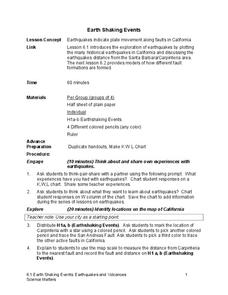
Earth Shaking Events
The world's largest measured earthquake happened in 1960 in Chile, reaching a terrifying 9.5 magnitude on the Richter Scale. The second lesson in the 20-part series introduces earthquakes and fault lines. Scholars map where previous...
Houghton Mifflin Harcourt
Nature’s Fury: Extra Support Lessons (Theme 1)
Earthquakes, hurricanes, volcano eruptions, and more. To enrich their study of nature's big events, kids map tectonic plates and major earthquake locations, identify emergency response agencies, and storyboard a film about volcanos.
Science Matters
Spaghetti Fault Model
Does increasing the pressure between two moving plates provide a stabilizing force or create more destruction? The hands-on lesson encourages exploration of strike-split fault models. The sixth lesson in a 20-part series asks...
DiscoverE
Shake It Up with Seismographs
Shake up your lessons on earthquakes. A simple seismograph lets scholars record "earthquakes" in the classroom. These earthquakes occur when classmates drop balls from different heights. Young scientists measure these with seismographs...
Science Matters
Seismic Activity and California Landforms
By the 19th lesson in the 20-part series, scholars realize volcanoes and earthquakes are related to plate boundaries. The lesson extends and applies the knowledge by having individuals create a bumper sticker for one specific area of...
Curated OER
Earthquakes and Volcanoes
In this earthquakes and volcanoes worksheet, students will review how volcanoes are formed and where they are found. Students will describe earthquakes and their magnitudes. Students will use a table to answer questions about tsunamis....
Curated OER
Plate Tectonics: Third Grade Lesson Plans and Activities
Third graders examine plate movements and boundaries with a lab that demonstrates how volcanoes and earthquakes are formed. It presents different types of stresses an object can withstand through a hands-on...
Science Matters
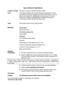
Up and Down Fault Blocks
The Sierra Mountains in Nevada and the Tetons in Wyoming originally formed as fault block mountains. In order to visualize these fault blocks, pupils use construction paper to create layers of earth. They cut the paper models and form...
Curated OER
Quiz on Earthquakes
In this earthquakes worksheet, students complete an on-line quiz, choosing questions and matching answers. Students score 1 point for each correct answer; a printed version is available.
Curated OER
The Biggest Plates on Earth
The best part about teaching guides is all the great information you can use to inform your class. They infer what type of boundary exists between two tectonic plates. Then, using given information on earthquakes and volcanism they'll...
Curated OER
USGS Seismometer
A large black-line diagram of a seismometer fills this page. It is not a instructional activity, but rather an explanation of how a seismometer works. You could make a transparency of it or display it via a video screen when...
Curated OER
Making Waves: A Study of Earthquakes and Tsunami
Students examine plate tectonics and the causative effect of earthquakes. In this tectonics lesson students differentiate between the types of energy waves that cause earthquakes and tsunamis and how waves travel at different...
Curated OER
2004 Asian Earthquake and Tsunami Disaster Project
Students are employees of a unit of the United Nations, they are responsible for coordinating disaster relief after a major disaster (the 2004 Asian Earthquake and Tsunami) occurs. The agency needs to understand the situation in each...
Curated OER
Sea Floor Spreading
Students discuss convection currents in the Earth's mantle, how they form, and how they move as well as the causes of earthquakes. Working in a group, they analyze a color coded World Earthquake Map and try to determine which direction...
Curated OER
Epicenters
In this earthquake worksheet, students use seismographs to determine how far away the cities were from the epicenter of an earthquake. This worksheet has 1 graphic organizer.
Curated OER
How Big was that Quake?
In this earthquake worksheet, students determine the magnitude of an earthquake based on the seismogram reading. This worksheet has 5 problems to solve.
Curated OER
Plate Tectonics
Young scholars use lecture, maps and video to analyze the distribution of earthquakes and volcanoes. They relate this distribution to the theory of plate tectonics and conduct several experiments to illustrate the forces at work in this...
Curated OER
GED Vocabulary: Earth and Space Science
In this earth and space science worksheet, students complete a crossword puzzle given seven clues and seven terms about earthquakes, the solar system, and convection currents.
Curated OER
The Great Wave
Students investigate tsunamis and how they are caused. In this natural disaster lesson, students discuss earthquakes, volcanoes, landslides and other causes of tsunamis. Students conduct an experiment in which they drop...
STEM for Teachers
Tsunami!
How does the depth of an ocean affect the speed of a tsunami's waves? Use Jell-o, graham crackers, and marshmallows to model the effects of an underwater earthquake and its resulting tsunami. The lesson includes hands-on activities,...
Curated OER
Converging Earthquake!
Learners identify the fault lines and tectonic plates on the map. For this earth science lesson, students simulate landscape formation using robots. They take a quiz at the end of the lesson to demonstrate mastery.
Other popular searches
- Volcanoes and Earthquakes
- San Francisco Earthquake
- Earthquake Proof Buildings
- Indian Ocean Earthquake
- Earthquakes and Epicenter
- Web Quest Earthquakes
- Plotting Earthquakes
- Earthquake Lab
- Earthquake Vocabulary
- Volcanoes Earthquakes
- Earthquake Safety
- Earthquakes Epicenters


