Curated OER
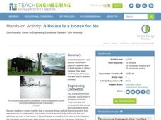
A House is a House for Me
Learners evaluate the impact climates have on the building of structures. They research the different types of materials used to build houses in various climates and build small models of houses which are tested against different climates.
Science Matters
Volcano Models
More than 80 percent of the earth's surface originated from volcanoes. The 16th lesson in a 20-part series introduces the shape and development of volcanoes. It begins with a demonstration using a balloon and flour to illustrate the...
Curated OER
Weathering Rocks
Here is a geology activity that is sure to get your charges excited. It's all about the process of weathering of rocks. Learners study natural events that can cause rocks to break apart. Some of these events are: ice wedging, plant...
Curated OER
Volcanoes: Fifth Grade Lesson Plans and Activities
Fifth graders explore volcanoes and the rocks they produce using the Internet. The lab portion of the lesson prompts young scientists to compare and describe igneous rocks. Next, they critique a pair or more of...
Curated OER
Volcanoes: Fourth Grade Lesson Plans and Activities
Young geologists begin exploring volcanoes of different structures and states: active, extinct, or dormant. During the lab, they make three models and compare different types of volcanoes, including composite, cinder cone, and...
Curated OER
Plate Tectonics: Fourth Grade Lesson Plans and Activities
The pre-lab portion of the lesson introduces emerging geologists to the various layers that make up Earth. After completing a sheet on the identification of the layers, class members simulate plate boundaries and their...
Science Matters
Eruptions and Volcano Types
The Mammoth Lakes area regularly releases warnings to hikers and skiers to be careful because melting snow releases trapped gases from volcanic vents. The 17th lesson in the 20-part series opens with a demonstration of carbon...
Science Matters
Landforms from Volcanoes
Three major types of volcanoes exist: cinder cone, composite/strata, and shield. The 18th lesson in a 20-part series covers the various landforms created from volcanoes. Scholars work in pairs to correctly identify the three...
Curated OER
Volcanoes!: Eyewitness Accounts
Students review previous lessons about volcanoes and name the phenomena they think the eyewitnesses of the Mount St. Helens witnessed. They play the roles of reporter, eyewitness and scientists who are serving on a committee...
EduGAINs
Form and Function
Will that structure survive the force? The differentiated instructional activity allows pairs to choose the structure they would like to construct and the building materials they wish to use. Individuals record their findings in...
Cornell University
Constructing and Visualizing Topographic Profiles
Militaries throughout history have used topography information to plan strategies, yet many pupils today don't understand it. Scholars use Legos and a contour gauge to understand how to construct and visualize topographic profiles. This...
Curated OER
Model Volcanoes
Young scholars represent volcanoes with models and sketches. They research volcanoes and plan how to build a model. They, in groups, build a model volcano and cause it to erupt making observations before and after the eruption.
Curated OER
Eyewitness Accounts
Students use eyewitness accounts to gather and evaluate information about the events of the May 18, 1980, eruption of Mount St. Helens. They play the following roles: reporter(s), eyewitnesses, and scientists who are investigating the...
Curated OER
American Journeys: Right Place, Right Time
Sixth graders measure distances on a map using string and a ruler. They complete mathematical word problems about measurement.
Curated OER
Pangaea Puzzle: Exploring the Tectonic Forces That Shape the Earth
Sixth graders follow in the footsteps of early scientists as they put the pieces of Pangaea back together and discovered the forces that create the variety of landforms and sea-floor features of our Earth.
Curated OER
Coasts
Middle schoolers explain the different types of marine coasts and where they are located in the United States and its territories. They explain and identify some of the life forms that inhabit different marine coastal regions.
Curated OER
Building Challenges
Young scholars work together to complete different building challenges. They use prior knowledge to build tunnels and different types of bridges. They share their creations with the group.
Curated OER
TE Activity: Survive That Tsunami!
Students examine the causes of tsunamis and observe a table top wave making machine. They make model houses while working in groups so that the can see how different construction types work. They discuss how engineers can design and...
Curated OER
Where Are We?
Students use Cartesian coordinates or degrees of latitude and longitude to locate important locations within their specific countries. They Use a grid to apply the concept of latitude and longitude, or positive and negative Cartesian...
Curated OER
Investigating the Types of Energy in Different Objects
Students investigate forms of energy. In this physical science energy instructional activity, students work with a partner classifying household items according to the type of energy they have. Students complete a related worksheet.
Curated OER
What is God calling us to do? Developing an action plan
Students recognize that God calls them to respond to what they've been learning. For this religion lesson students analyze Bible verses and contemplate how the verses guide them.
Curated OER
Keeping Our Pets Safe In An Emergency
Students fill out worksheets that teach them how to prepare for emergency situations and how to enable animal safety in emergency situations. In this emergency lesson plan, students talk about different kinds of emergencies and how they...
Curated OER
Where is Everyone Going?
Students conduct an experiment. In this emergency response lesson, students watch videos about hurricanes and discuss the difference between natural disasters and man-made disasters. Students perform a hurricane demonstration and...
Curated OER
Mapping Natural Disasters
Students use Cartesian coordinates to plot current natural disasters. They relate location of natural disasters to their specific major project countries. Students tie in geometry within this lesson as connected to spatial relationships...


