Concord Consortium
Concord Consortium: Stem Resources: Earthquakes Around the World
In this interactive, students manipulate a computer model that shows where earthquakes and volcanic eruptions have occurred since 1960, to make predictions, collect data and look for patterns. Includes career connection, and a question...
Natural History Museum
Natural History Museum: Volcanoes and Earthquakes
As an online exhibit from the Natural History Museum, this site provides three videos on natural processes of Earth. The videos cover tsunamis, earthquakes, and volcanoes.
US Geological Survey
Usgs: Yellowstone Volcano Observatory
Yellowstone Volcano Observatory is an instrument-based monitoring program designed for observing volcanic and earthquake activity in the Yellowstone National Park region. This website provides information about its geology, history,...
Science Buddies
Science Buddies: Ring of Fire 1: What Volcanoes Tell Us About Plate Tectonics
The Ring of Fire is a region of volcanic and earthquake activity that surrounds the Pacific Ocean. In this project you can explore the connection between plate tectonics and volcanic activity by mapping historical data.
NASA
Nasa Earth Observatory: Natural Hazards: Volcanoes and Earthquakes
NASA's Earth Observatory offers photos showing locations of volcanic activity and earthquakes. Click on thumbnails to view large images and read about the causes and effects of these natural hazards.
Center for Innovation in Engineering and Science Education, Stevens Institute of Technology
Ciese Real Time Data Projects: Musical Plates: A Study of Earthquakes
In this project, students use Real-time and volcano data from the Internet to explore the relationship between earthquakes, plate tectonics, and volcanos.
US Geological Survey
Usgs: Earthquakes
The U.S. Geological Survey sponsors this site about the history of earthquakes in the United States as well as information about how earthquakes are detected and measured.
Center for Innovation in Engineering and Science Education, Stevens Institute of Technology
Ciese: Musical Plates: A Study of Earthquakes and Plate Tectonics
This activity has students access USGS earthquake information to plot the their locations on a world map. Doing this will help students discover for themselves the boundaries of tectonic plates.
National Earth Science Teachers Association
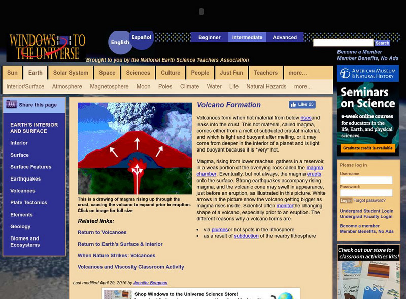
Windows to the Universe: Volcano Formation
Explanation of the factors that result in the formation of volcanoes, some basic but helpful animations and photographs.
Khan Academy
Khan Academy: Answers to Exploration Questions: Volcanoes
A site answering questions such as volcano type, how scientist predict eruptions, and how scientist know hot spots exist in Yellowstone National Park.
Khan Academy
Khan Academy: Answers to Exploration Questions: Earthquakes
Review these questions about Earthquakes on this site.
ClassFlow
Class Flow: Earthquakes & Volcanoes
[Free Registration/Login Required] This flipchart shows diagrams of plate tectonics and how earthquakes and volcanoes are formed. Activotes are needed to answer several questions.
US Geological Survey
Usgs: Volcano Hazards Program: Dotsero Volcanic Center
Since 2001 the USGS has been monitoring the earth's surface in Yellowstone to understand the activity of volcanoes and earthquakes. This resource recognizes the Dotsero Volcanic Center.
Scholastic
Scholastic: Study Jams! Science: Landforms, Rocks & Minerals: Earthquakes
A video and a short multiple-choice quiz on earthquakes, how they form, how they are measured, and the ways they can change the surface of the Earth.
American Geosciences Institute
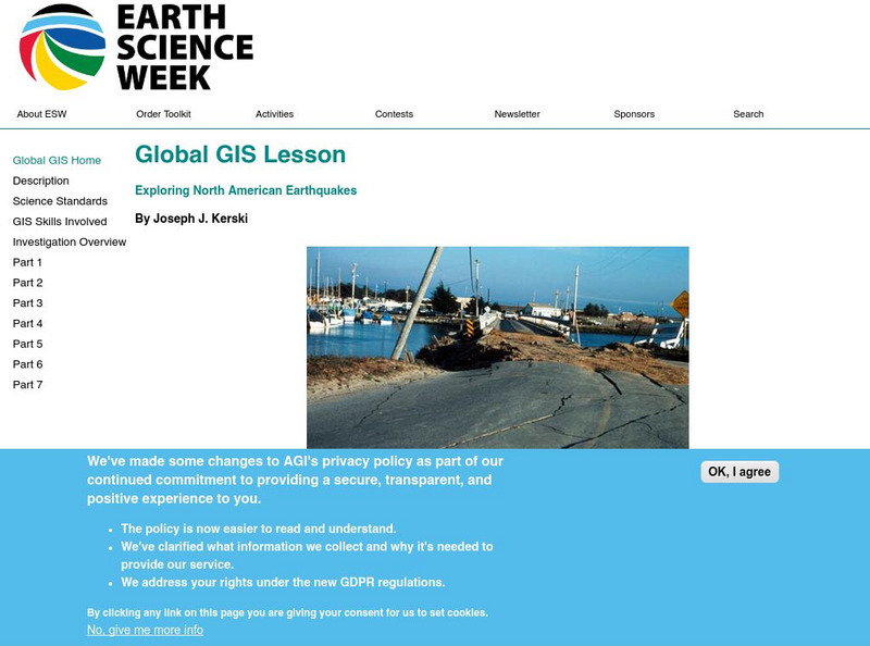
American Geosciences Institute: Earth Science Week: Global Gis Lesson: Exploring North American Earthquakes
In this series of lessons, learners use Geographic Information Systems (GIS) together with the tools and data from the North America Global GIS CD to investigate earthquakes, volcanoes, and population from a local to global scale....
Science Education Resource Center at Carleton College
Serc: Musical Plates: A Study of Earthquakes and Plate Tectonics
Four part lab activity involves students using real-time data to solve a problem, study the correlation between earthquakes and tectonic plates, and determine whether or not there is a relationship between volcanoes and plate boundaries.
NASA
Nasa Earth Observatory: Putting Earthquakes in Their Place
Discover the location of faults by viewing a schematic Global Tectonic Activity Map. View the location of different types of faults, active spreading centers and volcanoes
E-learning for Kids
E Learning for Kids: Madagascar: What Are Tectonic Plates and How Are They Moving?
This lesson teaches students about tectonic plates, plate boundaries, and their role in earthquakes and volcanoes.
Other
Digital Library for Earth System Education: Teaching Box: Plate Tectonics
A suite of lessons focusing on finding the fossil evidence for lithospheric plate tectonics. Inquiry-based exploration of plate tectonics evidence includes fossil distribution, earthquakes, and volcanoes.
Science Struck
Science Struck: Earthquakes and Volcanic Eruptions
Explains what earthquakes and volcanic eruptions are and how they are related.
Annenberg Foundation
Annenberg Learner: Dynamic Earth Interactives
Interactive tutorials on plate tectonics, plates and boundaries, and the Earth's structure convey the dynamism of geologic processes, such as earthquakes and volcanoes. Takes a multidimensional approach to coverage of basic geologic...
American Geosciences Institute
American Geosciences Institute: Dynamic Planet
Seven hands-on lessons module where students learn about our dynamic planet. These inquiry-based explorations investigate scientific models, earthquakes and seismic waves, Earth's interior, Earth movements, the lithosphere, plate...
PBS
Wnet: Thirteen: Savage Earth Online
PBS produced "Savage Earth," a television series about volcanoes, earthquakes, and tsunamis. Contains extensive information with great graphics.
Geographypods
Geographypods: Theme 2: Natural Environments
A rich collection of highly engaging learning modules on topics related to the natural environment. Covers four main areas - plate tectonics, forms and processes, weather and climate, and rainforest and desert. Within each of these,...


