Curated OER
Los Volcanes Mexicanos
Learners conduct Internet research on Mexican volcanoes. They explore various websites, complete a website worksheet, answer questions in Spanish, and create a timeline of a volcano's eruptions.
Curated OER
Hazards: Third Grade Lesson Plans and Activities
Learners discover hazards related to volcanoes and predict the effects these hazards have on people and land. As blossoming geologists explore various volcanic eruptions, including the hazards associated with them, they...
Curated OER
Friendly Volcanoes
Students discuss the benefits of volcanic activity on marine life. They explain the process of tectonic plates.
Curated OER
Plate Tectonic - Volcanoes Pre Lab
Second graders draw and compare parts of volcano. They investigate parts of a volcano and distinguish between magma and lava.
Science Matters
Ring of Fire
Over a period of 35 years, earthquakes and volcanoes combined only accounted for 1.5 percent of the deaths from natural disasters in the United States. The 15th lesson in a 20-part series connects the locations of earthquakes and...
Science Matters
Seismic Activity and California Landforms
By the 19th lesson in the 20-part series, scholars realize volcanoes and earthquakes are related to plate boundaries. The lesson extends and applies the knowledge by having individuals create a bumper sticker for one specific area of...
Science Matters
Earth Shaking Events
The world's largest measured earthquake happened in 1960 in Chile, reaching a terrifying 9.5 magnitude on the Richter Scale. The second lesson plan in the 20-part series introduces earthquakes and fault lines. Scholars map where...
Science Matters
Spaghetti Fault Model
Does increasing the pressure between two moving plates provide a stabilizing force or create more destruction? The hands-on lesson encourages exploration of strike-split fault models. The sixth lesson in a 20-part series asks...
Science Matters
Up and Down Fault Blocks
The Sierra Mountains in Nevada and the Tetons in Wyoming originally formed as fault block mountains. In order to visualize these fault blocks, pupils use construction paper to create layers of earth. They cut the paper models and form...
Curated OER
Volcanic Activity in the U.S.
Students locate and map ten volcanoes in United States, create chart comparing volcanoes by last eruption, type of volcano, location, and interesting fact, and create Powerpoint slide show describing basic
information about volcanoes and...
Curated OER
Plate Tectonic - Volcanoes Post Lab
First graders draw an erupting volcano. They learn the components of an erupting volcano.
Curated OER
Volcano Lesson Plans
Volcano and earthquake lessons can provide a great way to link science instruction to current events.
Curated OER
My Friend, The Volcano
Young scholars describe the positive impacts of volcanic activity on marine ecosystems. In this volcano lesson students explore the process that causes volcanic activity along the Mariana and Kermadec Island Arcs.
NOAA
Plate Tectonics II
Mid-ocean ridges, rift valleys, island arcs, mountain ranges, earthquakes, volcanoes ... there are so many features associated with plate tectonics. The 14th installment of a 23-part NOAA Enrichment in Marine sciences and Oceanography...
Curated OER
Quiz on Earthquakes
In this earthquakes worksheet, learners complete an on-line quiz, choosing questions and matching answers. Students score 1 point for each correct answer; a printed version is available.
Curated OER
Earth Forces
Students use geological techniques such as plate tectonics, mountain building, earthquakes, and volcanoes, in order to explain the earth.
Curated OER
What's Shaking?
For this Earth movements worksheet, students compare and contrast earthquakes and volcanoes. Students write a short essay about the similarities and differences and then complete 4 matching questions.
Curated OER
Plate Patterns
Students read about a volcano and use the latitude and longitude information to plot and describe the volcano on the map. They discuss patterns seen on the map. In addition, they color code a map according to zones, plates, etc.
Curated OER
Plate Tectonics: Movin' and Shakin'
Students are introduced to the causes of plate movements and the hazards they present. They plot the location of 50 earthquakes and 50 volcanic eruptions on a map and explore the relationships between plate tectonics, earthquakes, and...
Curated OER
Disaters!
Students read a fiction and nonfiction accounts about different types of disasters. The class uses iChat AV and iSight camera to interview students in a different part of the country about natural or manmade disasters in their area....
Curated OER
Geologist
In this geologist worksheet, students identify and collect five geologic specimens that have important uses, giving an example of each. Also, they create a drawing that shows the cause of a volcano, a geyser, or an earthquake. Finally,...
Curated OER
Earth and Space Science: Let it Flow
Students engage in a lesson plan in which volcanoes be explored and examined. After watching a video, students create volcanoes out of clay.
Curated OER
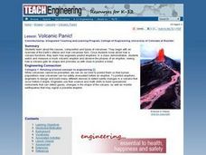
Volcanic Panic!
Students begin with an overview of the Earth's interior and how volcanoes form. They learn how engineers predict eruptions. In a class demonstration, students watch and measure a mock volcanic eruption and observe the phases of an...
Curated OER
It's Going to Blow Up!
Students discover the major characteristics of volcanoes on the Pacific Ring of Fire. They describe the processes that produce the "Submarine Ring of Fire." students explain the factors that contribute to explosive volcanic eruptions.


