Curated OER
Earth's Land and Water
Learners describe physical characteristics of bodies of water and landforms. For this land and water lesson plan, students model land and water with modeling clay and also discuss why people live near bodies of water.
Curated OER
Earth on the Earth
Fourth graders plot points on a graph and transfer those coordinates onto a large scale model resulting in an outline of the Western Hemisphere. They identify the major geographical landforms of the Western Hemisphere.
Curated OER
Our Ever Changing Earth
First graders discover plate tectonics. They observe the forces of erosion. They observe the forces of weathering. They state three ways the earth changes. They record observations and make conclusions about their observations.
Curated OER
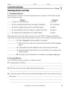
Viewing Earth and Sky
In this earth and sky worksheet, students review terms associated with map reading. Students also review topographic maps and how contour lines represent elevation. This worksheet has 5 matching, 5 true or false, 5 fill in the blank, and...
Curated OER
Looking at Landforms-Based on the Washington Quarter Reverse
Students use a Washington State Quarter to examine different landforms and discuss natural resources. After a class discussion on the items found on a Washington State quarter, students brainstorm a list of natural resources found in...
Curated OER
Research Report on Earth Science Topics
Sixth graders are given a variety of Earth Science topics which be covered during the year. They select one of their choices to research and work in class and at home to meet the guidelines for their report.
It's About Time
Effects of Plate Tectonics
Explore our world from within as you lead young scientists on a thrilling adventure. Pupils examine the location of plate boundaries to determine earthquake and volcano distribution around the globe and explore the cause of hot spots in...
Curated OER
Carve That Mountain
Students investigate major landforms (e.g., mountains, rivers, plains, hills, oceans and plateaus). They build a three-dimensional model of a landscape depicting several of these landforms. Once they have built their model, they act as...
Curated OER
Is There Water on Mars?
Young scholars decide whether or not there is or has even been water on Mars. They analyze temperature and pressure data from the Pathfinder mission to Mars, and then they analyze images of Mars, interpreting the landforms they see and...
Curated OER
Weather, Sea Level Rise and Climate Change
Eighth graders compare and contrast weather and climate. In this earth science lesson, 8th graders research weather data site and analyze historical data. They present their findings in class and explain identifiable trends.
Curated OER
Common Themes
Tenth graders test usefulness of a model Earth by comparing its predictions to observations in the real world. In this landforms lesson students construct an island from a contour map using model clay then analyze the landscape features...
Curated OER
Across the Landscape
Students create a unique, stunning display of the Earth's landforms. They discuss the many different types of the Earth's landforms such as deserts, mountains, oceans, plateaus, coastlines, and marshlands. Students discuss what...
Curated OER
Landforms And The Oregon Trail
Fourth graders investigate the historical context for the founding of The Oregon Trail. They conduct research to put together the events that led to the geographical route that was taken. The instructional activity also strengthens...
Curated OER
What on Earth is in the Earth?
Students explore the physical properties of sand, soil, and rocks and sort, classify, compare, and contrast the materials found in the soil. The differences between the living and non-living parts of the soil is discussed.
Science 4 Inquiry
Let's Get Moving
Rivers top the list of causes of erosion over time. Scholars experiment with wind, water, and ice reshaping sand. They connect the simulations facts about erosion and deposition to understand unique landforms such as the Grand Canyon and...
Curated OER
Neither Wind Nor Rain
Here is another in the interesting series of lessons that use the special State Quarters as a learning tool. This one uses the North Dakota State Quarter. During this instructional activity, your class learns about the different patterns...
Curated OER
Mapping the Aegean Seafloor
Earth science learners create a two-dimensional topographic map of the floor of the Aegean Sea. They use it to then create a three-dimensional model of the ocean floor features. This comprehensive resource delivers strong background...
Curated OER
Cruising the Mantle
Young scholars explore the plate boundaries of the earth. Through the use of video, internet and hands-on activities, students examine the types of plate boundaries. They create a model to illustrate the movement and interaction of the...
Scholastic
Study Jams! Igneous Rocks
Dynamic music pumps up viewers as they learn about intrusive and extrusive igneous rocks. Presentation slides include a graphic depiction of magma below Earth's surface , photographs of lava exploding and flowing, and close-ups of...
Curated OER
The Effects Of Earthquakes
Students investigate the concept of how earthquakes occur and the after effects of how they effect landforms. They conduct research it using a variety of resources and measure the varying intensities of how earthquakes effect the...
Curated OER
Gliding Glaciers
Glaciers are the star of the show in this Earth science lesson plan. In it, learners gain an understanding of how glaciers are formed, how they move, and what types of landforms they create. This lesson plan is written in the classic...
National Geographic
Mapping the Shape of Everest
With Mount Everest as the motivator, your earth science class learns about topographic maps. Begin by showing a film clip from The Wildest Dream: Conquest of Everest, featuring fearsome virtual imagery of a path up world's tallest peak....
Curated OER
The Seven Continents Scavenger Hunt
Who doesn't enjoy an engaging scavenger hunt? Here, scholars listen to, and discuss, the informative text, Where is my Continent? by Robin Nelson. They then explore the seven continents and four major oceans using Google Earth.
It's About Time
Paleoclimates
How do scientists know what the Earth was like in the past? This second installment of a six-part series focuses on paleoclimates and provides an overview of how geologists determine information about past climates using fossil pollen,...
Other popular searches
- Pictures of Earths Landforms
- Earths Landforms Reading
- Earths Landforms in Us
- Earths Landforms Answers
- Introducing Earths Landforms
- Earths Landforms in u.s.
- Landforms on Earth's Surface


