Curated OER
Changing Ways
Third graders examine hard boiled eggs as possible models for the earth's layers.
Curated OER
Sea to Sky
Young scholars investigate the Earth's major landforms and how they occur, and how engineers apply this knowledge for the design of transportation systems, mining, and measuring natural hazards. They listen to a teacher-led lecture,...
Curated OER
Coastal Geology and Geomorphology
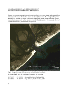
In this coastal geology worksheet, students use Google Earth to locate and identify different types of landforms and phenomena that occur along a coast. This worksheet has 2 short answer questions.
Curated OER
Coastal Geology and Geomorphology
In this coastal geology worksheet, students use Google Earth to locate the Oregon coastline. Students then complete 6 short answer questions based on coastal geology.
Curated OER
What is a Karst
Students investigate landforms by holding a class experiment. In this topography lesson, students define the word "karst" and discover why sinkholes are created on the surface of the Earth by completing worksheets. Students create a...
Curated OER
How Does Flowing Water Shape a Planet's Surface?
Students investigate how flowing water influence landforms. In this earth science lesson, students observe water behavior as it flows from the stream table at various inclinations. They discuss whether water shaped Mars landforms or not.
Curated OER
Where Should We Land?
Students discuss the difference between major landforms as a class. In groups, they rate the landforms based on the needs of the community that wish to settle there. They also discuss the push and pull factors of the colonists that made...
Curated OER
Soil Composition: Then and Now
Students identify the location of their school from a 1926 digitized Soil Sample map. Using remaining landforms, they determine the type of soil identified during that time, and compare it to the soil currently found near the school.
Curated OER
Deep Blue: Exploring the Deep Ocean
Students examine landforms. In this social studies lesson, students bounce a beach ball around in order to discover that seventy percent of the Earth is covered in water. Students
Curated OER
Wet Water, Dry Land
Young scholars observe and examine relationship between landforms and bodies of water, recognizing differences between them. Students then define island, peninsula, isthmus, archipelago, lake, bay, straight, system of lakes, and identify...
Curated OER
Erosion
In this earth science worksheet, learners describe the course of the river from its source to the mouth, including shapes of the valleys and erosion processes in each course. Then they identify possible types of erosion that would have...
Curated OER
Global Climate Change
Second graders investigate the effect of melting glaciers to sea level. In this earth science lesson, 2nd graders simulate the process in the lab by conducting an experiment using ice cubes and clay. They explain the consequences of...
Curated OER
Windbreakers; Earth Science, Topography, Weather
Students consider how topography affects weather and human activity. Students simulate a mountain range and observe surrounding wind patterns.
Curated OER
Earth Surface Socratic Questions
High schoolers explore the ways Earth's surface is shaped by hydrologic, climate and tectonic forces by participating in a whole class discussion. They respond to prompts that lead them to conclusions about the relationships between...
Curated OER
Create a Planet
Students craft planets from clay. In this geography skills lesson, students create model planets that mimic the geographic features found on Earth as well as the other planets. Students conduct research about characteristics of the...
Curated OER
Layer By Layer
Have your class learn about the formation of the Grand Canyon using this lesson. After listening to a variety of stories about the Grand Canyon and erosion, learners complete worksheets related to the geology of this area. What a...
Curated OER
The Geography - Writing Connection
Students examine and describe the four physical systems of the Earth. Using two of the systems, they practice their writing skills and use vocabulary associated with the different types of landforms. They predict the types of shelters...
Curated OER
Using Different Kinds of Maps
Third graders explore the landforms and population diversity. They read maps and examine geographic terms. Students create their own map of the United States and answer questions about the location of people. After exploring the map, 3rd...
Curated OER
The Work of Waves and Wind
This is not revolutionary, but it is informative. Earth science viewers in grades 7-12 get carried away with wave and wind erosion. They view diagrams of how waves impact ocean shorelines. They see examples of the different types of sand...
Columbus City Schools
Constructive and Destructive Geologic Processes
Show the class the world as they've never seen it before—from way above! Learners try to unravel the mysteries presented by rich satellite imagery, learn to interpret topographic maps, and study erosion by constructing their very own...
Compton Unified School District
How Can We Locate Places?
How can we locate places? Maps, of course! Expose second graders to the tools available in maps and discuss how these tools can help people find locations. Students also look at communities, including what makes a community and the...
NOAA
Currents
A deep ocean current circles the globe at a force that is greater than 16 times all the world's rivers combined. Groups analyze the effects of submarine topography on deep ocean current speed. They then determine how this speed affects...
Curated OER
The Southwest
Science stars unscramble twelve terms associated with the landforms and natural resources of the southwest United States. Print out this worksheet and assign it to your middle school earth scientists. Have them write definitions for each...
Curated OER
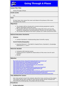
Going Through A Phase
Students are introduced to remote sensing equipment used to gather information about the moon. They learn basic facts about the moon such as size, landforms, temperature and gravitational influence on the earth's tides.
Other popular searches
- Pictures of Earths Landforms
- Earths Landforms Reading
- Earths Landforms in Us
- Earths Landforms Answers
- Introducing Earths Landforms
- Earths Landforms in u.s.
- Landforms on Earth's Surface


