Curated OER
Exploring Biomes Lesson 1: Mapping Biomes
Environmental science learners examine satellite imagery of temperature, vegetation, precipitation, and productivity. They use these maps to understand how scientists divide the planet into major biomes. As part of a larger unit on...
US Environmental Protection Agency
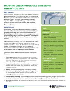
Mapping Greenhouse Gas Emissions Where You Live
After investigating the US Environmental Protection Agency's climate change website, your environmental studies students discuss greenhouse gas emissions. They use an online interactive tool to look at data from power production...
Teach Engineering
Where Are the Plastics Near Me? (Mapping the Data)
The last activity in a nine-part series has teams create a Google Earth map using the data they collected during a field trip. Using the map, groups analyze the results and make adjustments to the map to reflect their analysis. A short...
Curated OER
Effects of Ozone Depletion
Explore the causes of ozone depletion and the effect on plankton, algae, plants, amphibians, and humans. Learn how the Montreal Protocol has possibly helped reverse the decline of the ozone layer. Warning: photos of skin and eye...
Polar Trec
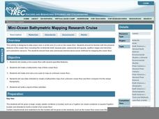
Mini-Ocean Bathymetric Mapping Research Cruise
Middle or high schoolers transform into oceanographers in a week-long simulation. To begin, each group follows directions to create a model of the ocean floor with specified features. Next, the groups prepare to set sail on a research...
Curated OER
Kildare, USA: An Environmental Health Simulation
Your biology class plays the role of epidemiologist when a mysterious illness breaks out in Kildare, USA. Using interviews with doctors, patients, and local citizens, maps, the results from different materials sampling, they work to...
It's About Time
Environmental Impacts and Energy Consumption
As scientists prove environmental impacts of using coal as an energy resource, do you think Santa regrets giving out so much of it? Through a demonstration of acid rain, pupils learn what makes it, where it occurs, the impact of it, and...
Curated OER
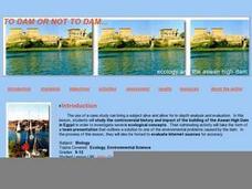
To Dam or Not to Dam
Young ecologists explore the Aswan Dam in Egypt via the internet. Each collaborative group is assigned a specific article about the ecological impact of the dam. Then they prepare a presentation to share with the rest of the class. Some...
International Technology Education Association
Become a Weather Wizard
Accurate weather forecasting is something we take for granted today, making it easy to forget how complex it can be to predict the weather. Learn more about the terms and symbols used to forecast the weather with an earth science lesson...
Curated OER
Soil: Food Mapping
Students examine the concept of food mapping . In this agriculture lesson, students explore food and agriculture systems in the United States in the past and today. Students complete food mapping activities.
National Wildlife Federation
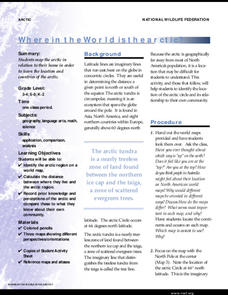
Where In the World Is the Arctic?
Exactly how far away is the Arctic? Learners use maps to orient themselves to their locations on the globe. They then make calculations to describe how their location relates to the location of the Arctic regions.
Environmental Education in Wisconsin
Biome Travel Guide
In a perfect marriage of social studies and science, groups work together to research and create a travel guide presentation to share with the class. Not only do kids learn about the climate and geography of a biome, but also the...
Columbus City Schools
Diversity of Living Things
Here's a topic classes can really dig—the fossil record. Use the well-organized and thoughtful road map to take eighth graders back in time to unearth the answer. Learn how our climate has changed, and how organisms have...
Curated OER
Changing Planet: Permafrost Gas Leak
Pair earth scientists up to use an amazing online arctic portal mapping tool and Google Earth to analyze permafrost changes. They compare changes to data on atmospheric concentrations of methane to see if there is a correlation. Then...
National Geographic
Rescuing, Relocating, and Rehabilitating Wildlife
Bring up the Deepwater Horizon (BP) oil spill that occurred in the Gulf of Mexico in 2010. Display the colorful diagram of the coastal and marine organisms living in the area. Show a video about relocating the eggs of the Gulf's sea...
Curated OER
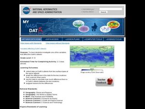
Variables Affecting Earth's Albedo
Students study the variables that affect the Earth's albedo. In this environmental data analysis instructional activity students interpret and graph information and calculate changes.
Curated OER
Watershed Landscape
Students demonstrate how water flows by building a human watershed using themselves. In this ecology lesson, students compare and contrast point-source and non-point source pollution. They write what they have learned from this activity...
Curated OER
Monitoring River Levels
In this environmental science worksheet, learners read and study water maps from an interactive website to complete 8 short answer questions that follow.
Curated OER
Nowhere to Run
In this environmental science worksheet, students explore the different climate change around the world and summarize them. They fill in the table provided.
Curated OER
Solving Environmental Problems
Learners identify a community environmental problem and possible solutions. They analyze the connection between the problem and the solutions and the importance of it to the local community. Students then draw a picture of an...
Curated OER
Using Repeat Photography to Map Environmental Hazards
Students investigate the changes of their environment by experimenting with photography. In this environmental observation lesson, students compare historic photographs of areas with pictures they have just taken. Students...
National Wildlife Federation
I Speak for the Polar Bears!
Climate change and weather extremes impact every species, but this lesson focuses on how these changes effect polar bears. After learning about the animal, scholars create maps of snow-ice coverage and examine the yearly variability and...
Curated OER
Agriculture: It Doesn't Just Happen
After reading an informational text on the Agricultural Research Service, learners research the role of the ARS in Oklahoma. Using reputable online sources, they label a map of the state with relevant areas. Researchers focus on one of...
Curated OER
Regents High School Examination: Living Environment 2003
The living environment, from the interior of a cell to the complex relationships among populations, are queried in this final examination. Learners look at air pollution maps, diagrams of cells, population graphs, and drawing of cells....


