Curated OER
Geography and Climate
Learners investigate geographical locations and their own personal experiences with the environment. In this environmental identification lesson, students participate in a match game using certain environmental and geographical...
Curated OER
Aquifer Model
Students, after researching and brainstorming about aquifers and locating aquifer maps of Texas, participate in the building of a model of an aquifer complete with a pumping station. They also answer a variety of questions at the...
Curated OER
Hyperlink Habitats
Students explore an online Hyperlink Habitat to illustrate the interconnectedness of a tropical rainforest ecosystem. They create a map of the Hyperlink Habitat and research a local ecosystem and create their own print or Web version of...
Curated OER
The Birds and the Beaks
Students explore the adaptations that birds have. In this adaptations lesson students view a video and create a concept map of birds and their adaptive traits.
Curated OER
The American Prairie
Students design an animal. In this prairie lesson, students learn about physical and behavioral adaptation, locate the Great Plains on a map, and design an animal that would be perfectly adapted for life on the prairie. ...
Curated OER
Pollution is Not a Solution
Students explore the environment by completing science worksheets in class. In this water conservation activity, students identify ways water is used in our society and how we abuse the privilege. Students discuss methods to reduce water...
Curated OER
How Texas is Planning To Manage Its Water
Students research water management strategies in Texas. They analyze projected demand for water in the year 2050, interpret graphs and tables and then discuss the data as part of a written report. They research and map the locations of...
Curated OER
Biomes: The Threat of the Sea
Young scholars create posters to raise awareness about Global Warming as an immediate threat. In this environmental lesson plan, students respond to the video Biomes: The Threat of the Sea by researching global warming and making...
Curated OER
How the Environment Affects Our Health
Ninth graders explore how the environment affects health. In this infectious disease instructional activity, 9th graders investigate what environmental situations cause infections diseases. Students study the symptoms, treatments,...
Curated OER
Using Maps to Make Public Health Descisions Case Study: Harmful Algal Blooms in the Gulf of Mexico
Students are introduced to GIS and its uses. Students participate as public health scientists to deliberate a course of action to explore possible research questions. Pupils interpret spatial data, and make predictions based on GIS data,...
Curated OER
Mapping Lab and Lead Poisoning
High schoolers are introduced to GIS and its uses. They make predictions before viewing the actual lead poisoning cases by location of Dade County. Pupils use actual Miami-Dade County spatial data to explore basic principals. Students
Curated OER
Environmental Fair for our St. Mary¿¿¿s River
Students list sources of pollution and their effects on the St. Mary River environment. They discuss how pollution may effect the environment and draw up a list of possible types of pollution.
Curated OER
Mapping the Homunculus
Students determine the relative number of nerve endings located in the skin. By calculating the reciprocal of these measurements, students have the appropriate data for predicting the relative size of the homunculus found on the cerebral...
Curated OER
Powering a Green Earth
Pupils compare and contrast renewable and nonrenewable energy. In this environmental science lesson, students discuss the importance of going green. They identify the different components in a power grid system.
Population Connection
The Human-Made Landscape
Agriculture, deforestation, and urbanization. How have human's changed the planet and how might we mitigate the effects of human activity on the planet? To answer these questions class members research the changes in human land use from...
Curated OER
Carbon Monoxide and Population Density
Tenth graders investigate the carbon monoxide level at a fixed latitude to determine if there is a relationship to population density. They download data sets and generate a graph, and find locations using the Earth's coordinate system....
Curated OER
"Hard" Data from Space
Young scholars use satellite images to analyze development patterns within Baltimore City. They prepare a land cover map for Baltimore indicating the prevalence of impervious surfaces and explore how these patterns affect water pollution.
Curated OER
Rain Forest Animals
Students research rainforest animals from the book The Great Kapok Tree. They create an animal presentation using PowerPoint. Pupils demonstrate their comprehension of the interdependence of the animals, people, and plants in the...
Curated OER
The Deforestation of the Temperate Forest Focus; Russian Taiga/Boreal
Twelfth graders complete a unit of lessons on the Russian Temperate Forest. They list the environmental problems associated with deforestation, conduct research, compare the Russian Taiga with other forests, create graphs, and develop an...
Curated OER
Water Quest
Students visit the Hydrology Study Site, conduct a visual survey to discover info about local land use and water quality, and document their findings by mapping the water body. They use this investigation to raise questions for further...
Curated OER
Home on the Range
Students use maps and mathematics to determine the appropriate panther population in a given area. In this Florida ecology lesson, students research the area requirements of male and female panther and use a map to help calculate how...
Curated OER
The O Zone-Code Read Alert
What are the effects of an air quality alert? Expert groups receive one component of air quality information resources to study. Pupils then jigsaw into new groups and share their knowledge. Finally, they draft a statement of what they...
Curated OER
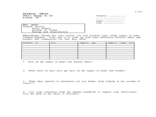
Who's Range is it?
Students investigate the habits of panthers by analyzing radio transmitted data. In this animal life lesson, students utilize computers to view the range of different statistics dealing with Florida panthers. Students...
Monroe City Schools
Clouds! Clouds! Clouds!
Here is a beautiful lesson plan on clouds designed for your 1st graders. Learners study three different types of clouds. They construct drawings of cumulus, cirrus, and stratus clouds. The Cloud Book, by Tommie dePaola is used to...


