Curated OER
Three Wars Equal One New Country: Part 3
Students explore the many reasons why and how Germany became a country.
Curated OER
Summer Festivals
Students read about European holidays and then design their own creative festival. In this cultural awareness lesson, students use primary and secondary resources in order to uncover facts and practices that occur during European festivals.
Curated OER
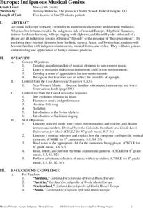
Europe: Indigenous Musical Genius
Students are introduced to several forms of indigenous European music. Students become familiar with instruments, musical and forms and styles from Spain, Sardinia, Austria and Switzerland. Students recreate selected rhythms and styles.
Curated OER
Life Inside Castle Walls
Students compare their life-style with the Middle Ages, create their own castles and end with a feast. They explore life in the Middle Ages, use their information and creativity to design a castle & a personal coat of arms; students...
Curated OER
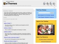
Country: Ireland
Students use the Internet to examine the history, castles, and folklore of Ireland. Photographs of sites are also included.
Curated OER
Country: United Kingdom
Students use the Internet to examine the food, sports and history of England, Scotland, Wales and Northern Ireland. They view photographs and maps.
Curated OER
The Panorama Of The European Union
Sixth graders investigate the existence of the European Union with the help of a map publication. They also brainstorm to think of terms related to the Union. Students write a summary that should conclude the European Union is a...
Curated OER
Claiming Land
Students examine several European maps with conflicting representations of the same geographic region. They uncover why different European nations produced different maps. In addition, they determine the role maps played in helping...
Curated OER
Countries in France
In this social studies activity, students find the foreign language terms from France and the answers are found through clicking the link at the bottom of the page.
Curated OER
Map of Italy
In this map of Italy worksheet, students find, color and label cities, surrounding countries, bodies of water and landforms in the country of Italy.
Curated OER
Fractions: Jewish Population of Europe during WWII
Students evaluate population maps and convert fractions to percentages. In this WWII lesson, students use statistics on the Holocaust to determine population loss and change. Students create their own math questions and answers using the...
Curated OER
Europe Capitals Map Quiz
In this online interactive geography quiz activity, students respond to 40 identification questions regarding capital cities of European countries.
Curated OER
EU and Turkey
Should Turkey be admitted to the European Union? Before debating this question, class members research the background and stated purpose of the EU, read articles of Turkey's bid to become a member of the EU, and the concerns other...
Curated OER
Imperialism in China
China has been through many changes over the last two centuries. This slideshow takes a look at the effects imperialism and European contact had on Chinese government. Images, well-organized information, and a complete outline make this...
Curated OER
The End of the War: WWII
Enhance your student's reading with this presentation on the end of WWII. This series of slides contains information, focus questions to guide student reading, and a video entitled, The Impact of World War II. Note: To view the video...
Curated OER
The Protestant Reformation Through Maps
A series of maps and photographs guide viewers through the spread and influence of the Protestant Reformation in Europe in these slides. With several bullet points detailing the causes of the Reformation, the presentation covers the...
Curated OER
Transatlantic Travel
Students design an interactive map with modes of transportation that actually move across the ocean. They construct transatlantic maps of the northern hemisphere and imagine what it would be like to operate various modes of...
Curated OER
Age of Metternich
Learners will define the goals and results of revolutionary acts carried out across Europe during the Age of Metternich. Eight countries and dates are listed where revolutions took place around the world between 1815 and 1848.
Curated OER
Rococo Art & Architecture
A splash of light against the dark background of the Baroque period, the Rococo Art of 18th century Europe shines brilliantly in this appealing and artistic presentation. The slides focus primarily on the paintings of French and English...
Curated OER
Medieval Top Trumps
I believe this resource is a type of game called top trumps one can assume that pupils must choose which medically trained individual they'd most like to receive treatment from in medieval Europe. Each of the eight options: mother,...
Curated OER
The Netherlands: map
Use the provided list to label a map of Europe and the Netherlands. There are 77 locations to label. You have to know your stuff to fill out this challenging map.
Curated OER
How Did British Imperialism and Colonization Impact India?
How did British imperialism and colonization impact India? Uncover how India was considered to be Britain's most valuable colony, how Europe's Industrial Revolution affected India, and the beginnings of the East India Company. A short,...
Ms. Catsos
Ancient Rome Map Worksheet
It wasn't just the great leaders of ancient Rome that shaped their civilization—the geography of the region played a major role as well. After first identifying major land masses, bodies of water, and city states on a map of Europe,...
West Liberty Community School District
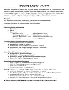
Exploring European Countries
Your class members will each explore a European country of their choice and report back to the class using a creative PowerPoint or Prezi. They will not only include a basic introduction to the country, but also what they discovered...
Other popular searches
- European History
- European Union
- European History Europe
- European Explorers
- Maps of Europe
- Eastern Europe
- Blank Maps of Europe
- European Exploration
- Eastern Europe Cultures
- Europe and the Atlantic
- Victory in Europe Day
- Outline Maps of Europe


