Curated OER
Imperialism and Expansion: Part 1
Learners explore the era of imperialism and expansion of the United States. For this American history lesson, students play a game regarding the U.S. attempts to expand the nation in the late 1800s and early 1900s.
Curated OER
Explorit's Wetlands Quiz
In this wetlands worksheet, students complete a 31 question multiple choice on-line interactive quiz about wetlands. Included are questions about plants, animals and geography.
Curated OER
Naming Roads
Students investigate the aspects of a historic map of roads and trails in the Southeastern United States. They explore reasons for giving roads certain names and decide on names for other roads themselves.
Curated OER
What's Your Temperature?
Learners take a look at the local newspaper and focus on the weather section. They get into small groups, and each one looks at the same map, but of a different part of the country. They must prepare a presentation that shows how...
Curated OER
Where Is Japan? How Are We Alike And Different?
First graders use literature, maps, and globes to explain how physical environments in various parts of the world are similar to and different from one's own, and that certain areas have common characteristics and can be called regions.
Curated OER
Something From Nothing
Students listen to story Joseph Had A Little Overcoat to explore people from another culture and how one item can be used to make other items; students use scraps of fabric and other knickknacks to create pictures or toys.
Curated OER
Rising Temperatures Threaten Penguins
Students examine the continent of Antarctica, then read a news article about the decline in the Antarctic penguin population. In this current events lesson, the teacher introduces the article with a discussion and vocabulary activity,...
Curated OER
A Tough Nut to Crack
Children, based on a set of criteria, evaluate the quality of pecans. They research recorded history of pecan trees as well as how their seeds moved across western Missouri into southeastern Kansas, Oklahoma, Texas and Mexico. In...
Curated OER
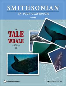
A Tale of a Whale: And Why It Can Be Told
Young scholars examine the characteristics of particular whales. In this whale characteristics lesson, students discover the methods scientists use to track whales and attempt to match the unique pattern of callosities themselves. A role...
Curated OER
Rhythmic Travel Around the World
Students explore and play rhythm sticks while listening to songs from around the world. They locate the countries of origin on a map, and tap their rhythm sticks to the beat of the music.
Curated OER
Religions of the World
Second graders explore the part that religion plays in a culture. They explore how many different religions there are in the world and where they're located.
Curated OER
Native Americans and Topography at Rose Bay
Students visit a wetland ecosystem. While they are there, students explore how to read topography maps of Rose Bay.
Curated OER
Mark Twain- Teaching About American Authors
Mark Twain lesson plans can shed light on his famous works, like "The Adventures of Tom Sawyer."
Curated OER
Thematic Unit on Cats
Students discover in which climates the cats of the world live in. They review the different climates of the world and use maps and globes to help them locate continents.
Curated OER
Exploring the Objectives of the European Union
Students identify the members of the EU and brainstorm on how these countries would benefit by having an alliance. In groups, they examine the main objectives of the EU and present to the class.
Curated OER
Rooster's Night Out
First graders complete interdisciplinary activities associated with a folktale from Cuba. In this Cuban folktale lesson, 1st graders read the Rooster's Night Out, before completing comprehension worksheets, make recipes, and...
Curated OER
Where Is Japan? How Far Is That?
First graders use literature and hands-on activities with maps and globes to explain distance and tools used to measure distance. They select tools to measure various objects in the classroom, then apply those concepts to their map...
Curated OER
Water and Land 207
Students examine maps of different projections, mathematically calculate distortions, and note the advantages and disadvantages of each map. They study the different maps and transfer the map to graph paper.
Johns Hopkins University
The Johns Hopkins University: Florida State Maps
Use this site from The Johns Hopkins University Applied Physics Laboratory to find out more about Florida's landforms. This website contains several different maps highlighting different geographical features of Florida.
A&E Television
History.com: The States
Learn unique facts about each American state. You can also read a more in-depth history of each state, watch videos and play a game about all the states.
Kidport
Kidport: United States of America Geography
This site contains a fun way to learn about the states within the United States. Click on the state that you want to learn more about and it provides facts, geographic landmarks, points of interest, major industries, a quiz and more.
NSTATE
The Geography of Florida
Here you will find a variety of cool facts about the geography of the state of Florida. Find out the geographic center, total area, elevations and much more.


