Curated OER
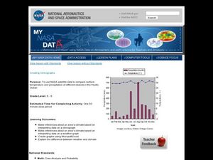
Creating Climographs
Students use satellite data to compare precipitation and surface temperatures on different islands. In this satellite lesson students create graphs and explain the differences between weather and climate.
Curated OER
Exploring our National Parks
Students utilize maps/Atlases to find key spatial information, locate U.S. National Parks, characterize the geography of a specific region, and create a National Park brochure.
Curated OER
Book: Finland
Students, after reading Chapter One in the book, "Finland," design and create in the computer lab a wildlife journal from an imaginary trip to Finland. They include different animals and plants that live in Finland as well as describing...
Indian Land Tenure Foundation
More Tribal Homelands
Here is a very fun idea that introduces young learners to how geographical location affects cultural development. They are introduced to four areas where Native Americans have lived in the past by reading stories and examining images....
Curated OER
Adapting to Survive
Pupils examine how the climate and environment affect people in Alaska. They identify the five regions of Alaska on a map, conduct Internet research, write a report on the climate differences in the five Alaskan regions, and write a...
Curated OER
Trekking to Timbuktu: The Geography of Mali - Student Version
Eleventh graders locate Mali on a world map, describe the landscape and climate of Mali, and locate the city of Timbuktu and describe the local weather. They compare life along the Niger in ancient times to that of today
Curated OER
My Region Through Time
Pupils identify the region of state in which they live on a regional map. They read information about the time period assigned and identify significant historical events that occurred in the region.
Curated OER
The Tibetan Plateau
Students discuss the characteristics of the biosphere, with a focus on the Tibetan Plateau. They participate in a question and answer period discussing biomes and climate patterns. They compare and contrast different ecosystems.
Curated OER
Where in the World Is That Volcano?
Identify the Earth's major volcanoes with an earth science lesson. Elementary and middle schoolers locate major volcanoes on a world map. Then, in groups, they research how the volcano affects the region in which it is located.
Curated OER
Design a Resort: Italian Villa
Students work in a group to design a travel brochure and television commercial for an Italian resort. They role-play having inherited a large sum of money and buying an Italian villa to turn into a resort. Students research geography,...
Polar Trec
The Amazing Antarctic Trek
This resource provides two ways to engage learners in using latitude, longitude, and research skills. In pairs, or on their own, learners will locate several Antarctic regions on a map. They will write the name of the place and a few key...
Curated OER
Regions of the US: Gulf Stream, States and Their Capitals
Fifth graders identify one way of dividing the US into geographical regions and then consider alternate ways of doing the same. They locate each of the fifty states and their capitals on a map. They research the Gulf Stream region.
Curated OER
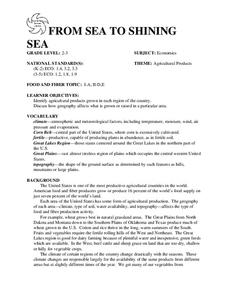
FROM SEA TO SHINING SEA
Identify agricultural products grown in each region of the country.
Discuss how geography affects what is grown or raised in a particular area.1. Hand out a copy of the two activity sheets "Food From Sea to Shining Sea" to each student....
Curated OER
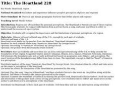
The Heartland
Students note how personal perceptions influence the understanding of what a region. They look at an agricultural map of what is considered to be the Heartland of the US. They read the words to George Strait's, America's Heartland to see...
Curated OER
Why Here? Why Not There?
Middle schoolers analyze a map and graph information on eleven countries. Using the characteristics of the countries, they determine if they should host the summer or winter Olympic games. After viewing a video, they locate the...
Curated OER
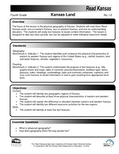
Kansas Land
Fourth graders discover the geographic regions of Kansas. In this geography lesson, 4th graders explore the different regions of Kansas and determine how the different geography affects daily life in Kansas.
Curated OER
CLIL: A Lesson Plan
Students explore Vancouver. In this Vancouver geography and English language building lesson, students brainstorm what they know about Vancouver and predict what their text will cover. Students listen to the informational content of...
Curated OER
Be the Kiwi
Learners explore aspects of New Zealand's environment. In this environmental geography lesson, students research the geography, resources and climate of New Zealand. This lesson includes a game, rubric, and extension.
Curated OER
What Do Maps Show?
Students discover the uses for various types of maps. In this geography skills instructional activity, students discuss the type of maps that exist and what their individual features are. Students then practice using different types of...
Curated OER
The Big Wet
Students research areas of Australia and other parts of the world characterized by a tropical wet and dry climate.
Curated OER
Regional Landforms and Native People
Third graders study the Native American tribes of Maidu and Miwok by studying Internet artifacts, culture, language, music, storytelling, architecture, food, clothing, crafts and geology.
Curated OER
Geography of the Study of the Spanish-speaking People of Texas
Students identify the physical features, demographic characteristics, and history of the four Texas towns featured in Russell Lee's photo essay, "The Spanish-Speaking People of Texas." They conduct Internet research, and create a travel...
Curated OER
Geography of Korea
Students are introduced to the geography of Korea. Using the internet, they identify the weather and climate in the country and create a week weather chart for Korea's four seasons. They complete an interview with a local weatherman...
Curated OER
Maps: Utah: Geography and Landforms
Fourth graders research Utah's regions, its climate, resources, and biomes.


