Curated OER
Dos mapas de Florida, el Caribe y parte de Sur America
What can maps tell us about the past? Find out with a Spanish lesson that incorporates geography. After examining maps individually, comparing two old maps of Spanish Florida and writing notes in the provided Venn diagram, pupils pair up...
The New York Times
Kiev in Chaos: Teaching About the Crisis in Ukraine
Provide a historical context for the political unrest between Russia and Ukraine that began in late 2013. Learners review their prior knowledge and chronicle new understandings with a KWL chart, watch a video explaining the Ukrainian...
Smithsonian Institution
Dia de los Muertos: Celebrating and Remembering
Help scholars understand the history, geography, traditions, and art of Dia de los Muertos, the Day of the Dead. Find background information for your reference as well as a detailed cross-curricular lesson plan. Learners compare...
Curated OER
Tears of Joy Theatre Presents Anansi the Spider
Accompany the African folktale, Anansi the Spider, with a collection of five lessons, each equipped with supplemental activities. Lessons offer multidisciplinary reinforcement in English language arts, social studies, science,...
Environment Agency - Abu Dhabi
Plate Tectonics
Young scholars observe a presentation on plate tectonics, layers of the earth, and plate boundaries. They then use the Internet to research major plates and label them on a world map.
Science Matters
Ring of Fire
Over a period of 35 years, earthquakes and volcanoes combined only accounted for 1.5 percent of the deaths from natural disasters in the United States. The 15th lesson plan in a 20-part series connects the locations of earthquakes...
iCivics
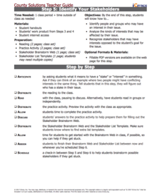
Step 5: Identify Your Stakeholders
Have you ever had a goal, but needed help achieving it? Scholars analyze the purpose of stakeholders in the fifth installment of a 10-part County Solutions - High School series. They investigate finances, personal concerns, geography,...
EngageNY
Synthesizing Information: Living Things in the Rainforest
How is a map a type of informational text? Class members view a world map of major rainforests, discussing its text features with a partner. Next, they take notes on key details from multiple texts about rainforests and write an...
Texas Education Agency (TEA)
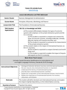
Foundation of International Business
Scholars work in teams to research the geography, economic conditions, and cultural factors associated with conducting business in another country. They create a PowerPoint to show what they've learned, and then design a brochure with...
Anti-Defamation League
"What is it Like to be an Outsider?”: Building Empathy for the Experiences of Immigrants
This lesson highlights the struggles of immigrants and the importance of showing empathy. Beginning with a read-aloud of a book in another language and a poem, scholars take part in a thoughtful discussion. Then, the class examines a...
Global Oneness Project
Far From Home
A timely and provocative instructional activity inspires high schoolers to tackle the Syrian refugee crisis. They analyze a compelling photo essay before discussing and writing about it.
Global Oneness Project
A Collapsing City Skyline
Have your high schoolers learn about the modern history of Myanmar by close-reading an article about the city and people of the city Yangon. As they'll learn, the country is going through some dramatic transitions. After...
Curated OER
Crowley's Ridge: An Upland in the Lowlands
Young geographers examine how Crowley's Ridge was formed. This is one Arkansa's six natural geologic divisions. The history of Crowley's Ridge is important in that the first settlers of the state were attracted to this region, and it...
Curated OER
Symbols of Our State: Arkansas
Here are a series of lessons designed to assist early elementary learners to discover the symbols of Arkansas. They learn about the state flag, insect, state seal, state bird, flower, tree, and gem. A booklet (emedded in the plan), is...
Curated OER
N is for Natural State
For any pupils who live in the state of Arkansas, this would be a fabulous educational experience to help them get to know their state better. Through the use of activities in literature, art, mathematics, science, social studies, and...
Curated OER
Mapmaker, Make Me a Map!
Here is a well-designed, very thorough lesson plan on mapping for very young children. Within the six-page plan, you will find everything you need to implement the lesson. They will identify various landforms found in Colorado on a map,...
Curated OER
Geo-portrait of the Caribbean: 1492 -1992
Students compare and contrast the Caribbean region in 1492 with the same region today , and use five themes of geography as avenues of comparison.
Curated OER
Where in the World is Hawaii?
Students compare a globe and a two-dimensional world map and explore how they both represent the planet Earth. They locate the Hawaiian Islands on the globe or the world map and describe how the geographical position is unique.
Curated OER
Where Do I Fit In?: Mental Mapping Student Neighborhoods
Learners examine geography through the themes of place, human/environment interaction, and region. They create a mental map of their own neighborhood, analyze their role in the world, and design a neighborhood that reflects their needs.
Curated OER
Mapping the Lewis and Clark Trail
Students explore how physical and human geography features effected Lewis and Clark's expedition by using the Lewis and Clark Digital Discovery Web site.
Curated OER
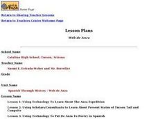
Spanish Through History - Web de Anza
Students examine the history, economics, and geography of the Anza era. They read primary source journals, diaries, and letters, conduct Internet research, and write a research report.
Curated OER
Outstanding Fields of Corn
Young scholars will show knowledge of the five themes of Geography by creating a Diorama. This lesson allows the student to use their knowledge of corn, including both past and present information and apply it to the five themes.
Curated OER
Countries of the World
Students define the meaning of the word country. In this countries of the world map instructional activity, students identify boundaries, countries, and symbols within countries on the map. Students distinguish the words country and...
Curated OER
Explore Surface Types on a Journey Around Earth
Students explore satellite data. In this technology cross-curriculum math and world geography lesson plan, students locate specific map areas using a microset of satellite data. Students use technology and math skills to determine...
Other popular searches
- Five Themes of Geography
- U.s. Geography
- China Geography
- Africa Geography
- Mexico Geography
- Canada Geography
- Asia Geography
- France Geography
- Japan Geography
- World Map
- Ireland Geography
- Geography Studies


