Curated OER
Geo-Magazine
Divide your geography class into groups and have each research an assigned region. The result of this project is a regional magazine that addresses the five themes of geography. Many valuable resource links are embedded into the...
Sharp School
Travel Brochure Project
Designing a travel brochure is a classic project that will help your class members develop a variety of skills, such as researching informational texts, designing creative visual products, and communicating what you have learned.
Smithsonian Institution
Borders with the World: Mexican-American War and U.S. Southern Borderlands
The Mexican-American War created social borders—not just physical ones. Scholars learn about the effects of the Mexican-American War on the people living in the borderlands using text excerpts, maps, and partnered activities. Academics...
Curated OER
Geography of Africa
Students examine the geography of Africa and understand its diverse ethnicity. In this African geography lesson, students create a mental map of Africa. Students label the maps and list the languages of Africa. Students compare the...
Curated OER
Learning About Maps
Students investigate the many uses and features of maps and globes and locate where they live on both. In this map lesson plan, student play a travel game and create their own maps to explore states, continents, countries, and islands.
Scholastic
Perfect Postcards: Illinois
Connect the geography and history of Illinois using an art-centered instructional activity on the railroads. The railroad connected once-distant places, particularly in the Midwest. Using research, class members create postcards of...
Curated OER
Ancient Middle East Geography
As part of a study of ancient Middle East geography, kids locate seas, rivers, regions, and cities on a map of the region.
Curated OER
Food on the Map
Students work together to examine the tastiest towns in the United States. After discovering the names of the equipment, they identify the seven continents. They take a survey and locate the cities and states of the foods mentioned.
Curated OER
Mapping South America
Students explore South America. In this South American lesson, students use their geography skills to create population, terrain, biomes/vegetation, and major exports maps. Students present their finished maps to their classmates and...
Curated OER
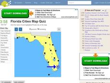
Florida Cities Map Quiz
For this online interactive geography worksheet, students examine a map of Florida and identify the 12 noted cities on the map using a pull down menu within 3 minutes.
Curated OER
Texas Cities Map Quiz
In this online interactive geography activity, students examine a map of Texas and identify the 15 noted cities on the map using a pull down menu within 3 minutes.
Curated OER
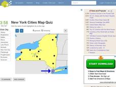
New York Cities Map Quiz
In this online interactive geography worksheet, students examine a map of New York and identify the 11 noted cities on the map using a pull down menu within 3 minutes.
Curated OER
MAKING CONNECTIONS WITH MAPS
Students define choropleth map. They construct a choropleth map. They interpret a choropleth map. They present geographic information.
Curated OER
Michigan Cities Map Quiz
In this online interactive geography instructional activity, students examine a map of Michigan and identify the 14 noted cities on the map using a pull down menu within 3 minutes.
Curated OER
South America Map Quiz
In this online interactive geography quiz worksheet, students examine the map that includes all of South America's countries. Students identify the 13 countries in 2 minutes.
Curated OER
Middle East Map Quiz
In this online interactive geography quiz worksheet, students examine the map that includes 26 Middle Eastern countries. Students identify the names of the countries in 4 minutes.
Curated OER
Central America Map Quiz
In this online interactive geography quiz worksheet, students examine the map that includes 22 Central American countries. Students identify the names of the countries in 3 minutes.
Curated OER
Canada Map Quiz
In this online interactive geography quiz activity, students examine the map that includes 13 Canadian provinces and territories. Students identify the names of the provinces and territories in 2...
Curated OER
California Cities Map Quiz
In this online interactive geography quiz instructional activity, students examine the map that includes 12 California cities. Students identify the names of the cities in 3 minutes.
US Mint
Absolutely and Relatively: The Puerto Rico Quarter Reverse
How much does your class know about Puerto RIco? How much can they learn from the back of a 2009 quarter? Use the coin, part of a series of quarters that depict US territories, to teach learners about the geography, culture, and history...
Curated OER
The Water Nearby
Learners explore water located near where they live. In this map skills maritime lesson, students use Google Maps to find their school and the body of water closest to them. Learners research the body of water and answer questions about it.
Curated OER
Geography: Ancient Rome
Students research Ancient Rome, the Mediterranean Region, Roman myths, and Latin. In this Roman life lesson, students study maps of the region, learn their language and customs, research the Punic wars, the catastrophe of Pompeii, and...
Curated OER
Mathematics of Cartography
Students practice their math skills as they explore maps. In this cartography lesson, students calculate distance, scale, coordinate systems, and projection as they work independently reading online maps.
Scholastic
Perfect Postcards: California
It's time to hear about some adventures in travel! The Transcontinental Railroad changed life and travel in the United States during the 1800s. Practicing online research skills, pupils discover the features they would like to visit on...
Other popular searches
- Geography Map Skills Scale
- Geography Map Skills Europe
- Usa Geography Map Skills
- Geography Map Skills Us
- Canada Geography Map Skills
- Map Skills Geography Themes
- Geography Map Skills Ohio
- Map Skills Geography


