Curated OER
Whole Language Approach to Map Making
Fifth graders, after reading Island of the Blue Dolphins, explore map making using the Whole Language Approach.
Curated OER
Utah History & Geography
Fourth graders practice large digit addition. Students become familiar with column addition. Students develop knowledge of counties and county seats.
Curated OER
The O Zone-Code Read Alert
What are the effects of an air quality alert? Expert groups receive one component of air quality information resources to study. Pupils then jigsaw into new groups and share their knowledge. Finally, they draft a statement of what they...
Curated OER
Cyberspace Safari
Middle schoolers go on an information gathering hunt on the Internet to study West African empires. They work in teams; meteorologists, bankers, writers, and archaeologists. They collect data on all sorts of topics related to West...
Curated OER
Transportation
Engage in an 8-day study of different modes of transportation. Your students explore the concept of location and define the physical characteristics of places, such as, land forms, bodies of water, natural resources, and weather.
Curated OER
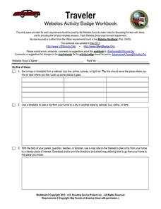
Traveler: Webelos Activity Workbook
This three-page worksheet is designed to be used by the Weblos of Boy Scouts of America. They are given 13 choices of academic activities that involve the use of maps, geography, math, and money. They must complete five of the activities...
Curated OER
Recreate the Race
Students research and find the route of the Alaskan dog sled race.In this Iditarod race lesson plan students find the checkpoints for the Iditarod on a map. Students research information in pairs about each one of the checkpoints....
Curated OER
Traveling Cat Flown Home to Family
Students locate Wisconsin and Belgium on a world map, then read a news article about a cat that stowed away on ship from the U.S. to Europe. In this current events lesson, the teacher introduces the article with map and vocabulary...
Curated OER
Explore Your World--Geography Takes You Places
Students examine how the world around them is constantly changing. In groups, they travel between centers in their classroom to role play the role of explorers in Washington D.C. They share their experiences with their classmates and...
Curated OER
Esperanza Rising - Anticipation Guide
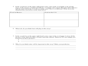
Learn about Mexican culture while simultaneously strengthening reading, writing and computer skills. In order to get the most out of Esperanza Rising, pupils should have prior knowledge of Mexican culture. Therefore, there are links to a...
Curated OER
Beyond Demographics
Young scholars study the Dominican Republic through watching and discussing a video about the country and its people. They explain life in the Dominican Republic and describe the emerging picture of the Dominican Republic as viewed...
Curated OER
Bank Loans Money to Start Businesses
After locating Latin American countries on a world map, children read about how microbanks are loaning money to help start small businesses. Involving both current events and economics, the teacher introduces the article with a map...
Curated OER
Water Sources in Cape Verde and West Africa
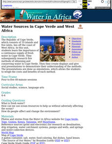
Young explorers study the scarcity and importance of a continuous supply of fresh water in Cape Verde. They research the five main ways that fresh water is obtained in these countries. Each research group prepares a presentation, and...
Curated OER
My First Biography: Christopher Columbus Storia Teaching Guide | Scholastic.com
Sail with Christopher Columbus on a biographical reading adventure. Young explorers learn about the life of Sir Columbus as they hone their comprehension skills through guiding questions, shared reading, and fluency practice. Included in...
Curated OER
Africa: A Cultural Safari
Students examine the kingdoms of West Africa during the Middle Ages. They label maps and identify Africa's physical features, simulate the trading of gold, buy and sell goods using cowrie shells, and participate in a cultural safari day.
National Geographic
Rescuing, Relocating, and Rehabilitating Wildlife
Bring up the Deepwater Horizon (BP) oil spill that occurred in the Gulf of Mexico in 2010. Display the colorful diagram of the coastal and marine organisms living in the area. Show a video about relocating the eggs of the Gulf's sea...
Polar Trec
The Amazing Antarctic Trek
This resource provides two ways to engage learners in using latitude, longitude, and research skills. In pairs, or on their own, learners will locate several Antarctic regions on a map. They will write the name of the place and a few key...
Curated OER
Population Change in Vermont, 1990-2000
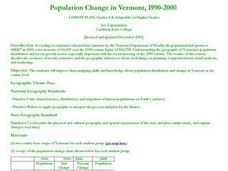
Students improve their mapping skills and knowledge about population distribution and change in Vermont at the county level. They are divided into groups of two or four. Each group is given two county base maps and the population...
Curated OER
Follow the Light
Here is another in the interesting series of lessons that use the special State Quarters as a learning tool. During this lesson, pupils learn about lighthouses, maps, the cardinal directions on a compass, and U.S. geography. There are...
Curated OER
Community Map of The Giver
Pupils read "The Giver" after finishing the unit on inventions and inventors. Using the information in the novel, they develop a geographic map illustrating the community in the story. They identify human and physical features and...
Curated OER
Max Knows Mexicao, United States and Canada
Students utilize their map skills to explore the regions of North America. They explore the physical characteristics and climates of the regions. Students label their map and prepare a presentation of their findings.
Curated OER
Oceans and Seas Map Quiz
In this online interactive geography quiz worksheet, students respond to 15 identification questions about oceans and seas of the world.
Curated OER
Asia Lakes Map Quiz
In this online interactive geography quiz worksheet, students respond to 6 identification questions regarding specific lakes located in Asia.
Environment Agency - Abu Dhabi
Plate Tectonics
Young scholars observe a presentation on plate tectonics, layers of the earth, and plate boundaries. They then use the Internet to research major plates and label them on a world map.
Other popular searches
- Geography Map Skills Scale
- Geography Map Skills Europe
- Usa Geography Map Skills
- Geography Map Skills Us
- Canada Geography Map Skills
- Map Skills Geography Themes
- Geography Map Skills Ohio
- Map Skills Geography


