Curated OER
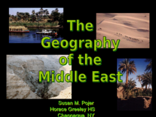
The Geography of the Middle East
Topographic, political, and satellite maps establish the world of the Middle East for your class- a land about which they have heard quite a lot, but might not really understand. This presentation would be a good introduction into a unit...
Curated OER
Geography: Floods on Topical Budget
Students explore, examine and study the causes and effects of flooding to assess floods in the past to understand floods in the present. They view a variety of video clips and discuss them and then divide up into small groups to plan...
Curated OER
Can You Control Floods
Students assume the role of an engineer or planner. As an engineer or planner they must come up with ideas that can be put into place to control floods. They produce a working model of flood control.
Curated OER
Special Report: Flood of the Great River
Students work together in groups and role play the role of television crews. Using the internet, they research specific events of the Mississippi River flooding and report their findings to the class from different angles. They are to...
Curated OER
Water, Water Everywhere: The Johnstown Flood
Students analyze the events that lead up to the failure of the South Fork Dam and the impact the flood had on the region. In this historical lesson students develop presentations on the Johnstown Flood.
Curated OER
Big Arky, A Real Arkansas Monster
Middle schoolers examine the world of the Arkansas alligator and topics that are related to wetland environments. They pay attention to the relationship between geography, climate, environment, and the animals who live there. A role-play...
Curated OER
Crowley's Ridge: An Upland in the Lowlands
This clever lesson combines elements of geography, art, literature, and storytelling. Pupils take a close look at the six geographical regions of Arkansas, and pay close attention to Crowley's Ridge - which is one of the six. In groups,...
Curated OER
Nature and Place Names in Arkansas
Middle schoolers examine the way that many place names in Arkansas came to be. By looking at Arkansas highway maps, they find names that come from the characteristics of each of the state's six geographical divisions. This interesting...
Curated OER
Floodplain Modeling
Students simulate the impact of fluctuating river volumes on structures and landforms. They experiment with table top-sized riverbed models and water. Students consider how human design can help mitigate the effects of a flood.
Curated OER
Geography: Water, Water Everywhere
Students discuss flooding and its causes. They view a Powerpoint presentation about floods and prevention methods. After creating a model with clay and pans, they investigate river behavior in various terrains with different amounts of...
Curated OER
Investigating the Climate System WEATHER
Learners research, interpret, and become able to explain general characteristics of weather in tropical regions. Students observe and compare tropical and mid-latitude weather patterns.
Curated OER
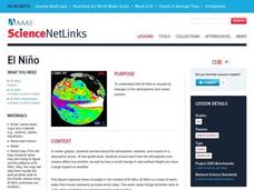
El Nino
Explore the properties of water and the affects of El Nino. Middle schoolers will learn about the devastation an El Nino can cause as well as the definition of El Nino. Additionally, they will discover the cause of El Nino along with the...
Curated OER
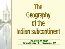
The Geography of the Indian Subcontinent
Gloriously adorned with a glimpse of the Taj Mahal, these slides detail important facts and characteristics of South Asian cultures, such as India, Pakistan, Afghanistan, and several other surrounding countries. Slides cover the...
Curated OER
Crowley's Ridge: An Upland in the Lowlands
Young geographers examine how Crowley's Ridge was formed. This is one Arkansa's six natural geologic divisions. The history of Crowley's Ridge is important in that the first settlers of the state were attracted to this region, and it...
Curated OER
When Nature Strikes: Natural Hazards Safety
Students observe the impact of natural disasters on humans, and become aware of the dangers of environmental hazards such as flash floods, tornadoes, and hurricanes.
Curated OER
Rivers and Streams Research Activity
In this geography research worksheet, student examine books, newspapers, or the internet to find information about the history of flooding in the United Kingdom. They write a fictional account in a news report, TV interview, or a blog....
Weebly
Ancient China
From China's physical geography and earliest beginnings of civilization to the Qin and Han dynasties, here is a nicely designed worksheet on ancient China, which includes a graphic organizer and timeline to summarize the reading...
NOAA
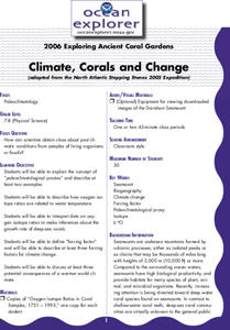
Climate, Corals and Change
Global warming isn't just an issue on land; deep ocean waters are also showing troubling signs. Young scientists learn more about deep water corals and the many recent discoveries researchers have made. Then they examine data related to...
Curated OER
A Question of Rivers
Interactive PowerPoints are terrific tools for self quizzing before an exam. This particular presentation is about the action and physical features of rivers. There are nine boxes to click on, each leading to a picture or map. When you...
Curated OER
The Great American Desert
In this American deserts worksheet, students study the images and read the passages to learn about the 6 divisions in the American landscape: the Eastern lowlands, the Flood Plain, the Great Plains, the Rocky Mountains, and the Pacific...
Curated OER
The Three Gorges: Should Nature or Technology Reign?
Students examine the construction of the Three Gorges Dam in China. In this Three Gorges Dam instructional activity, students research Internet sources pertaining to the dam. Students discuss the geography and culture of East China as...
Curated OER
Ancient China Test
In this geography and history test activity, students respond to 25 short answer and multiple choice questions about the history and geography of ancient China.
Curated OER
Ocean World
In this online interactive geography skills worksheet, students answer 5 multiple choice questions regarding El Nino. Students may submit their answers to be scored.
Curated OER
Using Local Geography to Make Maps
Students research, create, and present a scale representation of the county in which they live.


