Curated OER
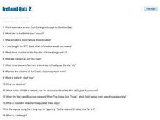
Ireland Quiz 2
In this Ireland instructional activity, students answer short answer questions about the history and geography of Ireland. Students complete 20 questions.
Curated OER
Ireland Quiz #3
In this Ireland quiz #3 worksheet, students answer 20 trivia-style questions about Ireland, not interactively, then scroll down to check their answers.
Curated OER
Geography A to Z: The Letter G
Using clues to answer questions is a way to increase deductive reasoning skills. Kids answer seven geography clues with answers all starting with the letter G. A great way to test world geography or warm up the class.
Curated OER
Ireland: the Emerald Isle
Third graders complete a unit of study that examines several perspectives of Ireland. They explore how climate shapes Irish culture, reference historical and political maps, compute exchange values for Irish money, complete worksheets,...
Curated OER
Dig Into Ireland
Students explore environments and wildlife of Ireland to find out how they were formed, and how they helped form Irish culture. Students research online to determine connections between present elements in Irish culture and wildlife and...
Curated OER
Geography Quiz 25
In this geography activity, students answer short answer questions about geography around the world. Students answer 23 questions about cities, rivers, countries, and more.
Curated OER
Ireland
Second graders discuss Ireland including its politics, education system, agriculture, etc . . . They locate Ireland on a map, and list facts about the country. They compare Irish money to American money.
Curated OER
Geography Quiz 23
In this geography worksheet, students answer short answer questions about the geography in Europe. Students complete 17 questions.
Curated OER
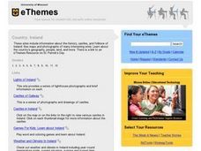
Country: Ireland
Students use the Internet to examine the history, castles, and folklore of Ireland. Photographs of sites are also included.
Curated OER
Comparing Countries: Denmark and Northern Ireland
In this comparison of Denmark and Northern Ireland learning exercise, students fill out a chart in which they compare the advantages and disadvantages of living in each country.
Core Knowledge Foundation
The United Kingdom
Scotland, Northern Ireland, Wales, and England are four countries united by more than a monarchy. Academics explore the geography of the nations that make up the United Kingdom. The resource is broken into six lessons focusing on...
Curated OER
Northern Ireland: A Struggle to Co-Exist (Lesson 1)
Students discover the history of Northern Ireland using a powerpoint presentation in this lesson created for an Advanced Placement Human Geography class. This lesson does not include a Powerpoint presentation (Teachers would be...
Curated OER
A Touch of Green: St. Patrick's Day in the Classroom
Try these ideas to add some Irish flair to your classroom this St. Patrick's Day.
Curated OER
Lesson Plan on Tolerance
Pupils, through discussion, internet and video resources, study the history of Northern Ireland and the religious segregation between Catholics and Protestants. They evaluate the current political situation and predict what the future...
Curated OER
Geography A to Z - All Around Europe #2
In this geography worksheet, students complete seven questions that expand their knowledge and understanding of the European geographical names.
Owl Teacher
Latitude & Longitude
Here is a activity activity where learners mark the latitude and longitude coordinates of cities all over the world. There are 15 cities to identify, from Baghdad, Iraq to Warsaw, Poland and Anchorage, Alaska.
Curated OER
Ire Land
Students imagine themselves as 'witnesses' to historical events in different time periods in the Irish conflict. They write 'day in the life' accounts of their 'place' in Irish history.
Curated OER
Internet Hunt at the "Fact Monster" Web Site- May #3
In this Internet fact hunt worksheet, learners access the "Fact Monster" web site to find the answers to 5 multiple choice questions. They answer science, history, and geography questions.
Curated OER
Tourism in Northern Ireland
In this tourism worksheet, students label pictures of tourist destinations with the name of the country they are located in, write sentences about pictures showing damage caused by tourists, identify locations on a map, and fill in...
Curated OER
Capitals of the World
In this geography worksheet, students write the capitals of 20 countries. Countries include England, Portugal, Australia, and Canada.
Curated OER
Map Activities
In this geography learning exercise, students follow the directions and shade 3 different regions of a UK political map, shade European Union countries on a political map of Europe, match 4 physical feature of Africa to their...
Curated OER
Transportation
In this transportation worksheet, students list the positive and negative aspects of different types of transportation. Students keep a diary of the different ways they used transportation for a week. This worksheet has 7 graphic...
Curated OER
Farming - Ireland
For this farming worksheet, students explain what is meant by sustainable development. Students review how rain develops. Students determine how climate effects crops that can be farmed. This worksheet has 4 graphic organizers, 1 graph,...
Mr. Nussbaum
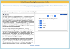
United Kingdom
An interactive practice tests scholars' reading comprehension skills. Learners read an informative text, then answer 10 questions.
Other popular searches
- Ireland Geography
- Ireland Geography Rivers
- Charts Ireland Geography
- Ireland Geography Map
- Ireland Geography Grade 4
- Ireland Geography Peat
- Ireland Geography Vikings
- Ireland Geography Famine
- Ireland Geography Local Area
- Ireland Geography Snow Zone
- Ireland Geography Belfast
- Geography Ireland Counties


