Curated OER
Create Your Own Country!
Students create their own countries. In this geography skills lesson, students establish governments, cultural backgrounds, atlas/geography components, national anthems, and national symbols for a country they create.
Curated OER
What's Your Temperature?
Learners take a look at the local newspaper and focus on the weather section. They get into small groups, and each one looks at the same map, but of a different part of the country. They must prepare a presentation that shows how...
Curated OER
Latitude and Longitude
Students identify latitude, longitude, prime meridian, international date line, and equator. They compute the latitude and longitude of different objects.
Curated OER
GEOGRAPHY OF FOOD & FIBER
Students will explain the ways geography determines the crops grown in the United States and other countries, and the resulting trade relationships.1. Discuss trade routes, both ancient and current. Discuss why the most direct route from...
Curated OER
Mongolia Geography
Young scholars examine the geography and culture of Mongolia. Individually, they cut out cut-outs of animals to place on their maps and label the grasslands and desert areas. They locate major cities and rivers along with vegetation.
Curated OER
Geography Search: The New World
Students explore the "New World". They collect geographic information related to the ocean, latitude and stars, longitude and time, wind patterns, and the weather. They analyze the geographic data and make decisions to plot their...
Science Matters
Ring of Fire
Over a period of 35 years, earthquakes and volcanoes combined only accounted for 1.5 percent of the deaths from natural disasters in the United States. The 15th lesson in a 20-part series connects the locations of earthquakes and...
National Wildlife Federation
Is It Getting Hot in Here, or Is It Just Me?
Currently, only 2.1% of global warming is felt on continents, while over 93% is felt in the oceans. The fourth lesson in the series of 21 on global warming is composed of three activities that build off one another. In the first...
Curated OER
Create-A-Country
Sixth graders work with a partner to fill out the attached form describing their own country. They will use the information about their country to create a PowerPoint presentation to show the class. They must present a slide for each...
Curated OER
Understanding Topographic Maps
Underclassmen create a cone-shaped landform and then draw a contour map for it. Then they examine a quadrangle (which was easily located with an online search), and relate it to what they experienced. The accompanying worksheet is...
Curated OER
U.S. History: What Happened Here?
Students apply the global positioning system to create maps of local historical sites. By collaborating with local historical groups, they research events and relate them to broader, national history. In addition to writing essays...
Curated OER
"Where in the World is my School?"
Students learn new vocabulary and discuss what GPS is and does. They locate their school using the equipment.
Curated OER
Maps, Charts, and Graphs
Students define key geographic terms and track a hurricane on a map. They examine various types of maps and find locations on them,including rivers, cities and mountains.
Curated OER
THE TRAVELS OF BABAR: An Adventure in Scales
Students locate and identify the seven continents. They use longitude and latitude in establishing a location. Students enhance the knowledge of geographical location with cultures. Individuals or small groups research multiple aspects...
Curated OER
New Hampshire and the Five Themes of Geography
Students explore the location, place, human-environmental interactions, movement, and regions of the New Hampshire landscape through the use of visual representations.
K12 Reader
Eratosthenes: Geographer and Mathematician
Mathematicians can be famous, too! Introduce your class to Eratosthenes with a reading passage. After they complete the passage, learners respond to five questions, some of which require opinions and others reading comprehension skills.
Curated OER
The Seven Continents Scavenger Hunt
Who doesn't enjoy an engaging scavenger hunt? Here, scholars listen to, and discuss, the informative text, Where is my Continent? by Robin Nelson. They then explore the seven continents and four major oceans using...
Montana State University
Meet Mount Everest
Learning about one landform might seem boring to some, but using the resource provided practically guarantees scholar interest. The second in a sequential series of eight covering the topic of Mount Everest includes activities such as a...
Curated OER
Around the World in 5 Days
Learners explore continents, draw map, discuss cultures, use research to learn geography, and investigate cultures.
Curated OER
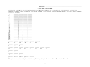
Canada Eh? Pre/Post Tests on Canada Using GPS
Students participate in a GPS activity and answer questions about Canada. In this Canada lesson, students identify location by using a GPS Unit and latitude and longitude. Students find an Inuksuk (station) and a complete worksheet.
Curated OER
Tear the Continents
Students tear paper into representative continent shapes and configure them with world oceans through relative location, direction and latitude and longitude starting points. They recognize the shape of the continents. Students recognize...
Curated OER
Where In the World Am I?
Learners identify their location in the world after studying latitude, longitude, relative location, and absolute location. They use assigned web site to find information to make a flipbook that answers questions about their location in...
Curated OER
Making Sense Of A Round World On A Flat Surface
Students engage in a lesson that is concerned with the development of geography skills. They take part in a number of activities that center around finding and traveling to different locations. The lesson has resource links that can be...


