Curated OER
Rivers and Streams
In this rivers and streams worksheet, students explore how rivers and streams react with the environment. Students also study where the major rivers flow in their local areas. Activities are provided that help students visualize the...
Curated OER
Human Impacts on Major Rivers of the World
Learners explore motivations behind human intervention in the stream flow of selected rivers, infer kinds of interventions and their results, and evaluate level of success of such interventions of stream flow as well as environmental...
Devine Educational Consultancy Services
Geography Student Workbook, Australia
Your youngsters will be experts on the geography of Australia after working with these activities and worksheets, which review the continent's weather, major landforms, dimensions, history, and climate.
Curated OER
Simulation: River Cruise: Rivers of the World
Students identify major rivers in the world. In this geography activity, students form teams and play a whole class board game in which clues are read and rivers are identified.
K12 Reader
United States Geography
Encourage reading for information with a text about United States geography. Kids read a short passage about the landforms in the United States, including mountain ranges and natural resources, and answer five reading comprehension...
Curated OER
The Tennessee River: The Tie That Binds
Seventh graders examine the Tennessee River to see why it is still a major transportation artery in lieu of the age of modern transportation such as interstate highways, air cargo, and elaborate railway systems.
Geography 360°
Introducing Europe
Provide your learners with a comprehensive introduction to Europe with this great set of worksheets. Map activities include matching European countries to their capitals and places on a political map, as well as...
Curated OER
The Rivers and Lakes of Alberta
Students are introduced to the online Atlas of Canada and they identify the lakes and major rivers of Alberta.
Curated OER
Natural Disasters and the Five Themes of Geography
Have your class do research on natural disasters and create a presentation using this resource. In completing this activity, learners apply the five geography themes to their research. They write a paper describing their results. It's a...
Curated OER
United States Map- Rivers
Students identify major rivers on a map of the United States. In this geography lesson plan, students discuss what a river is and use a map marker to identify the symbol of a river on a map.
Curated OER
Rivers Run Through It
Using a relief map of New York State, learners answer questions about the distance between different cities, identify bodies of water, and more. First, they discuss vocabulary related to the Hudson River area. Then, they complete a...
Curated OER
Geography of Canada
All about Canada! Learners explore the geography and providences of Canada by watching videos, studying maps and conducting internet research. By the end of this lesson, your class should be able to locate major areas and compare and...
Curated OER
Controlling the Flow of the Colorado River: A Study of Dams
Students research and map the Colorado River and its dams and predict the effects of a dam on an area. They suggest reasons a dam would be built and compare the Colorado River system with other major river systems within the US and...
Curated OER
Geography
Second graders explore the major rivers of Arkansas. They locate the major rivers in Arkansas on a state map. Students discuss how water is used in the region and the state of Arkansas.
Curated OER
States and Capitals, Mountains and Rivers
Students identify geographical locations in the midwestern United States. In this geography lesson, students identify 12 states and capitals and geographical features in the region by using U.S. maps. Students use blank maps to fill in...
Curated OER
Physical Geography of Africa
Fifth graders investigate the topography of Africa. In this physical geography lesson, 5th graders research the six regions of Africa and complete a physical map. Students locate various landforms in Africa. Students...
Curated OER
Special Report: Flood of the Great River
Students work together in groups and role play the role of television crews. Using the internet, they research specific events of the Mississippi River flooding and report their findings to the class from different angles. They are to...
Curated OER
The Earth's BIG Features
Your students will enjoy the vivid pictures and interesting facts about world geography, in this presentation. Depicted are several major geographical features found around the world and a description of each.
Curated OER
America Will Be
Learners work together to research and create different types of maps of the United States to be used as part of a geography trivia game.Groups research North American annual rainfall, climate, mountain ranges major rivers and state...
Curated OER
Important Rivers of the World
Third graders become familiar with names of the different parts of a river, define and locate drainage basins, locate six of the continents and explore the major rivers on each one, conduct research on a river of their choice.
Curated OER
Rivers of the World
In this geography learning exercise, students match the name for each of 20 rivers of the world with the major city where it is located.
Ms. Catsos
Ancient Rome Map Worksheet
It wasn't just the great leaders of ancient Rome that shaped their civilization—the geography of the region played a major role as well. After first identifying major land masses, bodies of water, and city states on a map of Europe,...
Curated OER
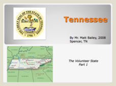
Tennessee: The Volunteer State Part 1
Explore the state of Tennessee, PowerPoint style! Regions, geographical features, and some amazing state facts are yours for the asking. Major cities are named and followed by related facts. This neat presentation on an interesting state...
Curated OER
Capitals, Oceans, And Border States
Students investigate geography by completing games with classmates. In this United States of America lesson plan, students examine a map of North America and identify the borders of Mexico and Canada as well as the Pacific and Atlantic....


