Curated OER
Utah History & Geography
Fourth graders calculate and determine the distances between counties in Utah. Using a map of Utah, they determine the distance between three county seats, the total distance round trip, and label a map with the distances.
Curated OER
Relief Maps
Students study geographical maps and their functions. In this geography lesson students work in groups to build a map to scale.
Curated OER
Underground Rails: The New York City Subway System
Pupils explore the New York Subway system. They investigate its usefulness as mode of transportation for the people in the city and study its history compared to other city subway systems. They examine how the subway connects the various...
Curated OER
The Ie Storm 1998: Maps and facts activity
Students investigate the St. Lawrence River Valley, ice Storm of 1998. In this middle school mathematics lesson, students interpret ice storm data from tables and maps. Students write about their own experiences of the ice...
Curated OER
Illinois State Map
For this Illinois geography worksheet, students color and label a map of Illinois. Students study the location of the capital and where Illinois is situated in the United States. There is a black line map of the state with a grey US map...
Curated OER
Pennsylvania State Map
In this geography of Pennsylvania worksheet, students color and label a map of the state. Students also study the location of Pennsylvania on a grey background map of the entire 50 states.
Curated OER
Utah State Map
In this geography of Utah worksheet, learners color and label a map of the state of Utah. Students also study a second map that shows the location of this state in the U.S.
Curated OER
Tennessee State Map
In this Tennessee state geography worksheet, learners color and label major cities and physical features on the map. Students also study a second map of the U.S. that shows the location of the state of Tennessee.
Curated OER
Virginia State Map
In this geography of Virginia worksheet, students color the map and label major cities and physical features. Students also study a second map showing the location of the state of Virginia in the United States.
Curated OER
Delaware State Map
In this geography of Delaware worksheet, students color the map and label major cities and physical features. Students also study a second map showing the location of the state of Delaware in the United States.
Curated OER
California State Map
In this geography of California worksheet, students color the map and label major cities and physical features. Students also study a second map showing the location of the state of California in the United States.
Curated OER
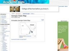
Georgia State Map
In this geography of Georgia worksheet, students color the map and label major cities and physical features. Students also study a second map showing the location of the state of Georgia in the United States.
Curated OER
Florida State Map
In this geography of Florida worksheet, students color the map and label major cities and physical features. Students also study a second map showing the location of the state of Florida in the United States.
Curated OER
Capitals, Oceans, And Border States
Students investigate geography by completing games with classmates. In this United States of America lesson, students examine a map of North America and identify the borders of Mexico and Canada as well as the Pacific and Atlantic....
Curated OER
Hip Hop and Geography
Students study the various geographic regions of the U.S. and discuss how popular music is influenced by cultural/regional factors. Groups choose East Coast, West Coast, Midwest, or South in rap/hip hop music and create a PowerPoint or...
Curated OER
Where is Kansas?
Students explore U.S. Geography by analyzing a map. In this state vs. country lesson, students utilize a U.S. map and locate the state of Kansas before researching the history and customs of the state. Students collaborate as a class to...
Curated OER
Navigation
Learners explain that globes are the best way to show positions of places, but flat maps are portable and can show great detail. They make a mercator projection of the route Lewis and Clark took on their journey.
Curated OER
Our City
Second graders familiarize themselves with the town they live in by practicing their imagination, library research and writing skills.
Curated OER
Where is the Trail? The Journey of Lewis and Clark
Learners explore the trail followed by Lewis and Clark on their journey across the United States. In this United States History lesson, students complete several activities to establish the Lewis and Clark Expedition, including a class...
Curated OER
Me on the Map Lesson 2
Learners analyze and interpret maps, globes and geographic information systems to define and identify cities, counties, states, countries and continents to create a booklet called me on the map. They also determine and calculate the...
Curated OER
Where I Live…
Second graders explore their community. In this social studies lesson plan, 2nd graders use Internet tools to locate their community on a map and then locate where they live.
Curated OER
Mapping an Empire
How did the expansion of the Roman Empire during the first century contribute to its downfall? Using a map of the Roman Empire in 44 BC and one of the Roman Empire in 116 AD as references, class member use critical reading skills to...
Curated OER
A Shuttle's Eye View
Students explore the goals of the Shuttle Radar Topography Mission as a springboard to exploring the topographical features of their own state or region. They synthesize their understanding of landforms and topography by mapping their...
Curated OER
Mapmaking
Learners examine the craft of cartography and how the Lewis and Clark expedition created and used maps. They analyze maps, read a handout, create a map, participate in a mini expedition and map out a route based on travel directions,...
Other popular searches
- Geography Map Skills Scale
- Geography Map Skills Europe
- Usa Geography Map Skills
- Geography Map Skills Us
- Canada Geography Map Skills
- Map Skills Geography Themes
- Geography Map Skills Ohio
- Map Skills Geography


